551 7224/9/7
Description Aerial photographic sortie 1984/7
Collection Records of Aberdeen Aerial Surveys, Aberdeen, Scotland
Catalogue Number 551 7224/9/7
Category All Other
Accession Number 2005/218
Permalink http://canmore.org.uk/collection/1336521
Collection Hierarchy - Sub-Group Level
Collection Level (551 193) Records of Aberdeen Aerial Surveys, Aberdeen, Scotland
> Group Level (551 193/9) Aerial Photographic Survey 1984
>> Sub-Group Level (551 7224/9/7) Aerial photographic sortie 1984/7
| Preview | Category | Catalogue Number | Title | Date | Level |
|---|---|---|---|---|---|
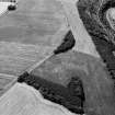 |
On-line Digital Images | SC 1014996 | General oblique aerial view centred on the cropmarks of a possible unenclosed settlement at the Hill of Laithers with the River Deveron adjacent, looking to the S. | 20/7/1984 | Item Level |
 |
On-line Digital Images | SC 1014997 | General oblique aerial view centred on the cropmarks of a possible unenclosed settlement at the Hill of Laithers, looking to the SE. | 20/7/1984 | Item Level |
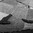 |
On-line Digital Images | SC 1014998 | General oblique aerial view centred on the cropmarks of a possible unenclosed settlement at the Hill of Laithers, looking to the ESE. | 20/7/1984 | Item Level |
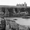 |
On-line Digital Images | SC 1015008 | General view on the remains of Slains Castle, looking to the W. | 20/7/1984 | Item Level |
 |
On-line Digital Images | SC 1014785 | Oblique aerial view of the remains of the fort of Little Conval, looking to the SSE. | 20/7/1984 | Item Level |
 |
On-line Digital Images | SC 1014786 | Oblique aerial view of the remains of the fort of Little Conval, looking to the ESE. | 20/7/1984 | Item Level |
 |
On-line Digital Images | SC 1014787 | Oblique aerial view of the remains of the fort of Little Conval, looking to the ESE. | 20/7/1984 | Item Level |
 |
On-line Digital Images | SC 1014788 | Oblique aerial view of the remains of the fort of Little Conval, looking to the E. | 20/7/1984 | Item Level |
 |
On-line Digital Images | SC 1014789 | Oblique aerial view centred on the cropmarks of the ring ditches and pit alignment at Fullerton, looking to the S. | 20/7/1984 | Item Level |
 |
On-line Digital Images | SC 1014790 | Oblique aerial view centred on the cropmarks of the ring ditches and pit alignment at Fullerton, looking to the SSE. | 20/7/1984 | Item Level |
 |
On-line Digital Images | SC 1014791 | Oblique aerial view centred on the cropmarks of the square barrow, roundhouses, subrectangular buildings, ring ditch and pits at Kinchyle and Little Kildrummie, looking to the W. | 20/7/1984 | Item Level |
 |
On-line Digital Images | SC 1014792 | Oblique aerial view centred on the cropmarks of the square barrow, roundhouses, subrectangular buildings, ring ditch and pits at Kinchyle and Little Kildrummie, looking to the WSW. | 20/7/1984 | Item Level |
 |
On-line Digital Images | SC 1014793 | Oblique aerial view centred on the cropmarks of the square barrow, roundhouses, subrectangular buildings, ring ditch and pits at Kinchyle and Little Kildrummie, looking to the SW. | 20/7/1984 | Item Level |
 |
On-line Digital Images | SC 1014794 | Oblique aerial view centred on the cropmarks of the square barrow, roundhouses, subrectangular buildings, ring ditch and pits at Kinchyle and Little Kildrummie, looking to the SW. | 20/7/1984 | Item Level |
 |
On-line Digital Images | SC 1014795 | Oblique aerial view centred on the cropmarks of the square barrow, roundhouses, subrectangular buildings, ring ditch and pits at Kinchyle and Little Kildrummie, looking to the SSW. | 20/7/1984 | Item Level |
 |
On-line Digital Images | SC 1014796 | Oblique aerial view centred on the cropmarks of the square barrow, roundhouses, subrectangular buildings, ring ditch and pits at Kinchyle and Little Kildrummie, looking to the SSW. | 20/7/1984 | Item Level |
 |
On-line Digital Images | SC 1014797 | Oblique aerial view centred on the cropmarks of the square barrow, roundhouses, subrectangular buildings, ring ditch and pits at Kinchyle and Little Kildrummie, looking to the ESE. | 20/7/1984 | Item Level |
 |
On-line Digital Images | SC 1014798 | Oblique aerial view centred on the cropmarks of the enclosure and the former airfield at Brackla House, looking to the WSW. | 20/7/1984 | Item Level |
 |
On-line Digital Images | SC 1014799 | Oblique aerial view centred on the cropmarks of the enclosure and the former airfield at Brackla House, looking to the WSW. | 20/7/1984 | Item Level |
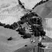 |
On-line Digital Images | SC 1014800 | Oblique aerial view of Tarradale House with the cropmarks adjacent, looking to the NNW. | 20/7/1984 | Item Level |
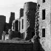 |
On-line Digital Images | SC 1015010 | Detailed view on the remains of Slains Castle, looking to the SW. | 20/7/1984 | Item Level |
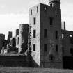 |
On-line Digital Images | SC 1015011 | Detailed view on the remains of Slains Castle, looking to the S. | 20/7/1984 | Item Level |
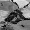 |
On-line Digital Images | SC 1014801 | Oblique aerial view of Tarradale House with the cropmarks adjacent, looking to the NW. | 20/7/1984 | Item Level |
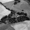 |
On-line Digital Images | SC 1014802 | Oblique aerial view of Tarradale House with the cropmarks adjacent, looking to the ESE. | 20/7/1984 | Item Level |


