 |
On-line Digital Images |
SC 1014767 |
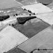
Oblique aerial view centred on the cropmarks of the ring ditches and enclosure at Dun and Balwyllo, looking to the S. |
20/7/1984 |
Item Level |
 |
On-line Digital Images |
SC 1014768 |
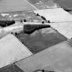
Oblique aerial view centred on the cropmarks of the ring ditches and enclosure at Dun and Balwyllo, looking to the S. |
20/7/1984 |
Item Level |
 |
On-line Digital Images |
SC 1014982 |
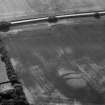
Oblique aerial view centred on the cropmarks of the possible unenclosed settlement, pits and ring ditch at East Cairnbeg, looking to the SSE. |
20/7/1984 |
Item Level |
 |
On-line Digital Images |
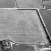
SC 1014983 |
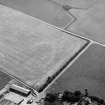
Oblique aerial view centred on the cropmarks of the double palisaded enclosure at East Cairnbeg with the farmstead adjacent, looking to the ESE. |
20/7/1984 |
Item Level |
 |
On-line Digital Images |
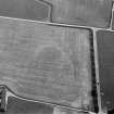
SC 1014984 |
Oblique aerial view centred on the cropmarks of the double palisaded enclosure at East Cairnbeg with the farmstead adjacent, looking to the SSE. |
20/7/1984 |
Item Level |
 |
On-line Digital Images |
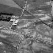
SC 1014985 |
Oblique aerial view centred on the cropmarks of the double palisaded enclosure at East Cairnbeg with the farmstead adjacent, looking to the SE. |
20/7/1984 |
Item Level |
 |
On-line Digital Images |
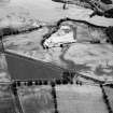
SC 1014769 |
Oblique aerial view centred on the cropmarks of the unenclosed settlement, rig, pits and ring ditches at Arrat's Mill, looking to the SE. |
20/7/1984 |
Item Level |
 |
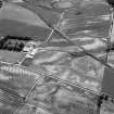
On-line Digital Images |
SC 1014770 |
Oblique aerial view centred on the cropmarks of the unenclosed settlement, ring ditches, souterrain, pit alignment, and linear features at Arrat's Mill, looking to the SW. |
20/7/1984 |
Item Level |
 |
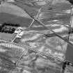
On-line Digital Images |
SC 1014771 |
Oblique aerial view centred on the cropmarks of the unenclosed settlement, rig, pits and ring ditches at Arrat's Mill, looking to the SE. |
20/7/1984 |
Item Level |
 |
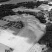
On-line Digital Images |
SC 1014772 |
Oblique aerial view centred on the cropmarks of the unenclosed settlement, rig, pits and ring ditches at Arrat's Mill, looking to the SE. |
20/7/1984 |
Item Level |
 |
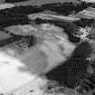
On-line Digital Images |
SC 1014773 |
Oblique aerial view centred on the cropmarks of the unenclosed settlement, roundhouses, souterrains, pits and rig at Kinnaird Castle, looking to the ENE. |
20/7/1984 |
Item Level |
 |
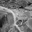
On-line Digital Images |
SC 1014774 |
Oblique aerial view centred on the cropmarks of the unenclosed settlement, roundhouses, souterrains, pits and rig at Kinnaird Castle, looking to the NE. |
20/7/1984 |
Item Level |
 |
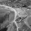
On-line Digital Images |
SC 1014775 |
Oblique aerial view with Cowie in the foreground and Stonehaven beyond, looking to the SSW. |
20/7/1984 |
Item Level |
 |
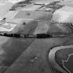
On-line Digital Images |
SC 1014776 |
Oblique aerial view with Cowie in the foreground and Stonehaven beyond, looking to the S. |
20/7/1984 |
Item Level |
 |
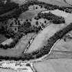
On-line Digital Images |
SC 1014778 |
General oblique aerial view centred on the remains of the stone circle, cropmarks of ring ditches and rig at Fullerton, looking to the SSW. |
20/7/1984 |
Item Level |
 |
On-line Digital Images |
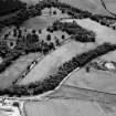
SC 1014779 |
General oblique aerial view of Pitcaple Castle with the cropmarks adjacent, looking to the SW. |
20/7/1984 |
Item Level |
 |
On-line Digital Images |
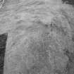
SC 1014780 |
General oblique aerial view of Pitcaple Castle with the cropmarks adjacent, looking to the SSW. |
20/7/1984 |
Item Level |
 |
On-line Digital Images |
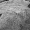
SC 1014781 |
Oblique aerial view of the remains of the fort of Little Conval, looking to the SW. |
20/7/1984 |
Item Level |
 |
On-line Digital Images |
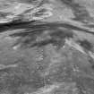
SC 1014782 |
Oblique aerial view of the remains of the fort of Little Conval, looking to the SW. |
20/7/1984 |
Item Level |
 |
On-line Digital Images |
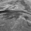
SC 1014783 |
Oblique aerial view of the remains of the fort of Little Conval, looking to the S. |
20/7/1984 |
Item Level |
 |
On-line Digital Images |
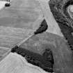
SC 1014784 |
Oblique aerial view of the remains of the fort of Little Conval, looking to the S. |
20/7/1984 |
Item Level |
 |
On-line Digital Images |
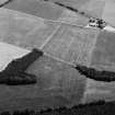
SC 1014996 |
General oblique aerial view centred on the cropmarks of a possible unenclosed settlement at the Hill of Laithers with the River Deveron adjacent, looking to the S. |
20/7/1984 |
Item Level |
 |
On-line Digital Images |
SC 1014998 |
General oblique aerial view centred on the cropmarks of a possible unenclosed settlement at the Hill of Laithers, looking to the ESE. |
20/7/1984 |
Item Level |
 |
On-line Digital Images |
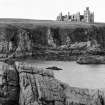
SC 1015008 |
General view on the remains of Slains Castle, looking to the W. |
20/7/1984 |
Item Level |


