551 7224/9/4
Description Aerial photographic sortie 1984/4
Collection Records of Aberdeen Aerial Surveys, Aberdeen, Scotland
Catalogue Number 551 7224/9/4
Category All Other
Accession Number 2005/218
Permalink http://canmore.org.uk/collection/1336518
Collection Hierarchy - Sub-Group Level
Collection Level (551 193) Records of Aberdeen Aerial Surveys, Aberdeen, Scotland
> Group Level (551 193/9) Aerial Photographic Survey 1984
>> Sub-Group Level (551 7224/9/4) Aerial photographic sortie 1984/4
| Preview | Category | Catalogue Number | Title | Date | Level |
|---|---|---|---|---|---|
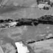 |
On-line Digital Images | SC 1007808 | Oblique aerial view centred on the cropmarks of the fort, ring ditch and rig at Mains of Edzell with the farmstead adjacent, looking to the SW. | 12/7/1984 | Item Level |
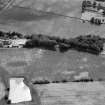 |
On-line Digital Images | SC 1007809 | Oblique aerial view centred on the cropmarks of the fort, ring ditch and rig at Mains of Edzell with the farmstead adjacent, looking to the WSW. | 12/7/1984 | Item Level |
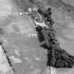 |
On-line Digital Images | SC 1007810 | Oblique aerial view centred on the cropmarks of the fort, pits and rig at Mains of Edzell with the farmstead adjacent, looking to the SSE. | 12/7/1984 | Item Level |
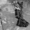 |
On-line Digital Images | SC 1007811 | Oblique aerial view centred on the cropmarks of the fort, ring ditch, pits and rig at Mains of Edzell with the farmstead adjacent, looking to the SE. | 12/7/1984 | Item Level |
 |
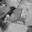
On-line Digital Images | SC 1007812 | Oblique aerial view centred on the cropmarks of the pit defined cursus, ring ditches, enclosures, pits and rig at Inchbare North and Smiddyhill, looking to the N. | 12/7/1984 | Item Level |
 |
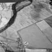
On-line Digital Images | SC 1007813 | Oblique aerial view centred on the cropmarks of the fort, ring ditch, pits and rig at Mains of Edzell with the farmstead adjacent, looking to the NNW. | 12/7/1984 | Item Level |
 |
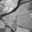
On-line Digital Images | SC 1007814 | Oblique aerial view centred on the cropmarks of the pit defined cursus, unenclosed settlement, ring ditches, enclosures, pits and rig with Stracathro Roman Fort and Temporary Camp adjacent at Inchbare North, looking to the ENE. | 12/7/1984 | Item Level |
 |
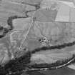
On-line Digital Images | SC 1007815 | Oblique aerial view centred on the cropmarks of the pit defined cursus, unenclosed settlement, ring ditches, pits and rig with Stracathro Roman Fort and Temporary Camp adjacent at Inchbare North, looking to the NE. | 12/7/1984 | Item Level |
 |
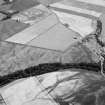
On-line Digital Images | SC 1007817 | Oblique aerial view centred on the cropmarks of the unenclosed settlement, ring ditches, pits and rig with Stracathro Roman Fort and Temporary Camp adjacent at Smiddyhill, looking to the SW. | 12/7/1984 | Item Level |
 |
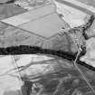
On-line Digital Images | SC 1007820 | Oblique aerial view centred on the cropmarks of the unenclosed settlement, ring ditches, pits and rig with Stracathro Roman Fort and Temporary Camp adjacent at Smiddyhill, looking to the S. | 12/7/1984 | Item Level |
 |
On-line Digital Images | SC 1007821 | Oblique aerial view centred on the cropmarks of the unenclosed settlement, ring ditches, pits and rig with Stracathro Roman Fort and Temporary Camp adjacent at Smiddyhill and Inchbare, looking to the SSE. | 12/7/1984 | Item Level |
 |
On-line Digital Images | SC 1007822 | Unidentified | 12/7/1984 | Item Level |
 |
On-line Digital Images | SC 1007823 | Unidentified | 12/7/1984 | Item Level |
 |
On-line Digital Images | SC 1007824 | Unidentified | 12/7/1984 | Item Level |
 |
On-line Digital Images | SC 1007825 | Unidentified | 12/7/1984 | Item Level |
 |
On-line Digital Images | SC 1007826 | Unidentified | 12/7/1984 | Item Level |
 |
On-line Digital Images | SC 1007875 | Oblique aerial view centred on the cropmarks of a rectlinear enclosure, possible souterrains, pits and rig at Chapel Knap, looking to the SSE. | 12/7/1984 | Item Level |
 |
On-line Digital Images | SC 1007877 | Oblique aerial view centred on the cropmarks of a rectlinear enclosure, possible souterrains, pits and rig at Chapel Knap, looking to the SE. | 12/7/1984 | Item Level |
 |
On-line Digital Images | SC 1007880 | Oblique aerial view centred on the cropmarks of a rectlinear enclosure, possible souterrains, pits and rig at Chapel Knap, looking to the SE. | 12/7/1984 | Item Level |
 |
On-line Digital Images | SC 1007882 | Oblique aerial view of the cropmarks of the enclosure, unenclosed settlement and other cropmarks at Myreside, looking to the SE. | 12/7/1984 | Item Level |
 |
On-line Digital Images | SC 1007883 | Oblique aerial view of the cropmarks of the enclosure, unenclosed settlement and other cropmarks at Myreside, looking to the SSE. | 12/7/1984 | Item Level |
 |
On-line Digital Images | SC 1007886 | Oblique aerial view centred on the cropmarks of a rectlinear enclosure, possible souterrains, pits and rig at Chapel Knap, looking to the SE. | 12/7/1984 | Item Level |
 |
On-line Digital Images | SC 1007891 | Oblique aerial view centred on cropmarks of the unenclosed settlement, roundhouses, pits and rig at Pittengardner, looking to the SE. | 12/7/1984 | Item Level |
 |
On-line Digital Images | SC 1007892 | Oblique aerial view centred on cropmarks of the unenclosed settlement, roundhouses, pits and rig at Pittengardner, looking to the SE. | 12/7/1984 | Item Level |


