 |
On-line Digital Images |
SC 1007978 |
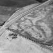
Oblique aerial view centred on the cropmarks of the pit defined cursus and linear features at Purlieknowe, looking to the SW. |
12/7/1984 |
Item Level |
 |
On-line Digital Images |
SC 1007981 |
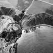
Oblique aerial view centred on the remains of Dunnottar Castle, looking to the WSW. |
12/7/1984 |
Item Level |
 |
On-line Digital Images |
SC 1007982 |
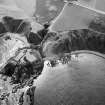
Oblique aerial view centred on the remains of Dunnottar Castle, looking to the WSW. |
12/7/1984 |
Item Level |
 |
On-line Digital Images |
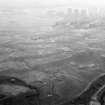
SC 1007985 |
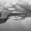
Oblique aerial view centred on the cropmarks of the unenclosed settlement and field system at Braehead with Stonehaven adjacent, looking to the WSW. |
17/7/1984 |
Item Level |
 |
On-line Digital Images |
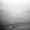
SC 1007986 |
Oblique aerial view centred on Balnagask Golf Course with Torry Battery in the foreground, looking to the SW. |
17/7/1984 |
Item Level |
 |
On-line Digital Images |
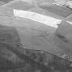
SC 1007987 |
Oblique aerial view centred on Balnagask Golf Course, looking to the S. |
17/7/1984 |
Item Level |
 |
On-line Digital Images |
SC 1007995 |
Unidentified |
17/7/1984 |
Item Level |
 |
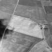
On-line Digital Images |
SC 1007782 |
Oblique aerial view centred on the cropmarks of a circular enclosure at Myreside with the farmstead adjacent, looking to the ENE. |
12/7/1984 |
Item Level |
 |
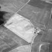
On-line Digital Images |
SC 1007784 |
Oblique aerial view centred on the cropmarks of a circular enclosure at Myreside with the farmstead adjacent, looking to the ENE. |
12/7/1984 |
Item Level |
 |
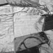
On-line Digital Images |
SC 1007785 |
Oblique aerial view centred on the cropmarks of a circular enclosure at Myreside with the farmstead adjacent, looking to the ENE. |
12/7/1984 |
Item Level |
 |
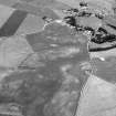
On-line Digital Images |
SC 1007795 |
General oblique aerial view centred on the cropmarks of the unenclosed settlement, ring ditches, souterrains, field boundaries and rig at Westside, looking to the ENE. |
12/7/1984 |
Item Level |
 |
On-line Digital Images |
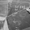
SC 1008024 |
Unidentified |
17/7/1984 |
Item Level |
 |
On-line Digital Images |
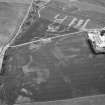
SC 1008025 |
Unidentified |
17/7/1984 |
Item Level |
 |
On-line Digital Images |
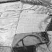
SC 1008026 |
Unidentified |
17/7/1984 |
Item Level |
 |
On-line Digital Images |
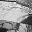
SC 1007796 |
General oblique aerial view centred on the cropmarks of the unenclosed settlement, ring ditches, souterrains, field boundaries and rig at Westside, looking to the ENE. |
12/7/1984 |
Item Level |
 |
On-line Digital Images |
SC 1007797 |
General oblique aerial view centred on the cropmarks of the unenclosed settlement, ring ditches, souterrains, field boundaries and rig at Westside, looking to the NE. |
12/7/1984 |
Item Level |
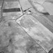 |
On-line Digital Images |
SC 1007798 |
Unidentified |
12/7/1984 |
Item Level |
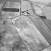 |
On-line Digital Images |
SC 1007799 |
Unidentified |
12/7/1984 |
Item Level |
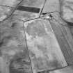 |
On-line Digital Images |
SC 1007800 |
Unidentified |
12/7/1984 |
Item Level |
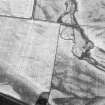 |
On-line Digital Images |
SC 1007801 |
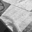
Oblique aerial view centred on the cropmarks of the unenclosed settlement, ring ditches, souterrains, field boundaries and rig at Westside, looking to the NNW. |
12/7/1984 |
Item Level |
 |
On-line Digital Images |
SC 1007802 |
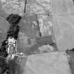
Oblique aerial view centred on the cropmarks of the unenclosed settlement, ring ditches, souterrains, field boundaries and rig at Westside, looking to the WNW. |
12/7/1984 |
Item Level |
 |
On-line Digital Images |
SC 1007805 |
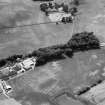
Oblique aerial view centred on the cropmarks of the fort, ring ditch and rig at Mains of Edzell with the farmstead adjacent, looking to the NW. |
12/7/1984 |
Item Level |
 |
On-line Digital Images |
SC 1007806 |
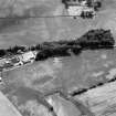
Oblique aerial view centred on the cropmarks of the fort, ring ditch and rig at Mains of Edzell with the farmstead adjacent, looking to the W. |
12/7/1984 |
Item Level |
 |
On-line Digital Images |
SC 1007807 |
Oblique aerial view centred on the cropmarks of the fort, ring ditch and rig at Mains of Edzell with the farmstead adjacent, looking to the WSW. |
12/7/1984 |
Item Level |


