551 178/1/34
Description Sortie 2011/34
Collection RCAHMS Aerial Photography Digital
Catalogue Number 551 178/1/34
Category All Other
Permalink http://canmore.org.uk/collection/1255337
Collection Hierarchy - Sub-Group Level
Collection Level (551 178) RCAHMS Aerial Photography Digital
> Sub-Group Level (551 178/1) 2011 Photographs
>> Sub-Group Level (551 178/1/34) Sortie 2011/34
| Preview | Category | Catalogue Number | Title | Date | Level |
|---|---|---|---|---|---|
 |
On-line Digital Images | DP 110528 | General oblique aerial view through Gleann Mile-feala towards Ushenish lighthouse, S Uist, taken from the W. | 14/11/2011 | Item Level |
 |
On-line Digital Images | DP 110529 | Oblique aerial view of the remains of the settlement and sheilings at Buail Ormaclett, S Uist, taken from the W. The lower and eastern group is visible as a green mound in the centre, while the upper and western group is nearer the viewpoint. | 14/11/2011 | Item Level |
 |
On-line Digital Images | DP 110530 | General oblique aerial view of the remains of the township at Usinish Bay, sheilings at Scalavat and nearby field boundaries and lazy beds, S Uist, taken from the W. | 14/11/2011 | Item Level |
 |
On-line Digital Images | DP 110531 | General oblique aerial view of the remains of the township at Usinish Bay, sheilings at Scalavat and nearby field boundaries and lazy beds, S Uist, taken from the W. | 14/11/2011 | Item Level |
 |
On-line Digital Images | DP 110532 | General oblique aerial view of the remains of the township at Usinish Bay, associated field boundaries and lazy beds, and the remains of hut circles, souterrains and an aisled roundhouse at Uamh Iosal and Uamh Ghrantraich, S Uist, taken from the W. | 14/11/2011 | Item Level |
 |
On-line Digital Images | DP 110533 | Oblique aerial view of the remains of the township, field boundaries and lazy beds at Liadale, S Uist, taken from the WNW. | 14/11/2011 | Item Level |
 |
On-line Digital Images | DP 110534 | Oblique aerial view of the remains of the township, field boundaries and lazy beds at Liadale, S Uist, taken from the W. | 14/11/2011 | Item Level |
 |
On-line Digital Images | DP 110535 | General oblique aerial view of South Uist and the Sound of Barra, taken from the NNW. | 14/11/2011 | Item Level |
 |
On-line Digital Images | DP 110536 | Oblique aerial view of the field system and cultivation remains at Aird Buidhe, looking towards Pabbay and Loch Boisdale, taken from the WSW. | 14/11/2011 | Item Level |
 |
On-line Digital Images | DP 110537 | Oblique aerial view of the field system and cultivation remains at Aird Buidhe, near Loch Boisdale, taken from the SW. | 14/11/2011 | Item Level |
 |
On-line Digital Images | DP 110538 | General oblique aerial view of the possible remains of a monastic settlement on Pabbay, Loch Baghasdal, looking towards Loch Boisdale, taken from the SW. | 14/11/2011 | Item Level |
 |
On-line Digital Images | DP 110539 | General oblique aerial view of the possible remains of a monastic settlement on Pabbay, Loch Baghasdal, looking towards Loch Boisdale, taken from the SW. | 14/11/2011 | Item Level |
 |
On-line Digital Images | DP 110540 | General oblique aerial view of the remains of the Crannogs in Loch An Eilean and the remains of the township of South Boisdale, taken from the WSW. | 14/11/2011 | Item Level |
 |
On-line Digital Images | DP 110541 | General oblique aerial view of the remains of the Crannogs in Loch An Eilean and the remains of the township of South Boisdale, taken from the WSW. | 14/11/2011 | Item Level |
 |
On-line Digital Images | DP 110542 | General oblique aerial view of the remains of the townships of Garrynamonie and Smerclate, with adjoining field systems and cultivation remains, near Loch boisdale, S Uist, taken from the W. | 14/11/2011 | Item Level |
 |
On-line Digital Images | DP 110543 | General oblique aerial view of the remains of the townships of Garrynamonie and Smerclate, with adjoining field systems and cultivation remains, near Loch boisdale, S Uist, taken from the WSW. | 14/11/2011 | Item Level |
 |
On-line Digital Images | DP 110544 | Oblique aerial view of the remains of the township of Smerclate, with adjoining field systems and cultivation remains, and the remains of Smerclete Dun near Loch an Duin, S Uist, taken from the W. | 14/11/2011 | Item Level |
 |
On-line Digital Images | DP 110545 | General oblique aerial view of the remains of the townships of West and East Kilbride, with adjoining field systems, looking towards the Eriskay causeway, S Uist, taken from the WNW. | 14/11/2011 | Item Level |
 |
On-line Digital Images | DP 110546 | General oblique aerial view of the remains of the field system at Eoligarry, including the remains of a chapel and burial ground, looking towards the pier, Barra, taken from the SW. | 14/11/2011 | Item Level |
 |
On-line Digital Images | DP 110547 | Oblique aerial view of the Air Terminal and shell grit factory with adjacent field boundaries, on Barra, taken from the WNW | 14/11/2011 | Item Level |
 |
On-line Digital Images | DP 110548 | Oblique aerial view of the Barra Air Terminal, looking towards Eoligarry, taken from the SSW. | 14/11/2011 | Item Level |
 |
On-line Digital Images | DP 110549 | General oblique aerial view of the Barra Air Terminal, looking towards Chiall, taken from the SSW. | 14/11/2011 | Item Level |
 |
On-line Digital Images | DP 110550 | General oblique aerial view of the Barra Air Terminal, looking towards Chiall, taken from the SSW. | 14/11/2011 | Item Level |
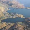 |
On-line Digital Images | DP 110551 | General oblique aerial view of Castlebay, Orasaigh, Bagh Beag and Bagh a' Chaisteil, Barra, taken from the W. | 14/11/2011 | Item Level |


