551 178/1/34
Description Sortie 2011/34
Collection RCAHMS Aerial Photography Digital
Catalogue Number 551 178/1/34
Category All Other
Permalink http://canmore.org.uk/collection/1255337
Collection Hierarchy - Sub-Group Level
Collection Level (551 178) RCAHMS Aerial Photography Digital
> Sub-Group Level (551 178/1) 2011 Photographs
>> Sub-Group Level (551 178/1/34) Sortie 2011/34
| Preview | Category | Catalogue Number | Title | Date | Level |
|---|---|---|---|---|---|
| Digital Files (Non-image) | TM 000912 | GPS recorded flight path and map for Sortie 2011/34 | 14/11/2011 | Item Level | |
 |
On-line Digital Images | DP 110584 | Oblique aerial view of the remains of the settlement, enclosures and dun at Bagh Ban, Pabbay, taken from the NW. | 14/11/2011 | Item Level |
 |
On-line Digital Images | DP 110585 | General oblique aerial view of the remains of the township, field system, and lazy beds at Vatersay and Hall, South Vatersay, taken from the SE. | 14/11/2011 | Item Level |
 |
On-line Digital Images | DP 110586 | Oblique aerial view of the remains of the townships, field system, field boundaries and lazy beds at Eorisdale and Vatersay, South Vatersay, taken from the NNE. | 14/11/2011 | Item Level |
 |
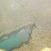
On-line Digital Images | DP 110587 | Oblique aerial view of the remains of the township, field system and lazy beds at Eorisdale, South Vatersay, taken from the NE. | 14/11/2011 | Item Level |
 |
On-line Digital Images | DP 110588 | Oblique aerial view of the remains of a fish trap, head dyke, lazy beds and field boundaries at Cornaig Bay, Vatersay, taken from the NE. | 14/11/2011 | Item Level |
 |
On-line Digital Images | DP 110589 | General oblique aerial view of Castlebay, looking towards the remains of the township of Brevig, Barra, taken from the WSW. | 14/11/2011 | Item Level |
 |
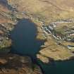
On-line Digital Images | DP 110590 | General oblique aerial view of Castlebay, looking over Kisimul Castle towards the remains of the township of Brevig, Barra, taken from the WSW. | 14/11/2011 | Item Level |
 |
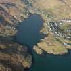
On-line Digital Images | DP 110591 | Oblique aerial view of the remains of the township and field system at Kentangaval, Castlebay, Barra, taken from the S. | 14/11/2011 | Item Level |
 |
On-line Digital Images | DP 110592 | Oblique aerial view of the remains of the township and field system at Kentangaval, Castlebay, Barra, taken from the SE. | 14/11/2011 | Item Level |
 |
On-line Digital Images | DP 110593 | General oblique aerial view of the remains of Kiessimul Castle,Castlebay, Barra, taken from the SSW. | 14/11/2011 | Item Level |
 |
On-line Digital Images | DP 110594 | Oblique aerial view of the remains of the townships and field systems at Castlebay, Glenlots and The Glen, Castlebay, Barra, taken from the SSE. | 14/11/2011 | Item Level |
 |
On-line Digital Images | DP 110595 | General oblique aerial view of the remains of the township of Balnabodach, and nearby head dyke, field system and lazy beds, Barra, taken from the SE. | 14/11/2011 | Item Level |
 |
On-line Digital Images | DP 110596 | General oblique aerial view of the remains of the farmstead and lazy beds at Fuiay, near Barra, taken from the E. | 14/11/2011 | Item Level |
 |
On-line Digital Images | DP 110597 | General oblique aerial view of the remains of the farmstead and lazy beds at Fuiay, near Barra, taken from the N. | 14/11/2011 | Item Level |
 |
On-line Digital Images | DP 110598 | Oblique aerial view of the remains of the farmstead and lazy beds at Fuiay, near Barra, taken from the WSW. | 14/11/2011 | Item Level |
 |
On-line Digital Images | DP 110599 | Oblique aerial view of the remains of the farmstead and lazy beds at Fuiay, near Barra, taken from the SW. | 14/11/2011 | Item Level |
 |
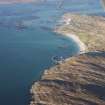
On-line Digital Images | DP 110600 | General oblique aerial view of cultivation remains and the pier at Aird Mhor, looking towards the location of the remains of fish traps at Sgeir Mhor and Aird Mhor, Barra, taken from the SE. | 14/11/2011 | Item Level |
 |
On-line Digital Images | DP 110601 | General oblique aerial view of the remains of the field systems and cultivation remains at Coileag and Balla, near the Coileag jetty, looking towards the Eriskay causeway, taken from the S. | 14/11/2011 | Item Level |
 |
On-line Digital Images | DP 110602 | Oblique aerial view of the remains of the township of Acairseid and nearby lazy beds, looking towards the remains of the township of Coileag, Eriskay, taken from the SSE. | 14/11/2011 | Item Level |
 |
On-line Digital Images | DP 110603 | Oblique aerial view of the remains of multiple fish traps near the remains of the township of Hartavagh and surrounding lazy beds, South Uist, taken from the SE. | 14/11/2011 | Item Level |
 |
On-line Digital Images | DP 110604 | Oblique aerial view of the remains of multiple fish traps near the remains of the township of Hartavagh and surrounding lazy beds, South Uist, taken from the E. | 14/11/2011 | Item Level |
 |
On-line Digital Images | DP 110605 | General oblique aerial view of Gasaigh, Loch Boisdale and Bein Ruigh Choinich, South Uist, taken from the SE. | 14/11/2011 | Item Level |
 |
On-line Digital Images | DP 110606 | General oblique aerial view of Gasaigh, Loch Boisdale and Bein Ruigh Choinich, South Uist, taken from the SE. | 14/11/2011 | Item Level |


