551 178/1/34
Description Sortie 2011/34
Collection RCAHMS Aerial Photography Digital
Catalogue Number 551 178/1/34
Category All Other
Permalink http://canmore.org.uk/collection/1255337
Collection Hierarchy - Sub-Group Level
Collection Level (551 178) RCAHMS Aerial Photography Digital
> Sub-Group Level (551 178/1) 2011 Photographs
>> Sub-Group Level (551 178/1/34) Sortie 2011/34
| Preview | Category | Catalogue Number | Title | Date | Level |
|---|---|---|---|---|---|
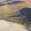 |
On-line Digital Images | DP 110633 | Oblique aerial view of the remains of the township of Nisishee and nearby head dyke, field system and lazy beds, Stangrigary, Harris, taken from the E. | 14/11/2011 | Item Level |
 |
On-line Digital Images | DP 110634 | Oblique aerial view of the remains of the field system, lazy beds and enclosures near Northton, Harris, taken from the SW. | 14/11/2011 | Item Level |
 |
On-line Digital Images | DP 110635 | Oblique aerial view of the remains of the township, field system, lazy beds and fish trap at Northton, Harris, taken from the SW. | 14/11/2011 | Item Level |
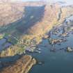 |
On-line Digital Images | DP 110636 | General oblique aerial view of the village and pier at Leverburgh, showing the remains of the township, fish trap, head dyke and lazy beds and the nearby remains of Dun Innisgall, Harris, taken from the WNW. | 14/11/2011 | Item Level |
 |
On-line Digital Images | DP 110637 | Oblique aerial view of the remains of the fish trap and lazy beds at Leverburgh, Harris, taken from the WSW. | 14/11/2011 | Item Level |
 |
On-line Digital Images | DP 110638 | Oblique aerial view of the remains of a fish trap, head dyke and lazy beds near the village of Leverburgh, Harris, taken from the WSW. | 14/11/2011 | Item Level |
 |
On-line Digital Images | DP 110639 | General oblique aerial view of the remains of a fish trap, head dyke and lazy beds near the village of Leverburgh, Harris, taken from the SW. | 14/11/2011 | Item Level |
 |
On-line Digital Images | DP 110486 | Oblique aerial view of the remains of Dun Loch an Duna, Isle of Lewis, taken from the NNW. | 14/11/2011 | Item Level |
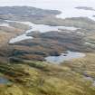 |
On-line Digital Images | DP 110487 | General oblique aerial view of the remains of Dun Loch an Duna, the townships of Grimshader and Ceann Hurnavay, with associated mill and head dyke, Isle of Lewis, taken from the NW. | 14/11/2011 | Item Level |
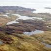 |
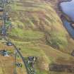
On-line Digital Images | DP 110488 | General oblique aerial view of the remains of Dun Loch an Duna, the townships of Grimshader and Ceann Hurnavay, with associated mill and head dyke, Isle of Lewis, taken from the NW. | 14/11/2011 | Item Level |
 |
On-line Digital Images | DP 110489 | Oblique aerial view of the remains of Leurbost township, with associated head dyke, field system and lazy beds, Isle of Lewis, taken from the WNW. | 14/11/2011 | Item Level |
 |
On-line Digital Images | DP 110490 | Oblique aerial view of the remains of Leurbost township, with associated head dyke, field system and lazy beds, Isle of Lewis, taken from the W. | 14/11/2011 | Item Level |
 |
On-line Digital Images | DP 110491 | General oblique aerial view of the remains of Ceos Blackhouse, Keose township and associated head dyke, field system and cultivation remains, looking across Loch Eirasort on the E coast of Lewis, taken from the WNW. | 14/11/2011 | Item Level |
 |
On-line Digital Images | DP 110492 | General oblique aerial view, looking towards the remains of the township of Gravir, on the shores of Loch Odhairn on the E coast of the Isle of Lewis, taken from the WNW. | 14/11/2011 | Item Level |
 |
On-line Digital Images | DP 110493 | General oblique aerial view of the remains of Gearraidh Richsaigh and Allt A'Ghrudaire townships, with associated head dyke and field system, on the shores of Loch Sealg on the E coast of the Isle of Lewis, taken from the W. | 14/11/2011 | Item Level |
 |
On-line Digital Images | DP 110494 | General oblique aerial view of the remains of Gearraidh Richsaigh and Allt A'Ghrudaire townships, with associated head dyke and field system, on the shores of Loch Sealg on the E coast of the Isle of Lewis, taken from the W. | 14/11/2011 | Item Level |
 |
On-line Digital Images | DP 110495 | General oblique aerial view of the remains of the township of Maaruig, with associated nausts, head dyke, field system and extensive lazy beds on the shores of Loch Mharaig on the E coast of Harris, taken from the NNW. | 14/11/2011 | Item Level |
 |
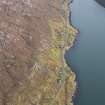
On-line Digital Images | DP 110496 | General oblique aerial view of the remains of the townships of Loch Maaruig and Maaruig, with associated nausts, head dyke, field system and extensive lazy beds on the shores of Loch Mharaig on the E coast of Harris, taken from the WNW. | 14/11/2011 | Item Level |
 |
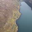
On-line Digital Images | DP 110497 | General oblique aerial view of the remains of the townships of Lechcan, West Tarbert and Tota Glas, with associated head dyke and piers on the shores of Loch a' Siar, Harris, taken from the NW. | 14/11/2011 | Item Level |
 |
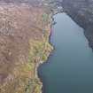
On-line Digital Images | DP 110498 | General oblique aerial view of the remains of the townships of Lechcan, West Tarbert and Tota Glas, with associated head dyke and piers on the shores of Loch a' Siar, looking towards Tarbert, Harris, taken from the NW. | 14/11/2011 | Item Level |
 |
On-line Digital Images | DP 110499 | General oblique aerial view of the remains of the townships of Lechcan, West Tarbert and Tota Glas, with associated head dyke and piers on the shores of Loch a' Siar, looking towards the village of Tarbert, Harris, taken from the NW. | 14/11/2011 | Item Level |
 |
On-line Digital Images | DP 110500 | General oblique aerial view Seilibost, Horgabost and the coastal area of Harris along the Sound of Taransay, Harris, taken from the NE. | 14/11/2011 | Item Level |
 |
On-line Digital Images | DP 110501 | General oblique aerial view Seilibost, Horgabost and the coastal area of Harris along the Sound of Taransay, Harris, taken from the NE. | 14/11/2011 | Item Level |
 |
On-line Digital Images | DP 110502 | General oblique aerial view of the remains of the township of Luskentyre, with associated field boundaries and lazy beds, in the Sound of Taransay, Harris, taken from the SW. | 14/11/2011 | Item Level |


