
Pricing Change
New pricing for orders of material from this site will come into place shortly. Charges for supply of digital images, digitisation on demand, prints and licensing will be altered.
Dunragit


Drain(S) (Post Medieval), Field Boundary(S) (Post Medieval)
Site Name Dunragit
Classification Drain(S) (Post Medieval), Field Boundary(S) (Post Medieval)
Canmore ID 78926
Site Number NX15NW 76.05
NGR NX 15007 57288
NGR Description Centre
Datum OSGB36 - NGR
Permalink http://canmore.org.uk/site/78926


- Council Dumfries And Galloway
- Parish Old Luce
- Former Region Dumfries And Galloway
- Former District Wigtown
- Former County Wigtownshire
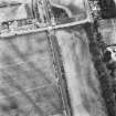
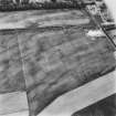
NX15NW 76.05 1486 5752 - 1505 5720
See NX15NW 76.00 and NX15NE 69.00
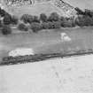
Aerial Photographic Transcription (10 September 1992 - 16 December 1992)
An aerial transcription was produced from oblique aerial photographs. Information from Historic Environment Scotland (BM) 31 March 2017.
Aerial Photographic Interpretation (15 December 2021)
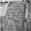
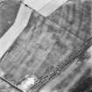
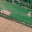
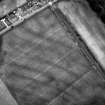
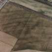
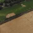
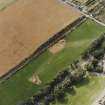
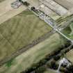
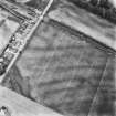
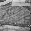
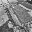
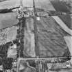
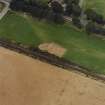
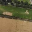
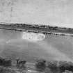
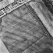
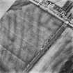
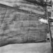
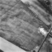
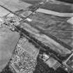
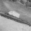
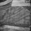
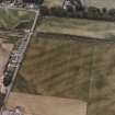
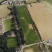
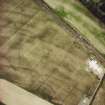
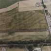
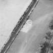
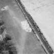
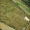
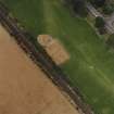
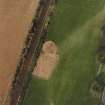
A series of field boundaries and drains that cut across the Dunragit timber enclosure (Canmore ID 78922) have been recorded as cropmarking on oblique aerial photographs (RCAHMSAP 1992).
Information from HES Archaeological Survey (K. Millican) 15 December 2021.
Note (23 August 2022)
The location, classification and period of this site have been reviewed and changed from FIELD BOUNDARY(S) (PERIOD UNASSIGNED).

