
East Reston


Pit Alignment (Prehistoric)
Site Name East Reston
Classification Pit Alignment (Prehistoric)
Alternative Name(s) Eye Water; Horn Burn
Canmore ID 60192
Site Number NT96SW 102
NGR NT 91030 60552
NGR Description NT 9092 6053 to NT 9107 6062
Datum OSGB36 - NGR
Permalink http://canmore.org.uk/site/60192


- Council Scottish Borders, The
- Parish Coldingham
- Former Region Borders
- Former District Berwickshire
- Former County Berwickshire
NT96SW 102 9092 6053 to 9107 6062
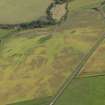
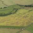
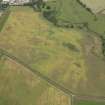
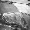
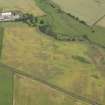
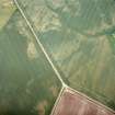
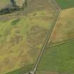
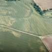
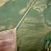
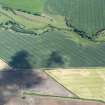
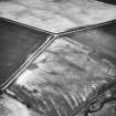
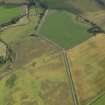
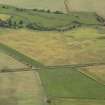
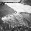
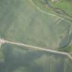
A sinuous pit-alignment, visible for about 210m, has been recorded as cropmarks on oblique aerial photographs (RCAHMSAP 1983, 1984, 1989, 1990) lying on near-level ground to the SW of the Eye Water.
Information from RCAHMS (MMB), 2 February 2005.
Scheduled (with NT96SW 72 and NT96SW 86) as 'Horn Burn... unenclosed settlement, enclosure and pit alignment... visible as cropmarks...'
Information from Historic Scotland, scheduling document dated 30 March 2009.
Sbc Note
Visibility: This site is visible as a cropmark.
Information from Scottish Borders Council

