Pricing Change
New pricing for orders of material from this site will come into place shortly. Charges for supply of digital images, digitisation on demand, prints and licensing will be altered.
Upcoming Maintenance
Please be advised that this website will undergo scheduled maintenance on the following dates:
Thursday, 9 January: 11:00 AM - 3:00 PM
Thursday, 23 January: 11:00 AM - 3:00 PM
Thursday, 30 January: 11:00 AM - 3:00 PM
During these times, some functionality such as image purchasing may be temporarily unavailable. We apologise for any inconvenience this may cause.
Castleton 4
Cup And Ring Marked Rock (Neolithic) - (Bronze Age)
Site Name Castleton 4
Classification Cup And Ring Marked Rock (Neolithic) - (Bronze Age)
Alternative Name(s) Castleton 4
Canmore ID 46819
Site Number NS88NE 11
NGR NS 85530 88162
Datum OSGB36 - NGR
Permalink http://canmore.org.uk/site/46819
- Council Stirling
- Parish St Ninians
- Former Region Central
- Former District Stirling
- Former County Stirlingshire
NS88NE 11 8552 8816.
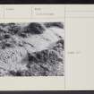
NS 862 883. Cup and Ring marked Rock. Situated 160 yds NW of Castleton farm, 105 yds NW of wall, 50 yds NE of wall, on top of a rock ridge running NW-SE with cliff on SW, are 3 groups of markings, 5 yds apart. They are well-preserved and clear, and comprise 2 ellipses - four and three rings - with central cups, and 3 cups- and-three-rings.
R W B Morris 1969
NS 8552 8816: 4 cup and ring marks - and 2 ellipses with central cups. Otherwise as described.
Surveyed at 1/2500.
Visited by OS (DWR) 8 February 1973
About 7m SE of Castleton 4c is a single cup and one ring. 8cm in diameter on horizontal rock. It has been re-covered.
R Morris and M van Hoek 1986.
Note (1979)
Castleton 4 NS 855 881 NS88NE 11
A rock outcrop bearing ellipses with central cups and cup-marks surrounded by up to three rings.
RCAHMS 1979
Morris 1968, 72, no. 177
Note (11 December 2018)
Date Fieldwork Started: 11/12/2018
Compiled by: ScRAP Team
Location Notes: The Castleton complex of rock art lies on farmland approximately 2 km SE of Cowie, 8 km SE of Stirling and approximately 2 km from the Forth at its closest point (Throsk, to the N). It comprises a number of outcrop ridges situated amongst arable and grazing land principally in the area surrounding Castleton Farmyard. Part of the complex – comprising the area of a field beside and to the NW of Castleton Farmyard – has been scheduled.
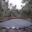
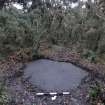
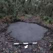
Castleton 4 is located within the scheduled area to the NW of Castleton farmyard. The field is crossed from NW-SE by an outcrop ridge, which slopes broadly to the NE on one side and more steeply to the SW on the other side, and along which Castleton 1 – 7 are located. The field is used from grazing cattle. Castleton 4 lies near the top of main part of the ridge, within a wooded area principally made up of whin and birch trees, and is approximately 150m NW of Castleton farmyard. It is located about 20m to the S of Castleton 3 which lies further along the same ridge. The panel also lies close to Castleton 5, which is approximately 3m to its SE, and Castleton 6, a further 2m to the SE from Castleton 5.
From the panel there are views N to the Ochils, although partially obscured by trees and other vegetation. There is evidence of historical quarrying activity in the general vicinity.
The panel described here is part of the group described under Canmore ID 46819, with this specific panel referred to as Castleton 4(a). Other panels described under this Canmore ID have been entered separately as Castleton 5 and Castleton 6.
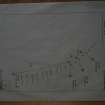
Descriptions, drawings and photographs of the panels and their arrangement can be found in Morris (1986) The Prehistoric Rock Art of Southern Scotland (except Argyll and Galloway), (p. 47), and in Van Hoek (1996) Prehistoric Rock Art around Castleton Farm, Airth, Central Scotland, in Forth Naturalist and Historian, vol. 19.
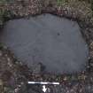
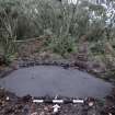
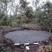
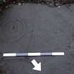
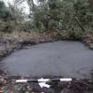
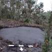
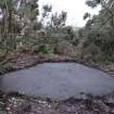
Panel Notes: This is a broadly oval shaped panel measuring 2m x 1.5 m and lying flush with the ground with its long axis oriented ESE-WNW. Its aspect is to the NE, facing down the slope of the ridge. It is located within a small clearance amongst the bushes in this wooded area.
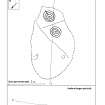
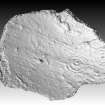
The surface is generally flat and smooth with some natural hollows. There are two cup-and-3-ring motifs to the SE end of the panel, each approximately 30cm in diameter, and each with a radial extending in a roughly W direction, from the centre to beyond the edge of the outside ring. They are placed symmetrically at either side of a groove in the panel surface, which is probably natural.
A further two motifs - a cup and two rings and cup and three rings - of a smaller size, and very faint, are located further to the W on the panel.


