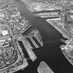
Glasgow, Govan, Doomster Hill
Motte (Medieval)(Possible)
Site Name Glasgow, Govan, Doomster Hill
Classification Motte (Medieval)(Possible)
Alternative Name(s) 'Tumulus'
Canmore ID 44078
Site Number NS56NE 18
NGR NS 555 658
Datum OSGB36 - NGR
Permalink http://canmore.org.uk/site/44078
- Council Glasgow, City Of
- Parish Govan (City Of Glasgow)
- Former Region Strathclyde
- Former District City Of Glasgow
- Former County Lanarkshire
NS56NE 18 555 658
For successive excavations (NS 554 658) to the NW of the indicated location and to the E of the parish church, see NS56NE 17.
The Doomster Hill stood on the S side of the Clyde, immediately opposite the ferry-house, on a spot occupied by the buildings of Harland and Wolff's (area centred NS 5559 6580) (OS field investigator [WMJ]) - now (ie. in 1976) demolished. The OSA (1795) states that it is supposed to have been a law hill, and describes it as 17' high, 150' in diameter at the base, and 108' in diameter on top. In 1845, its summit was occupied by a reservoir for an adjacent dye works; when this was being deepened, a few planks of black oak, some small fragments of bones, and a bed of what seemed to be decayed bulrushes was found (NSA 1845) (The published authorities refer to this feature as a tumulus, presumably because of the bone fragments noted above, but an 18th century sketch (information from Glasgow Evening News, 1 February 1937, illust) depicts it as a motte-like earthwork, with a ditch around its base.)
Visited by OS (W M J), 28 August 1951.
Statistical Account (OSA) 1795; New Statistical Account (NSA) 1845; J C Roger 1859


