Scheduled Maintenance
Please be advised that this website will undergo scheduled maintenance on the following dates: •
Tuesday 3rd December 11:00-15:00
During these times, some services may be temporarily unavailable. We apologise for any inconvenience this may cause.
Inchinnan, Old Parish Church And Graveyard
Burial Ground (Period Unassigned), Church (Period Unassigned)
Site Name Inchinnan, Old Parish Church And Graveyard
Classification Burial Ground (Period Unassigned), Church (Period Unassigned)
Alternative Name(s) All Hallows Church; St Conval's
Canmore ID 43063
Site Number NS46NE 11
NGR NS 4904 6803
Datum OSGB36 - NGR
Permalink http://canmore.org.uk/site/43063
First 100 images shown. See the Collections panel (below) for a link to all digital images.
- Council Renfrewshire
- Parish Inchinnan
- Former Region Strathclyde
- Former District Renfrew
- Former County Renfrewshire
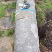
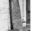
Inchinnan 1 (St Conval), Renfrewshire, recumbent cross-slab
Measurements: L 1.52m, W 0.52m at the head tapering to 0.39m, D 0.22,
Stone type: sandstone
Place of discovery: NS 4904 6803
Present location: in railed shelter outside Inchinnan New Parish Church.
Evidence for discovery: recorded by Stuart in the mid nineteenth century lying in the graveyard. A new church was built in 1900, and the slab was placed on raised plinths outside the church. It was taken to the New Parish Church when the old church was demolished in 1965 and displayed on a brick plinth in a shelter outside the church.
Present condition: very weathered with some edge damage and the top left corner missing.
Description
This is a slightly tapered rectangular slab, carved in relief only on the upper surface. Within a plain flatband border there is in the upper part of the slab a plain outline cross with an inner incised line and sunken armpits. The cross-arms extend out to the frame, and the spaces between the upper arms and on either side of the shaft are filled with heavy double-beaded interlace.
Date: late ninth to eleventh century.
References: Stuart 1867, pl 75, 1; ECMS pt 3, 458; Radford 1967, 183.
Desk-based information compiled by A Ritchie 2017
Inchinnan 2 (St Conval), Renfrewshire, cross-shaft fragment
Measurements: H 1.52m, W 0.51m at the base tapering upwards to 0.38m, D 0.18m
Stone type: sandstone
Place of discovery: NS 4904 6803
Present location: in railed shelter outside Inchinnan New Parish Church.
Evidence for discovery: recorded by Stuart in the mid nineteenth century lying in the graveyard. A new church was built in 1900, and the slab was placed on raised plinths outside the church. It was taken to the New Parish Church when the old church was demolished in 1965 and displayed on a brick plinth in a shelter outside the church. It seems likely that it has been re-used as a recumbent graveslab, perhaps in the seventeenth century.
Present condition: this portion of a shaft is broken at the point where it narrows into the (missing) cross-head, and it lacks its base. It is heavily weathered and face C has flaked away.
Description
This almost rectangular fragment was carved in relief on all four main faces, though only faces A, B and D survive. It tapers slightly towards the top, where there are shoulders sloping towards the cross-head. Each face has a cable-moulded border and is divided into three panels of heavy interlace patterns by broad plain bands.
Date: late ninth to eleventh century.
References: Stuart 1867, pl 75, 2; ECMS pt 3, 458; Radford 1967, 183.
Desk-based information compiled by A Ritchie 2017
Inchinnan 3 (St Conval), Renfrewshire, recumbent cross-slab or shrine cover
Measurements: L 1.60m, W 0.58m, D 0.25m
Stone type: sandstone
Place of discovery: NS 4904 6803
Present location: in railed shelter outside Inchinnan New Parish Church.
Evidence for discovery: recorded by Stuart in the mid nineteenth century lying in the graveyard. A new church was built in 1900, and the slab was placed on raised plinths outside the church. It was taken to the New Parish Church when the old church was demolished in 1965 and displayed on a brick plinth in a shelter outside the church.
Present condition: the once deep relief carving on the slab is severely weathered and the details are blurred. The slab is largely intact apart from edge-damage especially along the basal edges.
Description
This slab is carved in relief on the upper face A and on all four narrow faces, B, D, E and F. The underside, face C, is plain. There is a semi-circular projection at each corner and broad flatband mouldings along the edges which are plain except for the moulding at the head, which is carved with two twisted cords, and that at the foot, which bears a coiled serpent. There are traces of carving on the tops of the projections. Face A is carved with a central relief cross with rounded armpits, with a moulding below the arms and a wide plain band below the moulding. A single twist separates the ends of the arms from the border, and above the side-arms on either side an animal faces the cross. Two larger animals confront one another above the cross. Below the central plain band there is an interlace knot flanking the base of the cross-shaft. Below the shaft another pair of large confronted animals, and below the another pair with gaping jaws on either side of a central figure.
Face B has a single long panel with animals progressing to the right or head-end of the monument, with a double knot at the left-hand end. The five quadrupeds are set close together, one with its head turned to look back and the central animal facing outwards. The panel on face D contains six animals moving towards the head, with two facing back and one facing outwards. There is a long knot on the wider end, face E, and a single twist on face F at the foot.
Date: late ninth to eleventh century.
References: Stuart 1867, pl 76; ECMS pt 3, 458-9; Radford 1967, 182-3.
Desk-based information compiled by A Ritchie 2017
NS46NE 11 4904 6803.
For Inchinnan New Parish Churh, see NS46NE 7.00
(NS 4904 6803) Inchinnan parish church (dedicated to St Conval) was given to the Knights Templar by David I (1124-53). It was demolished in 1828 and replaced by another which in turn was demolished and replaced in 1900 by All Hallows Church. In 1965, this church was demolished to allow the extension of the airfield at Abbotsinch. In the churchyard are four tombstones with sloping sides, sculptured with swords, locally called the Templar's Graves. (See also NS46NE 7.01 for Early Christian stones).
New Statistical Account (NSA) 1845; Orig Paroch Scot 1851; R McClelland 1905; C A R Radford 1967.
Inchinnan, with its Early Christian stones, must posses considerable claim to having had a status comparable with an English Minster, at that period. (Shown on map as an early ecclesiastical site of an indeterminate nature).
P McNeill and R Nicholson 1975
A cross-marked nodule of quartze found at this church site in 1976 is in the Hunterian Museum, Glasgow. Other items, viz a green-glazed pottery disc bearing a Maltese cross, a pierced pewter disc with a lion and unicorn, and a granite ball 75mm in diameter with an eye for a chain, found here in 1977 are in the possession of D A Cunningham.
DES 1976; DES 1977.
Inchinnan Church was built about 1903 in Gothic Revival style.
SDD List 1963.
All Hallows Church, Inchinnan was built in 1904. Full description given by McClelland.
R McClelland 1905
NMRS REFERENCE
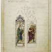
ARCHITECT: Sir Robert Rowand Anderson 1899-1904
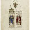
Brass eagle lectern - designed by Sir Robert Rowand Anderson.
St Conval's Church - 1) Demolished 1828
2) Built 1828. Demolished 1902.
3) Demolished in 1965/66 (Category A Listed). Information from NMRS Demolitions catalogue.
EXTERNAL REFERENCE
Scottish National Records Office
Inchinnan. Repair of the Church.
Notes concerning materials to be ordered and mason, slater and sarking work to be done.
1711 GD 220/6/610/16
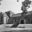
Photographic Survey (July 1963)
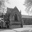
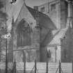
Photographic survey of the exterior of All Hollows Church, Inchinnan, by the Scottish National Buildings Record in July 1963. The church was later demolished for the building of Glasgow Airport.
Photographic Survey (May 1964)
Photographic survey of the exterior and interior of Inchinnan Old Parish Church (or All Hollows Church) by the Scottish National Buildings Record/Ministry of Works in May 1964. The church was later demolished for the building of Glasgow Airport.
Photographic Survey (June 1965)
Photographic survey of interior and carved stones by the Ministry of Works/Scottish National Buildings Record in June 1965 prior to demolition of the church.
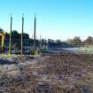
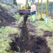
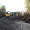
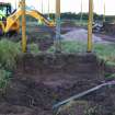
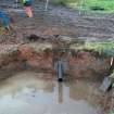
Watching Brief (11 October 2010 - 25 October 2010)
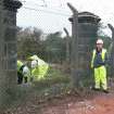
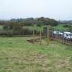
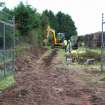
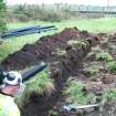
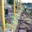
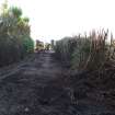
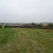
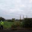
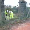
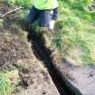
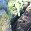
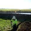
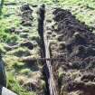
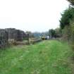
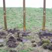
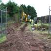
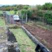
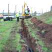
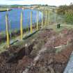
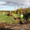
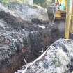
NS 4910 6810 A watching brief was carried out 11–25 October 2010 during the replacement of lighting and the construction of new fencing in and around the scheduled area surrounding All Hallows Church to the NE of the runway at Glasgow Airport.
The tracks required for new electrical cables and two new light bases were hand and machine excavated. No significant archaeological features were recorded in any of the excavated areas. No artefacts, other than ones relating to 20th-century use of the site, were observed. The quantity of made ground uncovered outside the boundary suggest that any potential archaeological remains have been removed by past levelling and landscaping work. The partially upstanding remains of the church and several fallen gravestones were still evident within the graveyard.
Archive: RCAHMS. Report: WoSAS
Funder: BAA Glasgow Airport
Alan Matthews – Rathmell Archaeology Limited
Excavation (22 May 2017 - 29 June 2017)
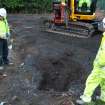
NS 49040 68030 (SMR ID: NS46NE 11) A community excavation was undertaken, 22 May – 29 June 2017, at the site of a possible early-Christian shrine and monastery. A medieval church, an 1828 church and a 1904 church were built on this site and the last church was demolished in the 1960s to make way for the Glasgow Airport runway.
A geophysical survey conducted by Magnitude Surveys prior to the excavation revealed two possible features in the Glebe, a possible 18th-century track from the graveyard to Causwayhead and a possible curving boundary feature. The survey did not identify any new gravestones in the graveyard, but did reveal the foundations of what may be the 1828 church.
A total of four trenches were dug within the All Hallows graveyard and two trenches were dug in the vicinity. Trench 1 (4 x 4m) was located over the S wall of the 1904 church. Features of the 20th-century church were revealed at a depth of c0.5m below the surface. These features included a wall, the sandstone tiled floor of the side aisle and a concrete surface beneath the pews. The walls of the 1904 church had been demolished and the site sealed with imported clay and topsoil. A 2 x 2m sondage was cut in the centre of the trench, through the concrete floor. Within this sondage the sub-floor deposits were excavated for a further 1.35m (a maximum depth of 1.85m below the surface). The uppermost deposits below the concrete consisted of several layers of demolition debris, made up of fragments of sandstone (some with curved or squared edges) sand, mortar and brick. They contained numerous sherds of stained glass and lead came. Segments of four sandstone walls were revealed. These walls were abutted by brown sandy layers that contained occasional small fragments of bone. The size of the sondage was further reduced to avoid the bone and at a depth of c1.5m below the surface several shroud pins and two coins were found. One coin has been identified as a 15th-century Scottish Billon penny and the other as a possible cut short cross penny of Hugh Walter of the early 13th century. At the bottom of the trench the top of a human skull was seen in section. The skull was left in situ and the trench not excavated further. This layer also contained stained glass, possibly 15th/16thcentury in date, nails and a sheep’s tooth.
Trench 2 (7 x 3m) was located over the path that once led towards the porch located to the N of the 1904 church. Like Trench 1, the uppermost deposits consisted of imported clay and topsoil that together were 0.40–0.75m deep. Once these deposits were removed, the porch step and 1960s tarmac path were revealed. A small rough cross was seen in the surface of the porch step. A deeper sondage was excavated in the middle of the trench. Below the tarmac path, there was a deposit of demolition debris (up to 0.7m deep) which contained architectural fragments, probably derived from the 1904 and 1828 churches. A massive wall was found towards the N end of the trench, the top of which was 1.2m below the surface. The wall was 0.9m wide and survived to at least 0.5m high. This wall was interpreted as the old, pre-1904, graveyard enclosure wall, aligned E/W, as seen on the 1st Edition OS map of the mid-19th century. Between the old graveyard wall and the porch step there was a series of deposits of brown clay silt, which together were c0.4–0.5m deep. This material contained only a few small fragments of brick and slate, a single nail and a single sherd of pre-Industrial pottery. This deposit had been cut into by the foundations for the 1904 church, a large linear hollow filled with demolition debris, and the old graveyard wall. The brown clay-silt sealed a few tumbled stones that may have once been a wall aligned E/W. These stones sat on top of yellowish weathered bedrock at a depth of 1.5m from the surface.
Trench 3 (4 x 4m) was excavated at the junction of the 1904 church and the Blytheswood Mausoleum. When the imported clay deposit and topsoil were removed, the outer church wall, the side and back aisle floors and a concrete surface beneath the pews were revealed. A small sondage was dug beneath the concrete and this revealed two earlier walls. One wall (aligned E/W) was thought to be the N wall of the 1828 church tower and a second wall (aligned N/S) may have been the W wall of the 1828 church. The footprint of the 1904 church was revealed in several places around the site by the removal of the turf, where the stones survived within about 0.2m of the surface.
Trench 4 was located over the Boiler House of the 1904 church where it had been thought some stone cross shafts from the All Hallows graveyard had been dumped. The fill of the Boiler House was removed until this became unsafe because of the large size and weight of the debris. The doorway to the Boiler House was exposed, and a few architectural fragments from the 1904 church were found, but no stone cross shafts were retrieved.
Trench 5 (3 x 6m) was dug in the centre of the Manse Green. No significant archaeological features were seen.
However, 40 sherds of pre-Industrial pottery (some probably medieval), a fragment of a shale bracelet, over 500 sherds of modern pottery and other modern material was retrieved from the deposits. These deposits have been interpreted as cultivated soils into which midden material has been added as fertiliser. The relative abundance of pre-Industrial pottery suggests that there was occupation dating from the medieval to the 17th-century nearby. The shale bracelet is possibly Iron Age in date and is the only prehistoric evidence retrieved. The geophysical survey had revealed a faint anomaly in the Glebe Field which could be interpreted as a possible curving wall or ditch to the NW of the churchyard. Permission was not granted to dig in the Glebe Field and so a machine cut trench (Trench 6) was located in the field to the E of it, to the N of the churchyard, in order to examine whether this possible curving feature extended beyond the Glebe Field. Only two very shallow, narrow, linear features were seen below the shallow topsoil and both contained modern pottery and glass.
Archive: NRHE (intended). Report: Calluna Archaeology (intended)
Funder: HLF, HES, Robert Barr Charitable Trust, Hugh Fraser Foundation, AMW Charitable Trust, Dickon Trust Fund, Peter Coats Trust and Pete
Heather James – Calluna Archaeology
(Source: DES, Volume 18)
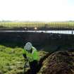
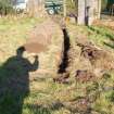
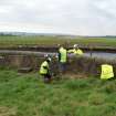
Watching Brief (12 December 2019 - 20 October 2020)
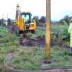
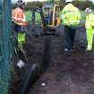
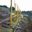
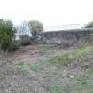
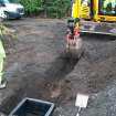
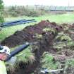
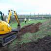
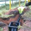
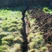
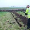
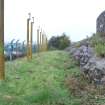
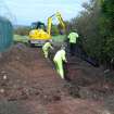
NS 491 680 A watching brief was carried out at the proposed development site next to All Hallows Church, (Canmore ID: 43063) from 12 December 2019–20 October 2020. No significant archaeological features or finds were encountered during the watching brief; however, a modern ditch extending E/W parallel to A8 Greenock Road was uncovered at the N end of the monitored area. This was interpreted as a possible foundation ditch for the wall that is present at the N end of the site.
Archive: NRHE (intended) Funder: Renfrewshire Council
Katharine Warden – GUARD Archaeology Ltd
(Source: DES Vol 22)


