Dalquharran Castle
Castle (Medieval)
Site Name Dalquharran Castle
Classification Castle (Medieval)
Alternative Name(s) Dalquharran Castle Policies; Old Dalquharran Castle; Dalquharran Castle (Old Castle); Dalquharran Castle (Ruin)
Canmore ID 40887
Site Number NS20SE 9
NGR NS 27255 01877
Datum OSGB36 - NGR
Permalink http://canmore.org.uk/site/40887
- Council South Ayrshire
- Parish Dailly
- Former Region Strathclyde
- Former District Kyle And Carrick
- Former County Ayrshire
NS20SE 9 27255 01877
(NS 2724 0187) Dalquharran Castle (NR) (remains of)
OS 6" map (1967)
See also:
NS20SE 29.00 NS 27055 02161 Dalquharran Castle (Country House)
NS20SE 29.01 NS 26498 02314 Gate-Lodge
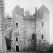
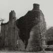
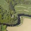
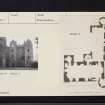
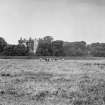
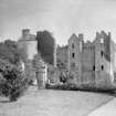
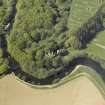
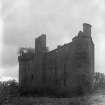
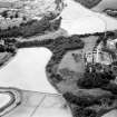
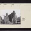
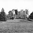
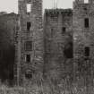
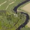
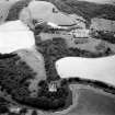
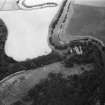
The remains of Dalquharran Castle occupy a strong position, guarded by the Water of Girvan, marshlands, and a former moat. The original castle, built in the 15th century, measures 60ft by 30ft with walls 5ft in thickness. A circular tower projects at the SE angle. The garret storey within the parapet walk has disappeared. The ground floor is vaulted. The large extension which transformed the N front was added in 1679.
D MacGibbon and T Ross 1892; N Tranter 1965
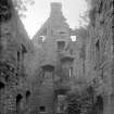
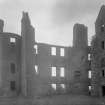
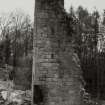
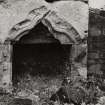
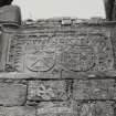
Dalquharran Castle is generally as described. The main entrance has a pediment dated 1679, while a window lintel is dated 1677. The walls are decaying, but, except for the S wall of the N wing, all are standing complete. Low garden walls, in disrepair, surround the building. At NS 2622 0190 are the remains of an ornate 17th century gateway.
Visited by OS (JLD) 5 May 1954
This building is still as described above.
Visited by OS (WDJ) 2 December 1959
As described above. The moat effect mentioned by MacGibbon and Ross the result of later terrace landscaping of the marshland which formerly protected the castle on the E and S sides.
Visited by OS (JRL) 18 May 1977.
Scheduled as Dalquharran Castle (Old Castle).
Information from Historic Scotland, scheduling document dated 21 May 2002.
NMRS REFERENCE
Architect: Robert Adam 1782-90 (Clerk of Works Mr Cairncross)
Wardrop & Reid, 1880, proposed adds & alts
DALQUHARRAN CASTLE DRAWINGS
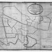
NMRS Photographic survey of drawings for Dalquharran Castle including: two letters from Robert Adam to Thomas Kennedy 1786 and 1789; an inventory of 1837; a survey of the estate by Hugh rodger 1781; designs for additions by Wardrop and Reid 1880; Letting particulars for 1893, 1903 and 1904; and a photograph album showing the Castle and estate c. 1885.
Copied 1980 Inventory 111
EXTERNAL REFERENCE
Dalquharran Estate: Material Belonging to Col. MacFarlan
A MD1-3 Manuscripts Containing 2 letters from Robert Adam to Thomas Kennedy of Dunure (whose interest is increased as they touch on Adam's wider architectural practice in Scotland towards the end of his life) and an inventory of a very full and detailed nature of 1837.
B MD4-12 Architectural drawings containing 2 sets of floor plans for the proposed additions of wings by Wardrop and
Reid of Edinburgh in February and March of 1880. The wings were executed but probably not quite as either of those plans intend. The drawings are individually rolled and being waxed tracings are now exceptionally brittle and thus their future depends on very great care being exercised for their protection.
C MD13-15 Printed Material. 3 sets of printed letting particulars for 1893, 1903 and 1904, giving a very full description of the house at this period and the estate in general.
D MD16,17 Typed Material. Containing an interesting account of the old castle and an unidentified topographical description of 1789, recording the state reched in Adam's new building and a tour of the old house. A sketch mentioned as taken by Capt. Grose's sketch is now in the collection of the National Gallery of Scotland. (That of D.N. Casthe was engraved and published in 1806 (AYD/70/23))
E MD18-20 Loose Photographs. Containing an important photograph of the house before the addition of Wardrop and Reid's wings.
F MD 21 Photograph Album. Containing a pleasant late-Victorian record of the House after its extension when occupied by the family, also views on the estate and connected properties. (27 photographs)
This material in conjunction with the drawings in the collection of the Royal Institute of Architects in Scotland give the NMRS a particularly complete record of the house, to add to the Soane material and the photographs recording its ruined state.
Field Visit (April 1982)
Dalquharran Castle NS 272 018 NS20SE 9
The old castle of Dalquharran stands on the N bank of the Water of Girvan 300m SSE of the late 18th-century castellated mansion of Dalquharran. It originally comprised a rectangular block of 15th-century date, three storeys and an attic in height, with a hall at first-floor level. A square stair-tower and a circular tower were subsequently added at the NW and SE angles respectively, and in 1679 a new wing and a second stair-tower were added on the N.
RCAHMS 1983, visited April 1982
(Grose 1789-91, ii, 198; MacGibbon and Ross 1887-1902, iii, 344-8).
Standing Building Recording (May 2007)
NS 2725 0187 Systematic gazetteer of historic and built features on the Dalquharran Estate as part of a wider conservation plan. Work was undertaken during May 2007 and the principal findings of note include:
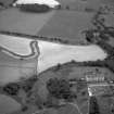
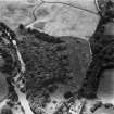
Dalquharran Old Castle Initial reassessment of the old castle included the recognition that the old castle originally consisted of a rectangular range with circular corner towers to both SE and SW (only the former now remains). Apparently associated with this was what appears to have been a walled enclosure – parts of
which are incorporated into the E wall of the E range, including a circular corner tower to the NE (now forming the base of a later angle tower).
The circular tower to the SW was removed and the corner buttressed; this work may have been coeval with the erection of a new stair tower at the NW corner of the main block – perhaps earlier 17th century.
Late 17th-century alterations included the addition of a new wing to the E, with circular NE angle tower, and a new stair-tower at the re-entrant with the original range. This bears a monogram, the date ‘1679’ and an inscription in Latin – a quotation from Buoncampagno de Signa’s Rhetorica Novissima of 1235. An
associated forecourt was laid out; its remains include gate-piers with frosted rustication to the N, and a dwarf wall containing intermittent recessed panels, surmounted by copes and iron railings, the latter now gone. Below the forecourt on its E side there seems to have been a further court, a service area that perhaps included stabling. In the later 18th century an ice-house was formed within one of the vaulted basement chambers of the main block of the castle.
17th-century gardens - The extent of gardens that were associated with the late 17th-century remodelling of Dalquharran Old Castle was better defined. A major avenue or ride ran northwards on the principal axis of the remodelled castle; this is still bordered with yew trees on its W side. Immediately to the W of this avenue lay a major walled garden, the E wall of which remains, still incorporating masonry of this period. The avenue
terminated at the Old Place of Dalquharran, which lay in the vicinity of the existing NW entrance to the policies.
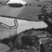
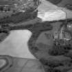
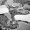
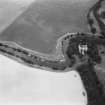
An area of the low-lying ground on the S and W sides of the old castle was enclosed by walls, extensive sections of which remain to the W (running up to the later burial enclosure), and along the riverside. At one point the riverside wall angles outwards, where there had perhaps been a viewing platform or the base of a garden building. A riverside walk was defined by further yew trees; at its W end there had been an entrance within the perimeter wall. This may be the same as the re-erected 17th century gate piers that survive further W along the riverbank. Little now remains of further avenues that are recorded on Roy’s survey of c1750; parallel ditches of one were recognised from aerial photographic evidence, running NW from a circular
planting in the vicinity of the walled garden to the W policies entrance.
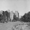
Late 18th-century and later landscape With the building of the new mansion of Dalquharran at the end of the 18th century the old castle became an eyecatcher for the new. The earlier walled garden was extensively remodelled, with new entrances within the perimeter wall and its wall head raised considerably.
In the later 19th century the walled garden was itself relocated to the NW of the new mansion house.
Archive deposited with RCAHMS.
Funder: Private client; Michael Laird Architects.


