Pricing Change
New pricing for orders of material from this site will come into place shortly. Charges for supply of digital images, digitisation on demand, prints and licensing will be altered.
Upcoming Maintenance
Please be advised that this website will undergo scheduled maintenance on the following dates:
Thursday, 9 January: 11:00 AM - 3:00 PM
Thursday, 23 January: 11:00 AM - 3:00 PM
Thursday, 30 January: 11:00 AM - 3:00 PM
During these times, some functionality such as image purchasing may be temporarily unavailable. We apologise for any inconvenience this may cause.
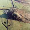
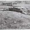
Dunadd
Cup Marked Rock (Prehistoric), Fort (Early Medieval), Ogham Inscribed Rock (Early Medieval), Well (Period Unknown), Carved Stone Ball (Neolithic)
Site Name Dunadd
Classification Cup Marked Rock (Prehistoric), Fort (Early Medieval), Ogham Inscribed Rock (Early Medieval), Well (Period Unknown), Carved Stone Ball (Neolithic)
Alternative Name(s) Dun Add; Dun Monaidh; Moine Mhor; River Add
Canmore ID 39564
Site Number NR89SW 1
NGR NR 83650 93559
Datum OSGB36 - NGR
Permalink http://canmore.org.uk/site/39564
First 100 images shown. See the Collections panel (below) for a link to all digital images.
- Council Argyll And Bute
- Parish Kilmichael Glassary
- Former Region Strathclyde
- Former District Argyll And Bute
- Former County Argyll
NR89SW 1.00 8365 9356.
(NR 8370 9356) Dun Add (Fort)
Well Trough (NR)
OS 6" map (1900)
NR89SW 1.01 8365 9356 Rock: Sculptured; Ogam
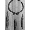
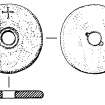
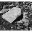
The Neolithic carved stone ball (NMS GP 220) is of greenstone, 2 and 3/4 inches in diameter, with six projecting discs. It was found on the rock close to the inside wall of the fort, on its SE side, and about 12 inches underneath the surface.
D Christison 1905
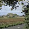
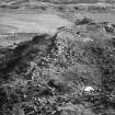
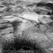
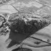
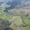
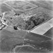
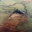
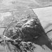
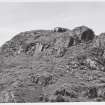
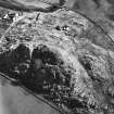
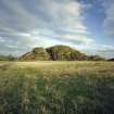
Dunadd: This Dark Age fortress stands on top of an isolated hill, once protected on nearly all sides by marshy ground. It is thought to have been the capital of the Scottish kingdom at Dalriada, founded by colonists from Ireland about A D 500. Excavations in 1904 and in 1929 confirmed that the site had been occupied in the Dark Ages but showed that there had been an earlier, Iron Age settlement here.
The layout of the drystone fort is sometimes described as nuclear with a central stronghold on the summit of the hill and two outer fortified enclosures on natural terraces lower down - a typical Dark Age plan.
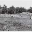
One enters the lowest enclosure through a natural gully on the SE side; the massive outermost wall is well preserved in part. Above this is the second enclosure, reached originally through a small gateway at the SW junction of the two walls. The topmost fort, or citadel, is a drop-shaped enclosure at the W end of the summit ridge and measures internally 30.5m by 13.7m. It is possible that this was an Iron Age dun and that the lower enclosures were added in the Dark Age. Immediately in front (NE) of the citadel is another small enclosure and below this to the NW is a ravine outside the walls in which a midden had accumulated during the occupation of the site. On the rock ridge in front of these two uppermost enclosures are several rock carvings (see NR89SW 1.01).
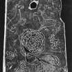
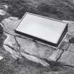
These include a boar allegedly in the Pictish style and protected by a glass, two or three lines of ogham inscription, a hollowed-out basin ("Trough" on OS 6") and a footprint. The boar perhaps dates from AD 736 when the Scotic capital was beseiged and captured by Fergus, King of the Picts. The footprint and basin probably mark the site of the inauguration of new kings of the Scots. The well on the main terrace, on which huts are traceable in the NE sector, is covered by flagstones and paved round its head, the water being tapped lower down for a farm supply. Also, at ground level, almost at the foot of the cleft on the W side, a small trough of slabs on edge seems to be a blocked spring-basin. Leitch notes a St Columba's Well at or near Dunadd. Near the well, on the S side of a walled cleft, some 4'6" up, is a lightly incised animal with an erect fir-tree tail, dog-like head and a possible collar, about 9" overall. Artifacts ranging from the mesolithic to medieval period were found during the excavations. They are now in the NMAS and include micro blades and scrapers, a 6-knobbed stone ball, EBA halberd, bronze ring-headed pin, spiral ring, food vessel sherds, a jet armlet, Romano-British sherds, Samian fragments, glass and amber beads, a rotary quern with an incised cross, Rhineland pottery, an inscribed slate disc, etc.
C Leitch 1904; D Christison 1905; J H Craw 1930; M Campbell and M Sandeman 1964; K Jackson 1965; A S Robertson 1970; D V Clarke 1971; J M Coles 1971; E W MacKie 1975
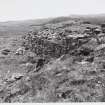
NR 8366 9356. This fort is generally as described and planned. It is best preserved on the E where the wall stands four courses high and 2.4m wide. Within the wall at the SW of the second enclosure are traces of a possible cell, and within the main enclosure are the foundations of a rectangular building.
The animal near the well is faintly visible; the blocked spring was not located.
Resurveyed at 1:2500.
Visited by OS (DWR) 26 April 1973
Dunadd fort is as described in the previous information. Apart from the possible cell at NR 8367 9355 and the rectangular foundations at NR 8371 9356 there are no traces of house sites to be seen.
Surveyed at 1/2500.
Visited by OS (BS) 15 February 1977
Field Visit (July 1980)
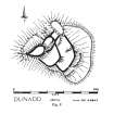
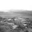
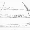
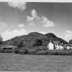
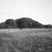
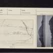
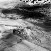
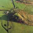
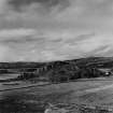
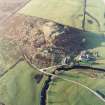
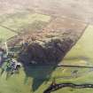
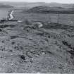
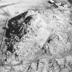
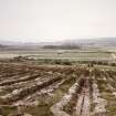
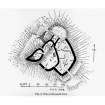
The isolated rocky massif of Dunadd rises to a height of 54m OD above the boggy flats of Moine Mhor, through which the River Add meanders towards the sea at Loch Crinan. The massif is roughly triangular on plan with peaks at the N and W angles and a broad flat apron to the SE bounded by a rocky ridge, through which a natural defile gives access from the lower ground. The W summit, the series of shelves between the twin peaks and the lower apron have been stoutly defended by a series of walls which make skilful use of the strong natural position, but the irregular N peak does not appear to have been defended in any way. The site was first set in context as a result of David Christison's fieldwork on the forts of this part of Argyll in 1903 (Christison 1904). Excavations were undertaken in 1904-5 by the Society of Antiquaries of Scotland under Christison, (1905) by the same body in 1929 under J H Craw (1930), and in 1980-1 by Dr Alan Lane, for Historic Buildings and Monuments: Scottish Development Department; the following account makes use of the published reports as well as further information and photographs kindly made available by Dr Lane. In Christison's report the various elements of the fort were lettered (A-F), and to facilitate comparison between his plan, prepared by the eminent architectural historian Dr Thomas Ross, and the recent survey the former is also reproduced here, with Christison's nomenclature retained. Ross's plan is important as it formed the basis for subsequent illustrations of the site, but the subtlety of his hatching has been ignored in later versions. The plan shows a grading in wall preservation from good (black hatch) to uncertain (greyer) or fugitive (white), the sort of representation that might be made by differences in the weight of stipple on a Commission plan, but which the uniformly black bands of all later plans of Dunadd cannot convey.
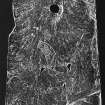
Christison divided the fort into two main portions, the 'Upper Fortress' (A-C) and the 'Plateau Fort' (D-F), a distinction that is still useful, and he also gave names to other parts of the fort, to which reference will be made later. The summit area (A) will be described first, followed by an account of the walls that enclose a lower shelf (B) and defend the area between B and the N peak (C). The walls that defend the lower apron (D-F) will then be examined, along with a series of outer features, including a line of set boulders, a lower outer wall on the NW flank, and three cup-markings. There is a brief account of some of the finds from the site. The important group of carvings on the upper terrace, including a boar and an ogam inscription, will then be discussed, as will a graffito of unknown date on a vertical rock face in the N portion of the interior. Mention is made finally of two references to Dunadd in the Annals of Ulster and to its position in historical studies of Dal Riata and Pictland.
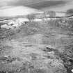
Christison's excavations involved 'following the line of the walls' and 'turning over the interior' of the fort, but the extent of his work is not certain. Craw excavated in three areas: Trench X, a triangular trench at the W extremity of the interior of the summit fort (A); Trench Y, in the gully to the NW of shelf B; and Trench Z, on a flat area to the W of enclosure D. The positions of the trenches are shown on Craw's plan, which is reproduced here to allow comparison with earlier and later versions. During the back-filling of his trenches, Craw positioned upright stones 'at the corners of the excavations, projecting about 1 foot from the ground, as a guide to any future excavations that may be undertaken'. The stones at the corner of Trench Z were the only stones that could be plotted in the course of the present survey. Craw's work, which involved two men for twenty-four days, was more successful in recovering small finds than in elucidating the structural remains. Few relics were found in Trench X, but fragments of animal bones were picked up; midden material and small finds were collected from Trench Y, though not apparently as stratified deposits. The positions of Dr Lane's trenches are indicated on a separate plan (Sites 1-4).
ARCHAEOLOGICAL DESCRIPTION
'UPPER FORTRESS'. Before the most recent excavations, the unusual pear-shape of the summit fort, Christison's 'Upper Ridge-fort' (A), was difficult to interpret. The excavations of 1980-1 in Site 1 revealed, however, that it is of two periods: in the earlier, the fort was oval and measured about 20m by 13m internally, but later there was an extension to the SW producing both the odd plan and the conspicuous kink in the NW wall. In both periods the entrance was on the NE, where an uneven path, which according to Christison 'had apparently been cut into steps', allows access to the summit. Only a short stretch of the wall of the earlier fort was revealed; it measured about 3.5m to 4m in thickness and it overlay the debris of earlier occupation. As radiocarbon determinations are not yet to hand, however, the evidence for the date of this wall must remain inconclusive; it appeared to be later than a pin-mould comparable with examples dated to the 7th or 8th century AD. Moreover, the rim of a pottery vessel of a class known as E-ware (see Introduction) was found sealed beneath the rubble representing either the demolition of the earlier wall or the construction-debris of its successor. Whatever the precise date of this structural alteration, its result was to increase the area of the summit fortress to about 30 m by 13m within a wall some 4 m thick. Christison says that the 'wall was traceable all round' still standing to a height of 1.2m, but he does not make it clear whether it was the inner or the outer face. At the present time, stretches of both faces can be traced, the inner still standing on the NE to a height of 0.65m in four courses. Christison also recorded that several feet of friable earth 'containing many relics' covered the interior, but few finds were made in the course of Craw's work. Possibly at the same time as the reconstruction of A, the decision was taken to enclose with walls both the terrace to the W of the summit and the shelf lying some 5 m below it on the NE. The latter (Christison's 'Middle Ridge-fort') measures about 22m by 11m and slopes appreciably from SW to NE. It is defended by wall B, about 2m in average thickness, linking a series of rocky outcrops and well preserved on the NE side, but barely traceable on the NW and SE. The best-preserved stretch of the inner face is on the E, where it stands to a height of 0.6m in four irregular courses. The Outer face may be traced in several places: on the NE, where it stands to a height of 0.7m in four courses; on the E in the cleft between two rock outcrops; and a short stretch just below the entrance to the summit fort. Wall B thus encloses the important group of carvings and inscriptions discussed below and indicated on the plan (a). Christison records that 'relics abounded' in the interior, where the deposits were as much as '4 or 5 feet deep' (up to l.5m). There are slight traces of a cross-wall, visible on the W as a line of facing-stones apparently springing from B and as a thin scatter of debris that runs towards a rocky outcrop on the E side. This wall was exposed in the course of Christison's excavation; it was not, however, bonded into wall B and 'was of inferior masonry, and in all probability of secondary origin'. There is a further stretch of walling in the interior on the NE, measuring 3.5m in length, 0.4m in thickness and standing to a height of 0.15m; it may have been part of an internal building, but without further excavation its relationship to the main wall is uncertain.
Access to the 'Upper Fortress' (A, B) from D is up a curving path from the bottom of the rocky massif on the SE. There is, however, now no certain trace of the steps clearly indicated by Christison, and the stones have presumably been dislodged by visitors to the summit.
Abutting the NE side of B, there is a rectangular area of stonework (b) on the top of a rock overlooking the E side of the interior of the fort; the outer facing-stones of this small plinth are still in position on the SE side, but the line on the NE is less clear. Christison described this feature as a buttress 'measuring 12 feet (3.65m) in length and 6 feet (1.8m) in breadth'; its interpretation is uncertain.
Christison postulated that the irregular terrace between wall B and the northern peak had been defended by two other walls (C), forming his 'Lower Ridge-fort', in order to block access from the NW, where the slopes, though steep, are not unscaleable. It is likely that this apparent chink in the defences would indeed have been filled, and that the two short stretches of stony debris that extend between the N angle of B and the base of the northern peak represent the remains of a defensive wall that has since tumbled downhill. On the E side of the terrace there is a short stretch of wall-debris on the proposed line, as well as a single surviving outer facing-stone. The cross-walls are shown unambiguously on Christison's sketch plan of 1903.
On the lower slopes of the western peak, there are slight traces of an outer work (here lettered G), which provided further protection to the summit fort on all sides except the S, where the rock faces are most precipitous. Boulders have been manipulated into position across clefts in the rock, and there are traces of wall-debris both in the gullies and along the tops of rock faces. The cross-wall within enclosure B may be a continuation of this line of defence, and there are indications of a further stretch of walling on the SW side of the ridge, but here the traces are rather tenuous.
'PLATEAU FORT'. The largest part of the fort (Christison's 'Plateau Fort') occupies an irregular terrace, its wall springing from the natural rock on the N and running in a series of straight alignments with some almost right-angled changes of direction (perhaps suggesting several periods of construction or gang-work) to terminate against the base of the rock below the summit fort on the W. In places the wall is well preserved, particularly on the NE, where it stands to a height of 1.1m in six courses, but elsewhere, notably where it meets the rock face, it is represented merely by a band of rubble, and at these points its line is less certain. In some stretches the line of the outer face is indicated only by the robber trenches from which stones have been removed.
In 1980 the wall was sectioned on the NE side (Site 2) in order to examine its structure, and a building sequence was established. In the earlier phase the wall measured between 3.1m and 2.6m in thickness, with both the outer and inner faces being battered; the second-phase wall was between 4.7m and 4m thick.
The entrance is through a natural cleft on the SE, which measures some 3m in width with sheer rock walls some 2.3m in height; there was presumably a substantial timber gateway at the point where the stone walls of the fort meet the rock faces of the cleft. Thomas suggested that the entrance had been bridged and that the wall was continued over it.
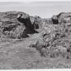
In 1904 Christison traced several walls in the interior, but not all can now be seen; there is no sign of the curving wall which formed the S side of his sub-division E and measured some 18 m in length, l.2m in thickness and from 0.22m to 1.06m in height. It was not visible on the surface before his excavations, and it may now be covered up again. It was carefully built of large flat slabs 'with a scarcement to the outside'. A short straight stretch of walling in approximately the same position appears to be of comparatively recent date. A well found at the N end of this enclosure can still be seen (c); about l.8 m in depth, it is 1.2m in diameter and was surrounded by a pavement of thin flat slabs set on edge and radiating outwards', but this may also be of recent date. The adjacent gap in the wall is said to have been made in order to allow access to the well by a farmer in Victorian times (Christison 1904). Two rectangular foundations, which can still be seen in the interior further to the S, are indicated on the plan.
The W third of the lower fort is defended by a wall, 3.5m in average thickness, which takes in a D-shaped area about 37m by 20m and incorporates a small cell or chamber (e) in its W angle. The physical relationship of this cell to wall D is not clear. The large slab noted by Christison (d) can still be seen, but it is perhaps unlikely that it served the purpose of a 'door slab', as he suggested. The 'postern' shown on Christison's plan is no longer visible, perhaps because this area is covered by rough drystone walling of very recent date; part of a second 'door slab' mentioned by him can still be seen, and thus the position of what he describes as a narrow entrance can be identified, though the entrance itself cannot, and the interpretation is not without uncertainty. Christison noted that, as with the summit fort (A) and the lower enclosure (B), his excavations in (D) revealed an appreciable depth of black soil with an 'abundance of relics'. Excavations across the line of wall D in 1980-1 (Site 3) revealed the outer, but not the inner, face and also cut across the corner of Craw's Trench Z. The outer face of the wall survived to a height of 0.7m in four courses, with an inner core of well-laid rubble. A bronze ringed pin of 6th-to 9th-century AD date was found on top of the rubble core of the wall. To the inside of wall D thick, charcoal-rich deposits of black soil were encountered, in which there were large quantities of clay mould fragments, crucible fragments and other artefacts. Analysis of this material is still under way, and the interpretation of the finds is tentative. It seems likely, however, that they represent the debris of bronze- and iron-working. The excavation of Site 3 was not completed and a deposit of at least 0.5m in depth, presumably including earlier material, remains to be examined.
The irregularly-shaped cell (e), incorporated within the W angle of D, measures about 1.2m by 1.2m at ground level, with the rock face forming the wall some 1.5m in height on the NE side. It is entered from the E, through a passage about 3m long and 1.1m broad, whose N side-wall stands to a height of 0.7m in three massive courses.
Outside the fort to the NE and some 30 m beyond the outermost wall there is a line of boulders (here labelled H) filling gaps between the rocky ridges. This feature was first noted by R B K Stevenson (1951) and was subsequently illustrated by R W Feachem (1955). A small cutting was made across this band of stones in 1981 (Site 4), but there was no indication that it had ever formed part of a more substantial defensive work. Burnt bone, carbonised cereal and the debris of iron-working were found beneath the stones. Similar settings have been recorded as the outermost element of several fortified sites in Argyll, and in most cases it has been assumed that these represent a late phase in the sequence of fortification.
The fortification described above is unlikely to belong to a single period of construction, though any suggested sequence can be no more than conjecture. The small dun represented by the earlier wall of A may belong to the first structural phase recognised so far, perhaps with the outer work G offering additional protection. B forms a natural extension to the enclosed area, and it is likely that D formed at one stage an independent barrier, for otherwise the dogleg of the S wall of D-F makes little sense; the recent excavations have suggested that wall D was demolished at some time after the metal-working activity in the 8th-9th centuries AD. At what stage the summit dun (A) was enlarged and the whole of the lower apron (F-F) was defended will not be known until a series of radiocarbon analyses from the most recent excavations is available.
At various points outside the fort on the S and E, the rock outcrops bear pecked markings of prehistoric date: a flat outcrop at the base of the rocky massif on the S (f) bears a cup-marking, which measures 150mm in diameter and 50 mm in depth; on a flat rock surface (g) a little to the E of the entrance there is a rather more oval cup-marking, 80mm by 70mm and 40 mm deep; on an outcrop 40m to the ENE of g and a little to the NNW of the modern entrance wicket-gate (beyond the area shown on the plan), there is a third cup measuring 70mm in diameter and 20mm in depth within an oval 'ring' 380mm by 320mm overall and up to 50mm broad.
Situated on level ground 20m to the S of the fort there is a ruinous rectangular building of no great age; its walls incorporate several massive boulders, doubtless derived from the outermost work of the fort.
ARTEFACTS. The artefacts recovered from the three campaigns of excavation provide one of the largest assemblages from any Early Historic site in Scotland. There is, however, no record of any stratification from the early excavations and little indication in which part of the site individual finds were made. Finds were few in the 'Upper Fortress' (Trench X), but plentiful in the midden deposits of Trench Y and Trench Z; Craw records of Trench Y that 'the irregularity of the slope made it difficult to follow the deposits in their successive order, and no differences in the character of the relics could be distinguished between those from the higher and the lower levels'. The finds from Christison's and Craw's excavations, listed in summary form in their reports, are now in the Royal Museum of Scotland, Edinburgh. Those from Dr Lane's excavations will, after conservation, also be deposited in that museum and have been mentioned here with Dr Lane's kind permission. Industrial activity on the site is attested by a wide range of moulds, crucibles and perhaps also by a number of incised stones which are 'sketch-pads' or 'motif-pieces', on which ornamental patterns were worked out. The moulds include examples for casting rings, pins and brooches in distinctive styles dating to the 8th and 9th centuries AD; several are comparable in some respects with those of the St Ninian's Isle hoard,10 others belong to the group known as Class G, and four would have produced finely decorated bird-headed brooches. A representation of a brooch is scratched on a small piece of slate, part of the design having been drawn with the aid of compasses; the brooch is penannular with expanded terminals, one of which is decorated with representations of bosses. A slate motif-piece, found in an unstratified location in the 'Upper Ridge-fort' (A), bears animals, a bird and intricate rosette motifs. The date of this interesting object is not, however, certain. Elaborate metalwork finds include a garnet in a gold setting decorated with filigree - probably an example of high-quality, 6th- or 7th-century Anglo-Saxon workmanship. Other unusual or exotic finds include a small enamelled bronze disc with interlace decoration, a glass tessera decorated with gold leaf (possibly of Mediterranean origin) and a glass bead with trellis ornament.
Pottery found on the site includes a rim fragment of a Bronze Age Food Vessel, four tiny fragments of samian ware, as well as a large number of sherds of imported pottery of later 6th to 8th centuries AD date, known as E-ware (see Introduction). A sherd of a wheel-made grey bowl belonging to another class of imported pottery, akin to D-ware, is also present. Other imported vessels of, as yet, less well-defined types and fabrics, and of somewhat later date, have also been found. Ironwork, which was recovered in some quantity, included weapons (a sword fragment and spearheads), knives and tools (among them, enigmatic 'slotted and pointed' objects, a three-pronged 'scratcher' and shears). Objects of personal adornment include jet armlets, a composite bone comb, a few bone pins, a bronze projecting ring-headed pin and glass beads. The discovery of fragments of Germanic glass may be indicative not only of the import of vessels, but also of the use of scrap in the manufacture of jewellery. A glass fragment of Roman origin has also been found.
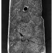
The stonework includes a Neolithic carved stone ball, as well as whetstones, polishers, whorls and a large number of rotary querns, one of which is decorated with an incised cross. One stone disc bears the inscription I(N)NOMINE ('in the name (of the Lord)'), in a style of lettering that suggests an 8th-century date. Among the more unusual discoveries was a small piece of yellow sulphide of arsenic known as orpiment, which was occasionally used as a yellow pigment in the decoration of manuscripts. The inscription and the pigment may indicate that some of the inhabitants of the site were literate and Christian, perhaps ecclesiastics.
HISTORICAL NOTE
Dunadd is mentioned twice in the Annals of Ulster, whose Scottish material up to about AD 740 is based largely on a set of annals kept at Iona. The entry for AD 683 reads 'The siege of Dun At and the siege of Dun Duirn'; a longer entry in Al) 736 records that 'Aengus son of Fergus, king of the Picts, laid waste the territory of Dal Riata and seized Dun At and burned Creic and bound in chains two sons of Selbach, i.e. Donngal and Feradach'. Such military action between the Picts and the Scots in the 7th and 8th centuries provides the context for fortifications such as Dunadd; Donngal and Feradach were leading members of the Cenel Loairn, 'the kindred of Loarn', one of the three leading families of Dal Riata, and it is likely that Dunadd was an important seat of one of the kindreds - perhaps originally that of the Cenel nGabrain, but possibly by this date that of Cenel Loairn itself.
The distinguished Celtic scholar, W F Skene, drew attention to the historical references to the site in a lecture given at Poltalloch in 1850, and in 1876 he identified Dunadd as the capital of Dal Riata. F W L Thomas's discussion of the site and the importance of the footprint in ceremonies of inauguration helped to increase the status of the site in popular imagination. Many of the references used by Skene and Thomas are, however, to Dun Monaidh, an identification refuted by Watson.
The strands of archaeological and historical evidence have been reviewed on many occasions with a variety of results; Stevenson interpreted the site as a classic example of a 'nuclear fort' or Dark Age capital; Feachem, on the other hand, saw it as an Iron Age fort, the defences of which may have been 'repaired or improved by undiscriminating or desperate persons until as late as the seventh century'. While it is unlikely that an isolated massif in this important location would have been ignored by Iron Age builders, there is no firm evidence that any of the walls at present visible are earlier than the third quarter of the first millennium AD. That the site was occupied, in some form, at a much earlier period is strongly suggested by the carved stone ball, the Food Vessel sherd, and the cup-markings. The same inference may also be drawn from the presence of sherds of samian ware, the fragment of Roman glass, a spiral finger-ring and projecting ring-headed pin - all of which have been found on sites of the earlier and later Iron Age in Atlantic Scotland. It is most unlikely, however, that surface traces of any structure associated with these earlier occupations of Dunadd would have survived the extensive remodelling of the site in the 7th-early 9th centuries AD, when it evidently attained its highest status as a settlement of considerable political significance.
RCAHMS 1988, visited July 1980.
Measured Survey (July 1980)
RCAHMS surveyed Dunadd fort on July 1980 with plane-table and alidade producing a plan at a scale of 1:100. The plan of the fort was redrawn in ink and published at a scale of 1:250 (RCAHMS 1988a, 150).
Publication Account (1985)
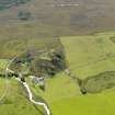
The fort occupies an isolated rocky boss which rises from a flat surrounding valley that must in earlier times have been very boggy. The upper terraces of the boss are defended by four lines of walling on different levels, and, on present evidence, it seems likely that most of the visible walls date to the middle and later 1st millennium AD. The site has been excavated on no less than three occasions: in 1904, in 1929 and in 1980-81, and it is not until the results of the most recent campaign are known that a full account will be possible. The small finds from all the excavations, however, show that the site was indeed an important one in the mid 1st millennium AD, and it is thus likely that Dunadd was one of the main centres of the kingdom of Dalriada at this time.
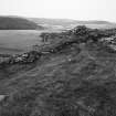
The site is a confusing one to visit. The main approach to the lowest terrace of the fort is through a narrow rocky defile, at the end of which would have been strong wooden gates doubtless with adjoining stone or wooden towers; the wall of this lowest terrace is unusually well preserved, perhaps partly reconstructed in modem times, but the outer face on the west is still an impressive expanse of drystone construction. There is a carefully lined well near the north end of the terrace. Several rectangular foundations were discovered in the course of excavations situated to the east of the entrance, but there is as yet no dating evidence. The twin summits of the rock now beckon, but only the western summit is defended, and as the ascent is continued, a second, but very denuded line of walling is crossed.
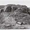
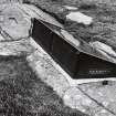
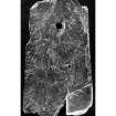
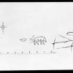
The summit fort and a smaller walled outer work to the east are remarkable not for the preservation of their walling, but for a series of carvings on a slab of rock situated at the south-west end of the lower enclosure. Today the original carvings are covered and protected by a glass-fibre replica. Here there is the carved figure of a boar, several lines of ogams inscription, the outline of a footprint, and a hollowed-out basin. Ogam is a way of writing, of Irish origin, using groups of strokes at angles to a base-line, though at Dunadd the natural fissures in the rock have been used as a base-line. Unlike Irish ogams, however, the inscription cannot be translated, and it thus has more in common with the enigmatic inscriptions of Pictland. The boar too has aspects of decoration that might suggest a Pictish origin, but more tellingly it lacks several features that would make such an attribution positive. The basin and the footprint have been interpreted as being part of the rituals of royal inaugurations of the kings of Dalriada.
The most recent excavations have shown that there were certainly two phases of construction of the topmost fortification, but there is as yet no evidence of the date of the earlier. Most of the finds from the site belong to the 6th to 9th centuries AD, although both earlier and later finds have been recovered; some of the most important finds indicate that metal-working of a high order was being undertaken-several hundred mould fragments have been found-and many beautiful brooches must have been produced.The finds from the early excavations are displayed in NMAS.
Information from ‘Exploring Scotland’s Heritage: Argyll and the Western Isles’, (1985).
Watching Brief (19 March 2014)
NR 8378 9354 A watching brief was maintained during the replacement of an information board. There were no finds or features of archaeological significance. The site of the new sign was located immediately adjacent the wicket gate into the site, at the top of a short path generally overlooking the nearby buildings. A shallow trench c 0.15m deep was excavated through turf and topsoil, over an area 0.9m (N/S) x 0.6m
(E/W). Once the trench was excavated, the sign was placed in situ and the footings concreted over
Information from Gordon Ewart (Kirkdale Archaeology) May 2014. OASIS ID: kirkdale1-196095
Note (30 October 2014 - 11 January 2017)
The fort on the summit of Dunadd is well-known as the major seat of power in the early medieval kingdom of Dalriada, and the remains include an important group of rock-carvings comprising: the incised outline of a boar; a sunken footprint; a rock-cut basin; and an ogam inscription. The remains of the fort itself, the walls of which variously stand to a height of 1m or have been reduced to mere bands of rubble, comprise four main elements: a small enclosure of no more than 0.02ha on the summit; a smaller enclosure taking in the rest of the crest of the ridge to the NE; and enclosure of about 0.05ha on a terrace below the crest on the SE; and a larger outer enclosure taking in a further 0.11ha on this flank and including the remarkable entrance passage that mounts the slope to the interior via a deep cleft in the outcrops between the terminals of the outer wall. In addition bands of rubble that may indicate the lines of other walls can be seen at various points on the W and N, while on the E lines of boulders between the outcrops may indicate the presence of a much larger outer enclosure on this side, though apparently not one bounded by a defensive wall. Excavations have been carried out on three occasions in the 20th century, firstly by David Christison in 1904-5, then by James Hewat Craw in 1929, and lastly by Alan Lane in 1980-81, these last are now fully published with an overall synthesis of the history of occupation and analyses of all the artefacts that have been recovered, which conclusively demonstrate that this was a major royal centre in the early medieval period (Lane and Campbell 2000). Excavations on the small summit enclosure or dun, however, not only revealed two early medieval phases of construction (though the earlier is possibly Roman Iron Age in date), but also rubble that may have been the remains of an earlier wall and possibly to be associated with a single radiocarbon date of 410-200 cal BC; there was also evidence of a slightly later period of occupation in the 1st century BC to the 1st century AD. The date of the construction of the inner of the lower enclosures on the SE flank is unknown, but it seems to have been in place in the 6th-7th centuries AD, while the outer enclosure seems to represent an extension of the fort in the 8th-9th centuries AD.
Information from An Atlas of Hillforts of Great Britain and Ireland – 11 January 2017. Atlas of Hillforts SC2466
Note (27 February 2019)
Date Fieldwork Started: 27/02/2019
Compiled by: ScRAP
Location Notes: Although an extensive search was undertaken in the field, supported by a variety of existing documentary evidence from numerous sources, none of the three previously record cup or cup and ring markings reported at Dunadd were traceable.
Measured Survey (18 October 2022)
NR 83650 93559 On 18 October 2022 archaeological measured drawing and photogrammetry was undertaken by members of the Historic Environment Scotland Cultural Resources Team on a small piece of walling (centred on NR 83727, 93576) outside the main rampart of Dunadd. The walling is identical in build to that of the main rampart and is built directly on to steep sloping bedrock. The working hypothesis is that the walling was used to level an area immediately outside of the northeastern rampart, above what is one of the routeways in to the fort, perhaps as an observation platform. Recording was undertaken as the walling has not been recorded before and there was concern over potential slumping. Archive: NRHE (intended)
Funder: Historic Environment Scotland
Stefan Sagrott and Laura Harrison – Historic Environment Scotland


