Pricing Change
New pricing for orders of material from this site will come into place shortly. Charges for supply of digital images, digitisation on demand, prints and licensing will be altered.
Upcoming Maintenance
Please be advised that this website will undergo scheduled maintenance on the following dates:
Thursday, 9 January: 11:00 AM - 3:00 PM
Thursday, 23 January: 11:00 AM - 3:00 PM
Thursday, 30 January: 11:00 AM - 3:00 PM
During these times, some functionality such as image purchasing may be temporarily unavailable. We apologise for any inconvenience this may cause.
Nether Largie Mid
Cairn (Bronze Age)
Site Name Nether Largie Mid
Classification Cairn (Bronze Age)
Canmore ID 39493
Site Number NR89NW 5
NGR NR 83037 98309
Datum OSGB36 - NGR
Permalink http://canmore.org.uk/site/39493
- Council Argyll And Bute
- Parish Kilmartin
- Former Region Strathclyde
- Former District Argyll And Bute
- Former County Argyll
NR89NW 5 83037 98309.
(NR 8304 9822) Cairn (NR)
OS 6" map, Argyllshire, 2nd ed., (1900)
The New Statistical Account notes 'urns' found in cairns in the Kilmartin Valley.
NSA 1845.
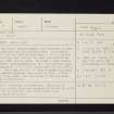
The Mid Cairn, Nether Largie, was excavated by Craw in 1929. It measured 109' x 101', and was said to have been c.10' in height, most of it having been removed for road repairs; it was 1' - 3' high when seen by Craw. He found 2 empty cists, both apparently undisturbed; cist 'A', with grooved side-slabs measured 4' x 2'4" x 2', while cist 'B' was 3'6" x 2'4" x 2'. The N end slab of 'B' bore a single cup mark, and faint axehead markings were noted in 1955. A flat slab, with 5 cup marks, was also found within the kerb.
J H Craw 1930; M Campbell and M Sandeman 1964
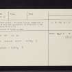
NR 8304 9830. Generally as described. The cairn is enclosed by a railed fence and measures 30.0m E-W by 31.0m. Only cist 'B' is visible. Resurveyed at 1:2500.
Visited by OS (IA) 26 April 1973
Nether Largie - Mid Cairn (DoE nameplate) is 1.3m high and is generally as described in the report of above.
Surveyed at 1/2500.
Visited by OS (TRG) 14 February 1977
Field Visit (May 1982)
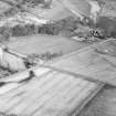
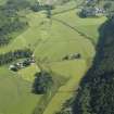
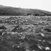
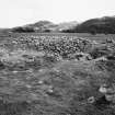
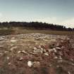
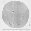
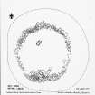
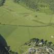
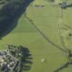
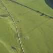
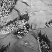
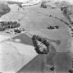
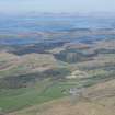
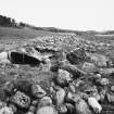
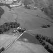
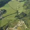
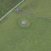
This cairn is situated 400m NNE of the chambered cairn (NR89NW 2) and 150m SSW of Nether Largie North Cairn (NR89NW 4), on a low terrace in the Kilmartin Valley. It was excavated in 1929, and the following description is largely based on the published account (Craw 1930, 127-30; Campbell and Sandeman 1964).
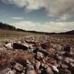
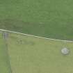
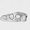
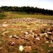
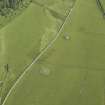
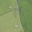
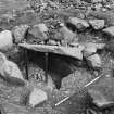
The cairn measures about 30m in diameter and was until the 1920s as much as 3m in height, but by the time it was excavated much of the cairn material had been removed 'not long before for repairing roads'. It is now an irregular platform of stones up to 1m high, in which several kerbstones can still be seen, particularly on the S arc. Excavation revealed two cists; the position of the more northerly, which was set in a pit beneath the cairn, is now indicated by low concrete posts, but the other is still visible near the S edge of the cairn. Aligned NE and SW, the N cist measured 1.2m by up to 0.7m and 0.6m in depth, and was paved with flat slabs. The massive lozenge-shaped capstone was 2.5m by 1.8m. The side-slabs had been carefully grooved in order to receive the end-slabs; on the inner face of the SE side-slab, outside the NE end-slab, there are two additional grooves, one of which had been pecked for a length of only 0.2m from the upper edge of the stone. The cist was empty. The S cist, which had been inserted into a pit dug into the natural gravel, is now displayed with the massive capstone supported above it, so that the interior may be viewed. The capstone is a large triangular slab measuring 1.9m by 1.9m and 0.28m in thickness, with the cist below aligned NW and SE and measuring about 1.4m by 0.6m and 0.55m in depth. The cist was found to be empty. On the inner surface of the NW end-slab there is at least one recognisable cupmark, which measures 50 mm in diameter and 10 mm in depth, and at the centre of the slab there is a pecked marking of a bronze axehead, which measures 150mm in length and 110mm in breadth at the blade and 70mm in breadth at the butt (Campbell and Sandeman 1964). Although both cists were devoid of burial remains and accompanying grave-goods, the excavator considered that they had not suffered earlier disturbance. About 9.5m NE of this cist, there is a slab measuring 0.95m by 0.63m and 0.21m in thickness, and bearing five cupmarks up to 50mm in diameter and 10mm in depth.
RCAHMS 1988, visited May 1982.


