Scheduled Maintenance
Please be advised that this website will undergo scheduled maintenance on the following dates: •
Tuesday 3rd December 11:00-15:00
During these times, some services may be temporarily unavailable. We apologise for any inconvenience this may cause.
Jura, Cladh Chlainn Iain
Chambered Cairn (Neolithic)
Site Name Jura, Cladh Chlainn Iain
Classification Chambered Cairn (Neolithic)
Alternative Name(s) Poll A Cheo; Strone
Canmore ID 38244
Site Number NR56SW 1
NGR NR 5048 6316
Datum OSGB36 - NGR
Permalink http://canmore.org.uk/site/38244
- Council Argyll And Bute
- Parish Jura
- Former Region Strathclyde
- Former District Argyll And Bute
- Former County Argyll
NR56SW 1 5047 6315
(NR 5048 6316) Cladh Chlainn Iain (NR) Stones (NAT)
OS 6" map, Argyllshire, 2nd ed., (1900)
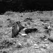
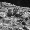
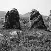
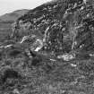
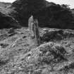
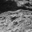
Cladh Chlainn Iain; This monument occupies an unusual position on a small shelf a short way above the shore. Though much disturbed, the remains suggest a small, wrecked tomb of Clyde type. The main feature is a pair of stones facing ENE which appear to be the portals of a chamber. They are 2ft9ins wide, 3ft high and 1ft2ins apart. To the SE, a smaller stone appears to have formed the corner of a narrow facade. The SE side of the chamber is represented by a slab on edge 4ft5ins long. Eight and a half feet behind the portal stones is a kerb of spaced small stones running in a straight line at right angles to the axis of the chamber. At the S corner, a stone is aligned NE. These stones suggest the remains of a roughly square enclosure, presumably a secondary feature. Little cairn material remains, and it is mainly turf-covered; the cairn seems to have extended 37ft 6ins SW from the portal stones, and is here edged by two large kerb stones, indicating a rounded end to the cairn. Cairn material extends about 5ft in front of the portal stones. Across the chamber, the cairn is about 20ft wide. (cf NR57SE 7)
A S Henshall 1972.
Generally as described by Miss Henshall. However, there is some doubt to the alleged SW extent of the cairn as it would include apparent "living" rock.
Surveyed at 1/10,000.
Visited by OS (J M) 16 May 1978.
Field Visit (May 1976)
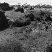
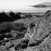
This cairn is situated about 1.3 km S of Strone, on a small shelf on the right bank of the Abhainn na Sroine, close to the shore of Poll a' Cheo. At its ENE end the cairn is 5.3 m broad and about 0.4 m in greatest height. Its length, however, is difficult to establish; the three kerb-stones to the rear of the chamber suggest a length of only 4 m, but an alternative suggestion, favoured by Henshall (1972), is that the turf-covered stony ridge extending for a further 6 m indicates the original outline of the cairn, and this is shown by a dashed line on the plan. In front of the portal stones the cairn material is visible over a distance of about 1.5 m, and this doubtless represents the original blocking of the tomb. The simple chamber is set behind a crescentic facade, with portal stones measuring 1.5 m and 0.9 m in height respectively and placed some 0.35 m apart. Only the S side-slab of the chamber (aligned ENE-WSW) survives, measuring 1.4 m in length, 0.15 m in thickness, and exposed to a height of 0.5 m.
RCAHMS 1984, visited May 1976
Measured Survey (May 1976)
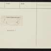
RCAHMS surveyed this chambered cairn with plane-table and alidade at a scale of 1:100. The resultant plan was redrawn in ink and published at the reduced scale of 1:250 (RCAHMS 1984, fig. 48A).


