Scheduled Maintenance
Please be advised that this website will undergo scheduled maintenance on the following dates: •
Tuesday 3rd December 11:00-15:00
During these times, some services may be temporarily unavailable. We apologise for any inconvenience this may cause.
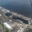
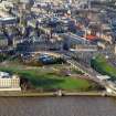
Dundee, Tay Road Bridge
Road Bridge (20th Century)
Site Name Dundee, Tay Road Bridge
Classification Road Bridge (20th Century)
Alternative Name(s) River Tay; Firth Of Tay; Outer Tay Estuary
Canmore ID 68099
Site Number NO42NW 75
NGR NO 41564 29456
Datum OSGB36 - NGR
Permalink http://canmore.org.uk/site/68099
- Council Dundee, City Of
- Parish Dundee (Dundee, City Of)
- Former Region Tayside
- Former District City Of Dundee
- Former County Angus
The Tay Road Bridge measures 7365 ft (2245m) in length and is the longest river-crossing road bridge in Britain; the shortest road route from the Fife abutment to Dundee was previously by Perth, a distance of about 50 miles (80 km). Each of the two-lane carriageways is 22 ft (6.7m) wide and the central (raised) footpath is 10 ft (3m) wide. The deck rises from 32 ft (9.8m) above sea level at the N end to 125 ft (38m) at the S, at a constant gradient of 1 in 81.
There are 3.6 miles (5.8 km) of approach roads on the Fife side, while at Dundee there are toll installations and network roads of an inverted trumpet design.
The bridge comprises 42 spans. Concrete foundations support twin columns of developing parabolic shape. These columns support steel plate box girders 12 ft (3.7m) wide by 10 ft (3m) deep with a composite top flange of concrete forming the roadway. The girders range from 10 ft (3m) to 20 ft (6.1m) deep over the navigation channel.Quantities of materials used were: concrete, 140,000 tons; mild steel bar reinforecement 4,600 tons, structural steel (mostly in the box girders) 8,150 tons.
The cost (excluding the cost of land and interest charges) was ?4.8M and construction began in March 1963; the opening by HRH The Queen Mother was on 18 August 1966. The designers and main contractors were W A Fairhurst and partners, Glasgow, and Duncan Logan (Contractors) Ltd., Muir of Ord, respectively; the administrative authority was the Tay Road Bridge Joint Board which first met on 3 September 1962.
A Borthwick 1966.
This bridge carries the A 92 (formerly A 914) public road across the River Tay between the parishes of Forgan (Fife) and Dundee (Angus), to the S and N respectively.
Information from RCAHMS (RJCM), 19 June 1996.
Site recorded by Maritime Fife during the Coastal Assessment Survey for Historic Scotland, Fife Ness to Newburgh 1996
The location assigned to this record defines the midpoint of the structure. The available map evidence indicates that it extends from NO c. 40746 30083 to NO c. 42560 28697.
Notable features of this bridge include a raised pedestrian walkway along its length, and a monumental pillar (NO42NW 75.01) at the S end. The bridgemaster's office (NO43SW 1004) and toll booths (NO 40725 30102) are at the N end. There are extensive approach-works at both end.
Information from RCAHMS (RJCM), 21 April 2006.
See also:
NO42NW 75.01 NO 42600 28667 Monument ('Stone' in Forgan roundabout)
NO43SW 1004 NO 40771 30109 Bridgemaster's Office
Extends onto map sheet NO43SW.
Location formerly cited as NO 425 287 to NO 407 300.
For corresponding railway bridge (NO 390 292 to 395 263), see NO32NE 11.
Project (2007)
This project was undertaken to input site information listed in 'Civil engineering heritage: Scotland - Lowlands and Borders' by R Paxton and J Shipway, 2007.
Publication Account (2007)
Although a high-level road bridge crossing of the Tay was considered as early as 1929, it was not until March 1963 that construction began on the present bridge which was opened to traffic in August 1966. It was then the longest river crossing of any road bridge in Britain, obviating a 50-mile detour.
The 7365 ft long bridge has 42 spans (31 of which are 180 ft span) with a deck rising from 32 ft above sea level at Dundee to 125 ft in Fife – a gradient of 1 in 81. To reduce the cost of construction the line chosen for the bridge had its north landfall at the old tidal harbour in Dundee, which was infilled and the site used as a fabrication yard by the bridge contractors.
Concrete foundations support twin columns of developing parabolic shape. These were founded on bedrock where the water was shallow and, in deeper water, carried on pile groups driven to the bedrock. The columns support steel-plate box girders 12 ft wide by 10 ft deep with a composite top flange of concrete forming the roadway. The girders range from 10 to 20 ft deep over the navigation channel. They were fabricated in the construction yard at Dundee, and then rolled into position along a service bridge at low level before being lifted and positioned on the columns.
These beams, each weighing 200 tons, were fabricated of steel plate and stiffened internally to give them a maintenance- free exterior profile. They act compositely with the concrete deck of the roadway to form T-beams which support, along their inner edge, precast concrete units that form both a central duct for services and a pedestrian footpath. Overall, 140 000 tons of concrete and 12 750 tons of steel were used. Each carriageway is 22 ft wide and the central footway 10 ft.
The cost of the bridge and its approaches, excluding land and interest charges, was £4.8 million. It was designed by W. A. Fairhurst & Partners. The main contractor was Duncan Logan (Contractors) Ltd. The box girders were fabricated by the Caledon Shipbuilding and Engineering Co. Ltd, Dundee, with Sir William Arrol & Co. Ltd, Glasgow. These firms were subcontractors to Dorman Long (Bridge & Engineering) Ltd, who had the contract for the steelwork and were responsible for the steelwork erection.
Paxton and Shipway 2007
Reproduced from 'Civil Engineering heritage: Scotland - Lowlands and Borders' with kind permission from Thomas Telford Publishers.
Publication Account (2013)
Completed in 1966 by W A Fairhurst, the bridge is built of twin steel hybrid box-girders with high tensile steel to the lower part of the box girder.
These were fabricated by Caledon Shipbuilding and Engineering Co, with Sir William Arrol, and stand on elegant twin chamfered piers. A version
of one on the Fife roundabout (south end of bridge) shows their taper from top to bottom.
There are 38 simply-supported spans of 25m at the ends, widening to 55m at the middle, giving the optical illusion of equal spans as far as midpoint,
and four continuous spans over navigation channels (protection added to those piers in 2012). Two viewing platforms, cantilevered over the roadways, and the toll booths, have been removed, and the approaches within Dundee are being altered to eliminate the roundabouts and overhead walkways that were a feature of that area. The bridge carries around nine million vehicles per year.
M Watson, 2013


