Scheduled Maintenance
Please be advised that this website will undergo scheduled maintenance on the following dates: •
Tuesday 3rd December 11:00-15:00
During these times, some services may be temporarily unavailable. We apologise for any inconvenience this may cause.
Inchtuthil
Fort (Middle Iron Age), Unidentified Pottery (Neolithic)
Site Name Inchtuthil
Classification Fort (Middle Iron Age), Unidentified Pottery (Neolithic)
Alternative Name(s) Inchtuthil Plateau
Canmore ID 28598
Site Number NO13NW 6
NGR NO 1152 3930
Datum OSGB36 - NGR
Permalink http://canmore.org.uk/site/28598
- Council Perth And Kinross
- Parish Caputh
- Former Region Tayside
- Former District Perth And Kinross
- Former County Perthshire
NO13NW 6 1152 3930.
(NO 1152 3930) Fort (NR)
OS 6" map (1957)
For barrows possibly formerly located within the interior, see NO13NW 7.00.
Field Visit (8 October 1957)
Fort, Inchtuithil
There is nothing to add to the account given in Proceedings, xxxv. The fort is clearly of Dark Age date since it incorporates Gourdie stones from the Roman fortress in the ramparts. The ramparts are impressive by reason of their scale, comparatively good state of preservation, and the large area which they cover in relation to the modest size of the interior. I do not know anything comparable.
Visited by RCAHMS (KAS) 8 October 1957
Publication Account (1963)
This fort occupies a promontory at the SW extremity of the plateau formed by the shifting of the bed of the River Tay, and occupied for the most part by its ephemeral neighbours, the Roman fort and camp. It is remarkable for having provided some of the earliest evidence for all-timber defences in Scotland. This consisted of a palisade trench running across the tail of the promontory accompanied by a ditch, both elements being found when a trench was dug into the fort in 1901. The area demarcated by the palisade and the rim of the promontory measured about 200 ft (60.9m) by 100 ft (30.5m) along the principal axes. This was doubled at some time after the Romans had abandoned their ambitious works on the main part of the plateau (NO13NW 5.00, 5.01, 5.02, 5.07 and 5.08), when as many of five ramparts and ditches were thrown across the neck of the promontory. The defended area now measured about 250 ft (76.2m) athwart the promontory and 150 ft (45.7m) along it. The defences occupied a space some 300 ft (91.4m) in width by 200 ft (60.9m) in length. Great numbers of the blocks of Gourdie stone used by the Romans to face their rampart were taken and used in this remarkable work. A hole was made in the middle of the enclosure in 1901, revealing what appeared to be part of the paved floor of a circular house.
R W Feachem 1963.
Field Visit (2 April 1969)
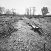
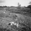
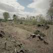
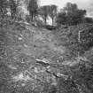
This promontory fort is located at the SW corner of the plateau, covering about 2 1/4 acres. It is defended on the E by five ramparts and ditches and the remains of a possible sixth outer rampart. Elsewhere, steep natural slopes provide the defences. The outer ramparts are composed of gravel from the ditches while the innermost rampart was supplemented by large 'Gourdie' stones from the Roman fort. In 1901, the filled-up ditch of an earlier work (almost certainly Roman), and the track of a palisade trench, measuring 200' by 100' axially were found. There was also a slight rampart around the top of the natural slopes. Within this earlier work, a rough hearth was found (J Abercromby 1902).
Resurveyed at 1/2500.
Visited by OS (WDJ) 2 April 1969
Measured Survey (17 April 1989)
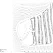
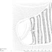
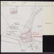
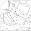
RCAHMS surveyed the fort at Inchtuthil (NO13NW 6) with plane-table and self-reducing alidade on 17 April 1989 at a scale of 1:500. The resultant plan was redrawn in ink as part of a ‘Comparative plans of upstanding forts’ illustration and published at a scale of 1:2500 (RCAHMS 1994b, 53).
Geophysical Survey (17 March 2011 - 5 April 2011)
NO 1152 3930 As an adjunct to geophysical work being carried out by the Roman Gask project at Inchtuthil magnetic and resistivity surveys were conducted, 17 March–5 April 2011, in the Iron Age fort at the extreme SW corner of the Inchtuthil plateau. The earthworks here, partly excavated in 1901, are of two different periods. The earlier set appears to have been somewhat oval in form consisting of an outer ditch and a palisade trench within which a roughly paved area (?hearth) was located. It seems probable that significant portions of these structures have been lost by erosion of the plateau margin. At a later date a series of five huge banks and ditches was thrown up cutting off the end of the plateau and in places overlying the earlier works. The later earthworks seem almost too massive for normal defensive purposes. Did this site, which commanded a spectacular view up the Tay valley, have some more ritual function?
The geophysical surveys covered most of the flat inner portion of the fort, which contains the earlier pair of ditches. Resistivity showed little of archaeological interest except a possible line of low anomaly following the track of the main ditch. The magnetic survey also picked up this ditch and hints at the palisade trench in places. There is also an anomaly near, but not coincident with the ‘hearth’. More interesting, however, is some evidence for another, previously unrecognised, linear feature some 5m outside and parallel to the main ditch along which there is a series of point high anomalies (?pits) Other anomalies included a strange oval feature (?modern), plus a strong anomaly that possibly corresponds to the position of a former tumulus shown on the 1st Edition OS 6” map.
Archive: RCAHMS (intended)
Funder: Blairgowrie Geoscience
Blairgowrie Geoscience, 2011
Note (9 May 2015 - 18 October 2016)
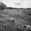
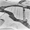
This remarkable and unusual promontory fort is situated at the extreme W tip of the Inchtuthil plateau. Its defensive lines are massively constructed, at first sight comprising no fewer than five ramparts with external ditches drawn across the promontory in a straight line, to form a close-set belt almost 60m deep that cuts off an area measuring about 80m from N to S immediately to the rear of the innermost rampart by up to 43m transversely (0.3ha). No entrance is visible and the ends of the ramparts have been truncated by landscaping works on both margins of the promontory. On closer inspection, however, the ditch between the slighter second and third ramparts is a comparatively shallow feature, suggesting either that the outer ramparts are an addition to the inner scheme, or that the two inner ramparts with their medial ditch were inserted behind an earlier scheme enclosing an area of perhaps as much as 0.5ha. This junction between the two defensive schemes is clearly visible in the exaggerated section drawn by Thomas Ross in 1901, when a trench was driven through the centre of the defences to reveal other hints of multiperiod construction in the inner defences where the base of the massive inner rampart, which measures some 8m in thickness by 1.3m in height, not only appears to extend beyond the lip of the ditch, but the inner scarp of the ditch displays a stepped profile that is likely to have been created by recuts of its line. In the field there are also traces of a stony bank superimposed on the crest of the inner rampart, though this may be a later enclosure in the designed landscape. The excavation trench was also driven into the interior, revealing an earlier ditch about 4m in breadth cutting off an area measuring about 60m from NNE to SSW by 30m transversely (0.14ha) on the NW tip of the promontory; a palisade trench was found behind it, but this diverged towards the N and may represent yet another phase of enclosure on the promontory. In addition to these earlier perimeters the excavators located an area of paving with a hearth within the interior, almost certainly representing the floor of an internal building. A key discovery of the excavations was that the inner rampart, which would have stood in excess of 6m above the bottom of its ditch, contained large quantities of Gourdie stone that can only have been robbed from the derelict defences of the Roman legionary fortress abandoned about AD 87. The only other find was a fragment of the upper stone from a rotary quern.
Information from An Atlas of Hillforts of Great Britain and Ireland – 18 October 2016. Atlas of Hillforts SC3042


