
Pricing Change
New pricing for orders of material from this site will come into place shortly. Charges for supply of digital images, digitisation on demand, prints and licensing will be altered.
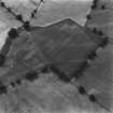
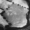
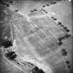
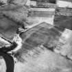
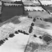
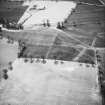
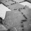
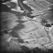
Strageath


Cropmark(S) (Period Unknown), Enclosure(S) (Roman)(Possible)
Site Name Strageath
Classification Cropmark(S) (Period Unknown), Enclosure(S) (Roman)(Possible)
Alternative Name(s) Strageath Mains
Canmore ID 148252
Site Number NN81NE 2.03
NGR NN 8963 1831
Datum OSGB36 - NGR
Permalink http://canmore.org.uk/site/148252


- Council Perth And Kinross
- Parish Muthill
- Former Region Tayside
- Former District Perth And Kinross
- Former County Perthshire
Field Visit (26 November 1997)
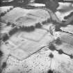
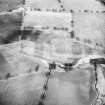
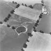
NN81NE 2.03 8963 1831
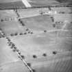
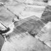
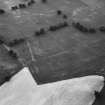
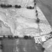
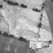
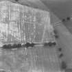
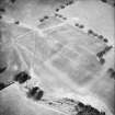
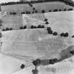
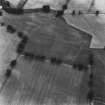
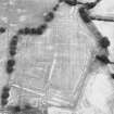
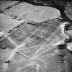
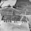
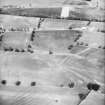
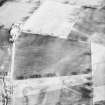
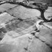
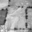
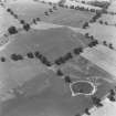
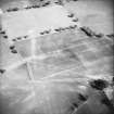
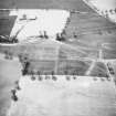
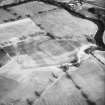
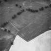
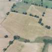
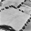
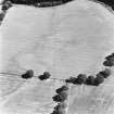
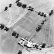
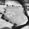
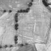
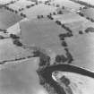
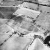
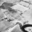
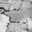
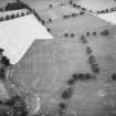
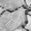
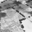
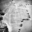
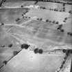
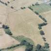
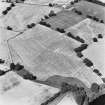
Cropmarkings on oblique aerial photographs (RCAHMSAP 1984-6) reveal a series of ditches on the terrace to the SE of Strageath farmsteading. The majority are aligned from E to W and may be related to the Roman fort NN81NE 2.00 to the SSE, perhaps as part of the annexes.
Visited by RCAHMS (DCC) 26 November 1997

