Accessibility

Font Size

100% 150% 200%

Background Colour

Default Contrast
Close Reset

Banff, General

Burgh (Medieval), Town (Medieval)

Site Name Banff, General

Classification Burgh (Medieval), Town (Medieval)

Canmore ID 18479

Site Number NJ66SE 45

NGR NJ 68754 64010

NGR Description Centred NJ 68754 64010

Datum OSGB36 - NGR

Permalink http://canmore.org.uk/site/18479

Ordnance Survey licence number AC0000807262. All rights reserved.
Canmore Disclaimer. © Bluesky International Limited 2025. Public Sector Viewing Terms

Toggle Aerial | View on large map

Digital Images

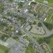
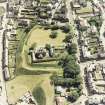
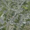
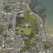
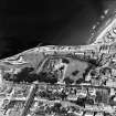
General oblique aerial view centred on Banff, looking to the ENE.
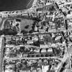
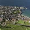
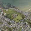
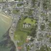
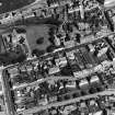
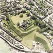
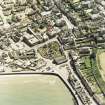
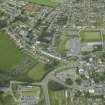
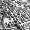
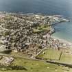
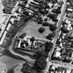
General oblique aerial view centred on Banff, looking to the ENE.Oblique aerial view centred on the church with the school adjacent, taken from the WSW.Oblique aerial view centred on the town of Banff, taken from the SSW.General oblique aerial view of Banff and Duff House Royal Golf Course, looking to the W.General view of St Mary's churchyard, Banff.
Titled: 'In Banff'.
PHOTOGRAPH ALBUM No.11: KIRSTY'S BANFF ALBUM.Oblique aerial view.Oblique aerial view.Oblique aerial view.Oblique aerial view.Oblique aerial view.Oblique aerial view.Aerial view of Banff harbour including North Pier, Beacon and town beyond.Photographic copy of painting showing general view.Oblique aerial view.Oblique aerial view.Oblique aerial view centred on the house and gate-lodge, taken from the SW.General view. 
Titled: 'High St., Banff'.
PHOTOGRAPH ALBUM No.11: KIRSTY'S BANFF ALBUM.General View Banff, Banff, Scotland. Oblique aerial photograph taken facing North. This image was marked by AeroPictorial Ltd for photo editing.General View Banff, Banff, Scotland. Oblique aerial photograph taken facing East. Oblique aerial view.Oblique aerial view.Oblique aerial view.Banff Harbour
View from NE showing NE and ESE fronts of E pier with brewery, warehouses and part of Banff Village in backgroundOblique aerial view centred on the church with the school adjacent, taken from the SE.Oblique aerial view centred on the house and gate-lodge, taken from the NNW.General oblique aerial view centred on the country house, golf course and road bridge with the towns adjacent, taken from the SW.View of smithy.
Titled: 'Smithy near Banff'.
PHOTOGRAPH ALBUM NO:11 KIRSTY'S BANFF ALBUMOblique aerial view.Oblique aerial view.Banff, General, NJ66SE 45, Ordnance Survey index card, RectoOblique aerial view centred on the house and gate-lodge, taken from the S.Watercolour showing general view of Banff  from the East with bridge and Duff House lodges in foreground.General oblique aerial view centred on Banff Bridge with Banff in the foreground and MacDuff beyond, looking ENE.General oblique aerial view centred on Banff Bridge with Banff in the foreground and MacDuff beyond, looking NE.Oblique aerial view.Oblique aerial view.Oblique aerial view.Oblique aerial view.Banff Harbour
View from NE showing NE front and part of ESE front of E pier with brewery, warehouses and part of Banff Village in backgroundGeneral oblique aerial view of the town centred on the High Street, taken from the S.Oblique aerial view centred on the church with the school adjacent, taken from the E.General oblique aerial view of Banff and Duff House Royal Golf Course, looking to the NW.Oblique aerial view.Oblique aerial view.Oblique aerial view.General oblique aerial view centred on Macduff with Banff adjacent, taken from the E.Oblique aerial view centred on the town of Banff, taken from the SSW.Elevated view from SE.General view. 
Titled: 'High St., Banff'.
PHOTOGRAPH ALBUM No.11: KIRSTY'S BANFF ALBUM.Oblique aerial view.Oblique aerial view.Oblique aerial view.Oblique aerial view.Oblique aerial view.Oblique aerial view.Photographic copy of painting showing view of the town of Banff with Duff House and The New Bridge.Oblique aerial view.Oblique aerial view.General view of St Mary's churchyard, Banff.
Titled: 'In Banff'.
PHOTOGRAPH ALBUM NO:11 KIRSTY'S BANFF ALBUMGeneral view of seashore 
Titled: 'SHORE NEAR BANFF'
PHOTOGRAPH ALBUM NO 11 : KIRSTY'S BANFF ALBUMView of smithy.   
Titled: 'Smithy near Banff'.
PHOTOGRAPH ALBUM NO 11: KIRSTY'S BANFF ALBUM.Oblique aerial view.Oblique aerial view.

Administrative Areas

  • Council Aberdeenshire
  • Parish Banff
  • Former Region Grampian
  • Former District Banff And Buchan
  • Former County Banffshire

Archaeology Notes

NJ66SE 45 centred 68754 64010

Banff, a royal burgh, is first mentioned as a burgh in a charter by William the Lion to the bishop of Moray (1189 x 1198); there is a confirming charter of 1226. The burgh was set in feu-ferme by the crown to the burgesses and community in 1372, and it made its first recorded appearance in Parliament in 1469.

G S Pryde 1965.

Architecture Notes

NJ66SE 45 68754 64010

EXTERNAL REFERENCE:

NMRS Copies of plans held in the SRO.

1826 - 1 photograph plan for improvements

18th century - 1 photograph feu plan

George McWilliam & Al. Duncan - 1 photograph sketch of the Castle Park feus

Scottish Records Office

History of the town and parish from c.1057.

Notes by William Rose.

1795 GD 36/458

Activities

Photographic Survey (1954)

Photographic survey of buildings in Banff by the Scottish National Buildings Record in 1954.

Photographic Survey (June 1957)

Photographic survey of buildings in Banff by the Scottish National Buildings Record in June 1957.

Photographic Survey (August 1965)

Photographic survey of buildings in Banff by the Ministry of Works/Scottish National Buildings Record in August 1965.

References

MyCanmore Image Contributions


Contribute an Image

MyCanmore Text Contributions