Pricing Change
New pricing for orders of material from this site will come into place shortly. Charges for supply of digital images, digitisation on demand, prints and licensing will be altered.
Upcoming Maintenance
Please be advised that this website will undergo scheduled maintenance on the following dates:
Thursday, 9 January: 11:00 AM - 3:00 PM
Thursday, 23 January: 11:00 AM - 3:00 PM
Thursday, 30 January: 11:00 AM - 3:00 PM
During these times, some functionality such as image purchasing may be temporarily unavailable. We apologise for any inconvenience this may cause.
Downie Hillock
Fort (Iron Age)
Site Name Downie Hillock
Classification Fort (Iron Age)
Alternative Name(s) Dounie Hillock
Canmore ID 15531
Site Number NH95NE 5
NGR NH 9675 5815
Datum OSGB36 - NGR
Permalink http://canmore.org.uk/site/15531
- Council Moray
- Parish Dyke And Moy
- Former Region Grampian
- Former District Moray
- Former County Morayshire
NH95NE 5 9675 5815
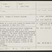
(NH 9675 5815) Fort: Downie (? Dounie) Hillock.
Visible on AP's (RAF/F22.58/1116:0340-1).
(Undated) information in NMRS.
The foundations of a fort were traced on Downie Hill by Mr John McEwan, minister of Dyke till 1914.
W Dyke 1966.
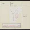
On Downie Hillock, an afforested knoll commanding extensive views in all directions, there is a fort. No trace of defences can be seen around the perimeter of the level oval summit of the knoll which measures 34.0m N-S by c.18.0m transversely, but at a lower level there is a terrace about 2.0m wide formed by scarping the slope. The entrance is in the S where the terrace widens to c.13.0m to provide space for an additional defence in the form of a short length of ditch flanking a break in the outer defensive scarp.
Surveyed at 1:2500.
Visited by OS (RL), 19 January 1971.
After the clearing of trees from the fort interior and perimeter, a low bank on the southern edge of the interior can now be seen. (GRC NH95NE 11).
Sponsor: Grampian Regional Council.
I Shepherd 1991i.
Field Visit (19 January 1971)
On Downie Hillock, an afforested knoll commanding extensive views in all directions, there is a fort. No trace of defences can be seen around the perimeter of the level oval summit of the knoll which measures 34.0m N-S by c.18.0m transversely, but at a lower level there is a terrace about 2.0m wide formed by scarping the slope. The entrance is in the S where the terrace widens to c.13.0m to provide space for an additional defence in the form of a short length of ditch flanking a break in the outer defensive scarp. (GRC NH95NE 11)
Surveyed at 1:2500.
Visited by OS (RL) 19 January 1971
Field Visit (1991)
After the clearing of trees from the fort interior and perimeter, a low bank on the southern edge of the interior can now be seen.
Sponsor: Grampian Regional Council.
I Shepherd 1991i.
Note (25 March 2015 - 31 May 2016)
The remains of a small fortification can be seen on the Downie Hillock, which is a relatively prominent knoll in a small forestry plantation in the low undulating country W of Brodie Castle. It is oval on plan, and the visible defences comprise a single rampart reduced to little more than a scarp that can be traced round the margin of the summit, which measures about 34m from N to S by 18m transversely (0.05ha). The whole clearing is clothed in a deep litter of dead bracken, obscuring the character of the rampart and a slight terrace that extends along the W flank below the scarp and is possibly linked to the shallow ditch with an external bank that can also be seen at the S end. Both this bank and ditch and the inner scarp are pierced by an entrance on the S.
Information from An Atlas of Hillforts of Great Britain and Ireland – 31 May 2016. Atlas of Hillforts SC2917


