
Ach An Fhionnfhuaraidh


Field System (Prehistoric), Hut Circle (Prehistoric), Souterrain (Prehistoric)
Site Name Ach An Fhionnfhuaraidh
Classification Field System (Prehistoric), Hut Circle (Prehistoric), Souterrain (Prehistoric)
Canmore ID 7205
Site Number NC92SW 7
NGR NC 9039 2390
Datum OSGB36 - NGR
Permalink http://canmore.org.uk/site/7205


- Council Highland
- Parish Kildonan
- Former Region Highland
- Former District Sutherland
- Former County Sutherland
NC92SW 7 9039 2390.
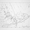
(NC 9039 2390) Enclosure with Earth House (NR)
OS 6"map, (1963)
A hut-circle with a ruinous souterrain attached, in a westerly aspect, discovered during field investigation on the north edge of abandoned 18/19th century settlement.
Visited by OS (W D J) 3 June 1961
The hut is 12.0m diameter inside a heather-covered wall spread to 2.5 broad and standing, in the N, to 1.0m. The entrance, unusually, is in the NW arc. There is another break, 1.5m wide in the S, from which extends the souterrain curving sharply to the W round the outside of the hut. It is only visible as a regular area of subsidence, about 10.0m in length by 2.0m broad, having one or two slabs lying displaced across it, and smaller stone partially visible in the sides of the collapse. An associated stony bank proceeds from the SSE quarter of the hut, in a southerly direction for about 60.0m before fading. There is no evidence of associated cultivation (but see NC92SW 35).
Resurveyed at 1:10 560.
Visited by OS (J M) 13 January 1977
Field Visit (5 June 1991)
This hut-circle is situated on a natural terrace and measures 9.7m from E to W by 8.6m transversely within a stony bank 3.5m in thickness and up to 1.1m in height. The entrance is on the WNW, and opens out onto a stony apron, to the W of which is what may be an oval enclosure. Three facing stones are visible along the bank, with a further four at the entrance.
A souterrain is entered from the SE arc of the hut-circle, arcing round to the W. Its position is marked by a cresentic-shaped hollow measuring about 8m in length by 0.6m in breadth across which there are two lintel stones. A bank springs from the SE of the hut-circle and a track runs past on the E.
The field-system comprises square and sub-rectangular plots defined by lynchets and banks, up to 1.2m in height. Rig has removed or smoothed some of the banks and an earth-and-stone bank crosses several of the plots to the SW and W of the hut-circle.
(KILD91 368)
Visited by RCAHMS (DCC) 5 June 1991.

