Pricing Change
New pricing for orders of material from this site will come into place shortly. Charges for supply of digital images, digitisation on demand, prints and licensing will be altered.
Upcoming Maintenance
Please be advised that this website will undergo scheduled maintenance on the following dates:
Thursday, 30 January: 11:00 AM - 3:00 PM
During these times, some functionality such as image purchasing may be temporarily unavailable. We apologise for any inconvenience this may cause.
Lewis, Teampull Nan Cro' Naomh
Burial Enclosure(S) (Post Medieval), Cemetery (Medieval) - (Post Medieval), Chapel (13th Century)
Site Name Lewis, Teampull Nan Cro' Naomh
Classification Burial Enclosure(S) (Post Medieval), Cemetery (Medieval) - (Post Medieval), Chapel (13th Century)
Alternative Name(s) Teampull Na Cro Naomh
Canmore ID 4346
Site Number NB45NW 1
NGR NB 43280 59315
Datum OSGB36 - NGR
Permalink http://canmore.org.uk/site/4346
- Council Western Isles
- Parish Barvas
- Former Region Western Isles Islands Area
- Former District Western Isles
- Former County Ross And Cromarty
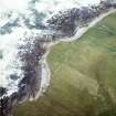
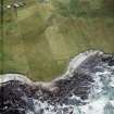
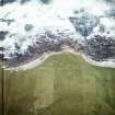
Teampall nan Crò Naomh (Church of the Holy Blood), possibly 13 th century Sunken remains of chapel with lonely burial ground, sited where stone-dyked pastures run down to meet the sea. The lumpy ruin is gable-less now, but putlock holes and evidence of openings can still be seen. All about lie weathered tombstones, and one or two unadorned 18th century burial chambers with large-bouldered, squared-off corners. Notice the good survival of shell lime harl and mortar clinging to the inner and outer walls of the northernmost chamber.
Taken from "Western Seaboard: An Illustrated Architectural Guide", by Mary Miers, 2008. Published by the Rutland Press http://www.rias.org.uk
NB45NW 1 43280 59315
(NB 433 593) Teampull nan Cro'Naomh (NR) (In Ruins)
OS 6"map, Ross-shire, 2nd ed., (1898)
The Object Name Book describes the church as ' The ruin of a church on the sea shore, which is about 45 links long, by 30 links wide. Its walls are about 5 feet high. Tradition says nothing about it, beyond that it was much visited to by Catholics in former times; so much so that they came from all the adjacent islands on a pilgrimage to it. It was built of stone and mortar with a loft. Attached to it is a grave yard in which are two vaults'.
(Name Book 1852)
"Holy Cross Church in Galan" listed.
(M Martin 1934).
"Teampull nan Cro'Naomh..., situated within an old grave-yard".
"The two gables are destroyed, and the earth outside the church reaches almost to the wall-heads". Despite Martin's version, "as it stands the name would appear to mean Church of the Holy Blood".
(RCAHMS 1928, visited 28 June 1921).
"Part of the outer walls remain, in a crumbling condition"
OS Reviser (W S) 21 June 1956.
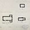
Teampull nan Cro' Naomh, at NB 4329 5931, is as described and planned by the Commission. The graveyard is still in use and the name is still known locally.
Visited by OS (N K B) 16 June 1969.
Field Visit (28 June 1921)
Teampull nan Crò’ Naomh.
Near the seashore and about ¼ of a mile west-north-west of Galson farmhouse, Teampull nan Crò’ Naomh is situated within an old graveyard. It is oblong on plan and orientated. The two gables are destroyed, and the earth outside the church reaches almost to the wall heads, which are roughly 5 feet high on the inside. The church, measuring 19 feet by 12 feet 1 inch internally, with walls averaging 2 feet 6 inches in thickness, is entered by a door 2 feet 5 inches in width in the west of the south wall. Thirteen inches from the outside face this opening has 3 ½-inch checks, with bar-hole on either side and squared sconsions. The building has been lit by three windows at the east end, one window, 6 inches wide and splayed inwardly with stepped sills, being placed in each of the side walls and the other in the centre of the east gable; the last appears to have been 1 foot 6 inches wide. In the north wall are three (? putlog) holes 7 inches wide, and three are also seen in the south wall, but only two are in a corresponding position to the former.
As it stands, the name would appear to mean Church of the Holy Blood, but Martin refers, to the building as ‘Holy Cross Church in Galan’.
RCAHMS 1928, visited 28 June 1921.
OS map ref, Lewis ii
Note (2005)
This chapel site was included in a research project to identify the chapel sites of Lewis and surrounding islands. The Lewis Coastal Chapel-sites survey recorded 37 such sites.
R Barrowman 2005
Ground Penetrating Radar (November 2019)
NB 43345 59319 A geophysical survey was carried out over the modern graveyard surrounding Teampull nan Cro’ Naomh at South Galson, Isle of Lewis, in November 2019. Teampull nan Cro’ Naomh, is a possible 13th-century chapel and associated older graveyard which is visible in the field as a pronounced mound immediately to the N and W of the survey area (Canmore ID: 4346). The chapel is a Scheduled Ancient Monument and therefore the survey did not encroach on this Scheduled Area. Two ruins lie to the S of the chapel and mark the northern limit of the survey area in the W of the area. These are of unknown date (post-medieval – AD 1540 to 1900) and have the appearance of mausoleums. The site lies on machair adjacent to the coast.
A Ground Penetrating Radar (GPR) survey, over an area of 0.4ha, was undertaken to provide a detailed plan of the cemetery grounds showing the location of past burials to assist with management of the cemetery. Data was collected with a 500MHz antenna at 0.02m intervals along parallel traverses 0.25m apart using ‘zig-zag’ data collection.
The GPR survey has successfully mapped numerous burials across the site. Anomalies indicative of burials have been identified which appear to correspond with headstones and grave markers. Additional responses clearly suggestive of burials have been identified which do not appear to correspond to any headstones and grave markers.
Throughout the survey area several areas of increased response have also been noted. These are anomalies which cannot be clearly identified as burials, and some may simply be due to natural variations in the subsoil. However, it is likely that the bands of high amplitude response in the W of the area may well be associated with burials. While some clearly defined burials have been noted within these bands of high amplitude response, the results are confusing, and several grave markers do not have a clearly associated burial response. Given that this is the oldest portion of the cemetery the complexity of the data is not surprising given the potential for a high density of burials.
Archive: Rose Geophysical Consultants
Funder: Galson Cemetery Committee
Susan Ovenden – Rose Geophysical Consultants
(Source: DES Volume 21)
Note
Title: Chapel-sites on the Isle of Lewis: Results of the Lewis Coastal Chapel-sites Survey
Journal: SCOTTISH ARCHAEOLOGICAL INTERNET REPORTS (e-ISSN: 2056-7421)
Author: Barrowman, R C
Publisher: Society of Antiquaries of Scotland, Edinburgh
Date: 2020
MCE (2023): Reviewed as part of the GAPR. Publication was completed in 2020. Open Access publication with SAIR. Publication grant-aided by HES.


