Scheduled Maintenance
Please be advised that this website will undergo scheduled maintenance on the following dates: •
Tuesday 3rd December 11:00-15:00
During these times, some services may be temporarily unavailable. We apologise for any inconvenience this may cause.
Wilsontown
Colliery (20th Century)
Site Name Wilsontown
Classification Colliery (20th Century)
Canmore ID 99853
Site Number NS95NE 84
NGR NS 9542 5563
Datum OSGB36 - NGR
Permalink http://canmore.org.uk/site/99853
- Council South Lanarkshire
- Parish Carnwath
- Former Region Strathclyde
- Former District Clydesdale
- Former County Lanarkshire
Field Visit (20 March 1996)
NS95NE 84 9542 5563
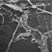
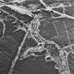
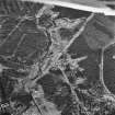
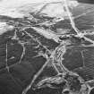
The remains of this mine comprise the ruins of the pithead and other buildings, a large bing and the trackbed of a railway siding. At the pithead there is a concrete and brick building, still roofed, with an iron door at the W end. Inside there can be seen the top of an inclined shaft, now choked with rubble. At the E end of the building there is a brick-lined, vertical shaft, with a machinery plinth (presumably for the winding gear, beside it) (CSW 1054). The main bing is to the W of the pithead, and to the S of that there are the remains of several buildings. Most of these are in a fragmentary condition, but one survives to gable height (CSW 1053, NS 9530 5560). It measures 16.1m E-W by 3.8m over brick walls 0.3m thick. It has three compartments, each of which has a door and a window in its S wall. There is also a door in the E end wall, and there is a fireplace at each end of the W compartment, which has been subdivided. Between this building and the bing to the N, an embanked railway siding runs W towards the Mouse Water, which was crossed on a viaduct, of which only the footings of the piers survive.
A spoil tip, smaller than the existing tip, is depicted here on the 2nd edition of the OS 6-inch map (Lanarkshire 1898, sheet xiv). No features are depicted on the 1922 edition of the map (revised 1910), so the visible remains all probably date to the middle decades of the twentieth century.
(CSW 1053-4)
Visited by RCAHMS (SDB) 20 March 1996


