 |
On-line Digital Images |
DP 095491 |
RCAHMS Aerial Photography Digital |
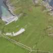
Oblique aerial view of the raised beaches, rig, clearance cairns, field boundaries and fish artwork at Port Sgibinis, taken from the E. |
1/9/2010 |
Item Level |
|
 |
On-line Digital Images |
DP 095493 |
RCAHMS Aerial Photography Digital |
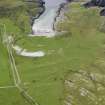
Oblique aerial view of the raised beaches, rig, clearance cairns, field boundaries and fish artwork at Port Sgibinis, taken from the NE. |
1/9/2010 |
Item Level |
|
 |
On-line Digital Images |
DP 095496 |
RCAHMS Aerial Photography Digital |
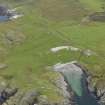
Oblique aerial view of the raised beaches, rig, clearance cairns, field boundaries and fish artwork at Port Sgibinis, taken from the SW |
1/9/2010 |
Item Level |
|
 |
On-line Digital Images |
DP 095497 |
RCAHMS Aerial Photography Digital |
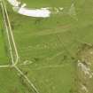
Oblique aerial view of the raised beaches, rig, clearance cairns, field boundaries and fish artwork at Port Sgibinis, taken from the NE. |
1/9/2010 |
Item Level |
|
 |
On-line Digital Images |
DP 095499 |
RCAHMS Aerial Photography Digital |
Oblique aerial view of the raised beaches, rig, clearance cairns and field boundaries at Port Sgibinis, taken from the N. |
1/9/2010 |
Item Level |
|
 |
On-line Digital Images |
DP 095500 |
RCAHMS Aerial Photography Digital |
Oblique aerial view of the raised beaches, rig, clearance cairns, field boundaries and fish artwork at Port Sgibinis, taken from the NNW. |
1/9/2010 |
Item Level |
|
 |
On-line Digital Images |
DP 095501 |
RCAHMS Aerial Photography Digital |
Oblique aerial view of the raised beaches, rig, clearance cairns, field boundaries and fish artwork at Port Sgibinis, taken from the SW. |
1/9/2010 |
Item Level |
|
|
All Other |
551 166/1/1 |
Records of the Ordnance Survey, Southampton, Hampshire, England |
Archaeological site card index ('495' cards) |
1947 |
Sub-Group Level |
|