 |
On-line Digital Images |
DP 092216 |
RCAHMS Aerial Photography Digital |
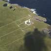
Oblique aerial view of the Muckle Skerry lighthouse, taken from the ESE. |
23/7/2010 |
Item Level |
|
 |
On-line Digital Images |
DP 092217 |
RCAHMS Aerial Photography Digital |
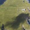
Oblique aerial view of the Muckle Skerry lighthouse, taken from the E. |
23/7/2010 |
Item Level |
|
 |
On-line Digital Images |
DP 092218 |
RCAHMS Aerial Photography Digital |
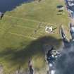
Oblique aerial view of the Muckle Skerry lighthouse, taken from the ENE. |
23/7/2010 |
Item Level |
|
 |
On-line Digital Images |
DP 092219 |
RCAHMS Aerial Photography Digital |
General oblique aerial view of the Muckle Skerry lighthouse, taken from the NE. |
23/7/2010 |
Item Level |
|
 |
On-line Digital Images |
DP 092220 |
RCAHMS Aerial Photography Digital |
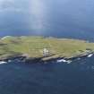
General oblique aerial view of the Muckle Skerry lighthouse, taken from the NNE. |
23/7/2010 |
Item Level |
|
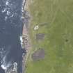 |
On-line Digital Images |
DP 139244 |
RCAHMS Aerial Photography Digital |
Oblique view of Muckle Skerry, centred on the mounds, looking to the ENE. |
19/7/2012 |
Item Level |
|
 |
On-line Digital Images |
SC 2355281 |
Records of the Ordnance Survey, Southampton, Hampshire, England |
Muckle Skerry, The Kiln, ND47NE 7, Ordnance Survey index card, Recto |
c. 1958 |
Item Level |
|
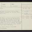 |
On-line Digital Images |
SC 2355282 |
Records of the Ordnance Survey, Southampton, Hampshire, England |
Muckle Skerry, The Kiln, ND47NE 7, Ordnance Survey index card, Recto |
c. 1958 |
Item Level |
|
|
All Other |
551 166/1/1 |
Records of the Ordnance Survey, Southampton, Hampshire, England |
Archaeological site card index ('495' cards) |
1947 |
Sub-Group Level |
|