
Broch Of Mousa, Mousa


Burnt Mound(S) (Prehistoric)
Site Name Broch Of Mousa, Mousa
Classification Burnt Mound(S) (Prehistoric)
Canmore ID 946
Site Number HU42SE 3
NGR HU 45948 23711
NGR Description HU 4594 2370 and HU 4597 2368
Datum OSGB36 - NGR
Permalink http://canmore.org.uk/site/946


- Council Shetland Islands
- Parish Dunrossness
- Former Region Shetland Islands Area
- Former District Shetland
- Former County Shetland
HU42SE 3 4594 2370 and 4597 2368
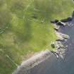
HU 459 237 (C S T Calder 1965). A mound of burnt stones lies 250 yds ENE of the broch of Mousa (HU42SE 1).
RCAHMS 1946, visited 1930.
At HU 4595 2371, a turf-covered mound of burnt stones, c.11.0m by c.12.0m and c.1.2m high. An upright slab protruding through the turf in the hollowed centre. Further to the SE at HU 4597 2368, is a smaller oval mound of burnt stones, c.7.5m by c.4.0m and c.1.0m high, with two upright slabs protruding through the turf, one on its SW margin and the other on the NE.
Visited by OS (AA) 16 May 1968.
Field Visit (24 July 1930)
A mound of burnt stones lies 250 yds ENE of the broch of Mousa.
RCAHMS 1946, visited 24 July 1930.
Field Visit (16 May 1968)
At HU 4595 2371, a turf-covered mound of burnt stones, c.11.0m by c.12.0m and c.1.2m high. An upright slab protruding through the turf in the hollowed centre. Further to the SE at HU 4597 2368, is a smaller oval mound of burnt stones, c.7.5m by c.4.0m and c.1.0m high, with two upright slabs protruding through the turf, one on its SW margin and the other on the NE.
Visited by OS (AA) 16 May 1968.

