
Kirkstyle


Mound (Period Unassigned)
Site Name Kirkstyle
Classification Mound (Period Unassigned)
Alternative Name(s) Can 031
Canmore ID 9410
Site Number ND37SW 13
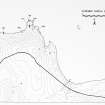
NGR ND 3470 7311
Datum OSGB36 - NGR
Permalink http://canmore.org.uk/site/9410


- Council Highland
- Parish Canisbay
- Former Region Highland
- Former District Caithness
- Former County Caithness
ND37SW 13 3470 7311.
A rectangular, stony mound about 8 by 15 by 0.5m high, left uncultivated in a ploughed field.
C E Batey 1982.
An amorphous mound, according to the farmer the remnant of an old building.
Visited by OS 8 July 1982.
Project (1980 - 1982)
Field Visit (8 July 1982)
An amorphous mound, according to the farmer the remnant of an old building.
Visited by OS 8 July 1982.
Field Visit (1982)
A rectangular, stony mound about 8 by 15 by 0.5m high, left uncultivated in a ploughed field.
C E Batey 1982.
Field Visit (12 July 2011 - 22 July 2011)
The Orkney Research Centre for Archaeology (ORCA) was commissioned by Xodus to provide a baseline assessment of the onshore historic environment assets in an area of the Canisbay parish, Caithness, that may be affected by a proposed marine renewable development and which will later be used to inform an Environmental Impact Assessment.
A total of 18 sites were identified at the Ness of Huna and Ness of Quoys Options combined, of which five were of moderate significance, one uncertain and the rest of low or negligible significance.
Information from Orkney Research Centre for Archaeology (ORCA).

