
Pricing Change
New pricing for orders of material from this site will come into place shortly. Charges for supply of digital images, digitisation on demand, prints and licensing will be altered.
Wife Geo


Croft (Period Unassigned)
Site Name Wife Geo
Classification Croft (Period Unassigned)
Alternative Name(s) Can 047
Canmore ID 9287
Site Number ND36NE 34
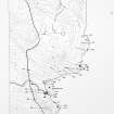
NGR ND 3958 6956
Datum OSGB36 - NGR
Permalink http://canmore.org.uk/site/9287


- Council Highland
- Parish Canisbay
- Former Region Highland
- Former District Caithness
- Former County Caithness
ND36NE 34 3958 6956.
Two roofed buildings of an occupied croft.
OS 6" map, Caithness, 1st ed., (1873); Name Book 1873.
A modern croft measuring 10.53m by 5.18m with a maximum height of 1.8m. C E Batey 1980
The roofless ruin of a croft with the grass-covered remnants of a second small structure lying close on the west.
Visited by OS 21 July 1982.
Project (1980 - 1982)
Field Visit (1980)
A modern croft measuring 10.53m by 5.18m with a maximum height of 1.8m.
C E Batey 1980
Field Visit (21 July 1982)
The roofless ruin of a croft with the grass-covered remnants of a second small structure lying close on the west.
Visited by OS 21 July 1982.

