
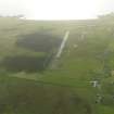
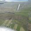
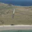
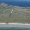
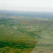
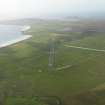
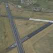
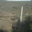
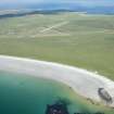
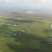
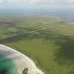
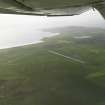
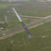
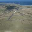
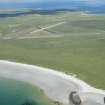
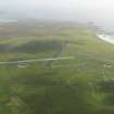
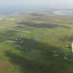
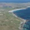
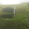
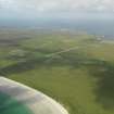
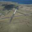
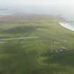
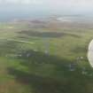
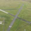
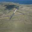
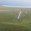
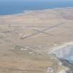
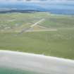
Tiree Airfield


Airfield (20th Century)
Site Name Tiree Airfield
Classification Airfield (20th Century)
Alternative Name(s) Tiree Aerodrome; Tiree Airport; Port Adhair Thiriodh; The Reef
Canmore ID 92820
Site Number NM04SW 21
NGR NM 00593 44853
NGR Description Centred NM 00593 44853
Datum OSGB36 - NGR
Permalink http://canmore.org.uk/site/92820


- Council Argyll And Bute
- Parish Tiree
- Former Region Strathclyde
- Former District Argyll And Bute
- Former County Argyll
NM04SW 21.00 centred 00593 44853
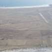
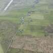
The runways are mainly on map sheet with the northenr part on whilst the Technical area is recorded under NL94SE 54.00 and NM04NW 52.00.
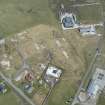
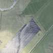
NM04SW 21.01 NM 00000 44672 Control tower (old)
NM04SW 21.02 NM 00095 44036 Aircraft Hangar
NM04SW 21.03 Centred NM 00502 44427 Aircraft Hangars; buildings; huts (S dispersal )
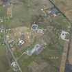
NM04SW 21.04 Centred NM 00372 43995 and NM 00794 43995 Military Camps
Tiree Airport [NAT] (at NM 0029 4482)
OS (GIS) AIB, April 2008.
The site was first occupied and made operational in late 1941. The airfield is still in use for services to Glasgow and Barra. Many concrete bases for the hangars can be seen around this airfield.
D J Smith 1983; B Quarrie 1987
Noted in Guy 2001, Strathclyde, A Survey of 20th Century Defences.
J Guy 2001; NMRS MS 810/11, Part 1, 5-9

