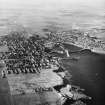
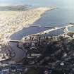
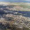
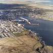
Wick, General
Burgh (16th Century) (1589), Town (Medieval)
Site Name Wick, General
Classification Burgh (16th Century) (1589), Town (Medieval)
Alternative Name(s) Pulteneytown; Lower Pulteneytown
Canmore ID 9221
Site Number ND35SE 81
NGR ND 36344 51005
NGR Description Centred ND 36344 51005
Datum OSGB36 - NGR
Permalink http://canmore.org.uk/site/9221
- Council Highland
- Parish Wick
- Former Region Highland
- Former District Caithness
- Former County Caithness
ND35SE 81 centred 36344 51005
Notes of a lost charter by Robert I, probably c.1393-1394 to Nicholas or Neil Sutherland state that he was granted the town of Auldwick in Caithness 'with one burgh of barony'. Wick became a royal burgh by charter in 1589.
G S Pryde 1965.
See also under Wick, Pulteneytown, General and Wick, Lower Pulteneytown, General
REFERENCE - NMRS
Collection of old negatives of Wick and environs held by Wick Heritage
Trust (Johnston photographers), (Mrs M Sutherland).
REFERENCE - Scottish Record Office
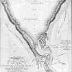
Request to Thomas Telford to mark on an enclosed sketch the proposed
position of the Bridge and Harbours. In addition the Directors of the
British Society require information on the site of the village and roads connecting it with the harbour.
1806 GD9/12/139
Details of Feu Contract requirements before Mr Telford's Plans and
Estimates for the British Society's Fishing Station at Wick may be
proceeded with. A legal title to the estate must be procured and then
its possession made known to Sir Benjamin Dunbar, the local landowner.
1806 GD9/12/183-185
Divot Houses. Secretary of British Society requests assurance that all
have been taken down. If any remain John Macleay, the Agent, is to state
the reason.
1820 GD9/17/105
Publication Account (1995)
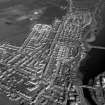
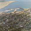
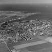
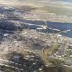
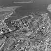
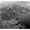
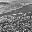
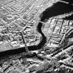
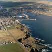
Wick is called Vik in the Sagas (Old Norse vik, bay), and in 1140 Earl Rognvald was entertained there. It owed its existence to the river mouth, the only anchorage on the Caithness coast between Cromarty and Scrabster, though exposed to northeast gales. A small town throughout the Middle Ages, it became a royal burgh in 1589. The old town lay north of the river round the High Street, but, because of 18th and 19th century development in this area, no older houses survive. The old parish church at the west end of the High Street was replaced by the present church in 1830, but one fragment survives, the 16th-century St Fergus' Aisle, since used as a burial vault and capped with Victorian crenellations. There is some good 19th-century architecture in Bridge Street, including the Town Hall of 1828, the classical Royal Bank of Scotland of about 1830, and the Italianate sheriff court of 1862-6.
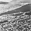
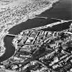
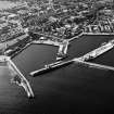
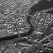
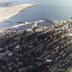
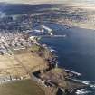
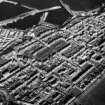
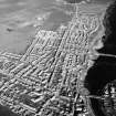
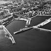
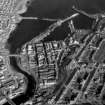
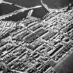
Wick depended on the fishing trade, yet there was no harbour, only jetties built against the congested north bank of the river where ships had to unload onto the shore. In the late 18th century there were nevertheless some 200 boats fishing from Wick and by 1800 some sixteen curing firms producing Thomas Telford drew the attention of the British Fisheries Society and of Sir William Pulteney, one of its direcrors, to the advantages of Wick for a new fishing station. They agreed with him, and in 1803 acquired 390 acres of land on the south side of the river and began to build a harbour, while the land was leased to settlers who would build houses. Telford designed the harbour, a new stone bridge, the layout of the new town, and plans to which houses were intended to conform, as well as 'a healthy walk for the inhabitants with a full view of the bay and the offing'. The harbour caused trouble for many years and the Stevensons struggled with it later. It consisted of two basins with a massive breakwater now terminating in a lighthouse with octagonal tower. There is also a pilot house. Telford's bridge was replaced in 1877 by another in similar style.
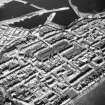
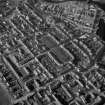
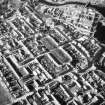
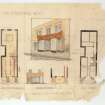
Much of the new settlement, called Pulteneytown after Sir William, Telford's patron, was built within the next twenty years. It fell into two parts, the grid round Argyll Square, and an area for curing-houses and cooperages on the lower· ground near the quayside. Telford suggested plans for the houses and stipulated sizes for walls and doors in an unsuccessful effort to ensure uniformity 'in the Elevation of Houses'. The main streets were to have two-storey houses, the lesser single-storey, all stone-faced and roofed with slate. While some of their character has been lost by unsympathetic alterations, parts of Argyll Square and its surroundings retain the attractive simplicity of Telford's original design.
Pulteneytown was intended for professional fishermen, not part-time crofter-fishers as were villages on the west coast, and the herrings which were the chief catch needed ro be either pickled in salt (white herring) or smoked (red herring) to preserve them, so numerous curing-houses were essential. These were built on the low ground by the harbour, an area much altered subsequently. The best example of a curing-yard is now the Wick Heritage Centre in Bank Row. The buildings are set round an open court, some used for displays relating to old Wick and the fishing industry, which include the original kipper kiln with rows of replica!) kippers hanging on tenterhooks and a box-vent in the roof to let out the smoke. Next to it
is the reconstructed cooperage, in which were made some of the many thousands of barrels needed every year to ship out the herring. The arched entrances in the walls gave direct access for carts. Other enterprises attached to the new town were an inn, a cookshop, a boatbuilding yard, a mill, a brewery and a distillery. By 1818 some seven curinghouses, twelve cooperages and 108 dwellings had to been built, while 59,043 barrels of herrings had been shipped out the year before. Through the 19th century Wick and Pulteneytown prospered, despite the decline of the herring from the middle of the century. Pulteneytown was one the successes of the planned settlements of the 18th and 19th centuries of residential streets on the high ground grouped barrels of pickled herring.
Information from ‘Exploring Scotland’s Heritage: The Highlands’, (1995).


