
'The Pap', Hillhead


Broch (Iron Age)(Possible)
Site Name 'The Pap', Hillhead
Classification Broch (Iron Age)(Possible)
Alternative Name(s) Keiss, Wic 161
Canmore ID 9182
Site Number ND35SE 5
NGR ND 3762 5140
Datum OSGB36 - NGR
Permalink http://canmore.org.uk/site/9182


- Council Highland
- Parish Wick
- Former Region Highland
- Former District Caithness
- Former County Caithness
ND35SE 5 3762 5140.
(ND 3762 5140) The Pap (NAT) Broch (NR)
OS 6" map, (1968)
Broch - 'Hillhead Broch' or 'The Pap', Broadhaven was excavated by Sir Francis Tress Barry in 1903. From the plan then made, it can be seen that the outside of the broch to the E and some 30ft distant from the entrance were two converging passages, each about 17ft in length to the point of convergence. Inward another 7 1/2ft was a 5 1/2ft thick outer casing wall, and on the left side of the passage here was a 2ft wide entrance with a flight of six steps leading down to an 8ft deep well. The broch wall itself was 13ft thick, and on either side of the entrance- passage was a guard-chamber. The diameter of the inner court was 30ft, but reduced some 2 to 3ft be some still remaining portions of a facing wall. There was a chamber in the N and S sides of the broch wall. Internally, the height of the wall was about 9ft. In its present (1910) condition, the interior of the broch is largely filled with debris, beneath which the wall face is hidden. On the exterior towards the W, the wall is visible for a height of about 2ft.
Found in this broch and now in the National Museum of Antiquities of Scotland (NMAS) is the top of a human skull in which are three small perforations placed so as to form a rough equilateral triangle.
RCAHMS 1911, visited 1910.
Numerous small finds from the Hillhead Broch were donated to the NMAS by the representatives of the late Sir Francis Tress Barry in 1908.
Proc Soc Antiq Scot 1909.
A badly mutilated mound of earth and stones some 18m in diameter and 1.3m in height standing on rising ground in the corner of a cultivated field, is all that remains of this broch. The hollowed centre of the mound measures about 13m in diameter. A portion of the outer face of the broch wall, some 0.1m high, can be seen on the NE side.
Various fragments of stone, shells and animal bone found in or near this broch are in Wick Museum, with several photographs of the excavations. Revised at 1:2500.
Visited by OS (W D J) 21 April 1962.
Badly overgrown but part of the outer wall is visible.
C E Batey 1981.
No change to the previous field report.
Visited by OS (J B) 18 August 1982.
Bone dice found at unknown location in broch; GA 846. Numbered 3, 5,
4, 6. 33 x 10mm.
RMS GA 847. Solid bone. All surfaces are extremely worn, but on three of the four faces some markings are visible. It is impossible to be certain that all markings on any one face have been recognised. Some dots (probably all) enclosed by a circle. 47 x 8mm.
Proc Soc Antiq Scot 1909; D V Clarke 197; E W MacKie 1971.
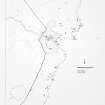
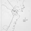
ND 3 6 (area) As part of a wider study of Iron Age Caithness, the broch settlements at Everley (ND 3699 6828), Keiss Harbour (ND 3531 6108), Keiss Road (ND 3488 6151), Whitegate (ND 3541 6120), Skirza (ND 3940 6844), and Hillhead (ND 3762 5140) were recorded by total station survey in June 2000. Aspects of the artefactual assemblage uncovered during 19th-century excavations by Laing and Tress Barry were also studied.
Sponsor: NMS.
A Heald and A Jackson 2000
Project (1980 - 1982)
Field Visit (1981)
Badly overgrown but part of the outer wall is visible.
C E Batey 1981.
Publication Account (2007)
ND35 3 HILLHEAD ('The Pap')
ND/3762 5140
Probable solid-based broch near Broadhaven in Wick, Caithness, sited on flat ground. It was excavated by Tress Barry in 1901 and one photograph of the operation survives; the resulting plan by John Nicholson was published by the Commission a few years later [2]. By the time the latter's investigator visited the site in 1910 the building was again choked with debris (perhaps the excavated interior had been back-filled), the only feature visible being about 60cm (2ft) of the outer wallface on the west.
Contemporary plan and photographs
The contemporary photograph suggests that the explorations were confined to the interior and to the entrance passage, and that the outer wallface remains mostly buried. There is little to be seen at the site now but a badly damaged mound with a length of the broch outer wall visible [4 & plan].
The contemporary plan of the excavations provides some further information [2]. The main entrance faces east and was 3.96m (13ft) long and 1.0m (3ft 3in) wide at its outer end. The plan shows that it had been extended outwards at some stage. The further outward extension – to a point where the passage divides into two, with another door-frame at the junction – was evidently not exposed when this photograph was taken. Likewise the outer casing wall remained to be found. There were two narrow and elongated guard cells, one on either side, and these appear at first sight to be in front of the primary door-frame; this looks as if it is formed of two 60cm long recesses in each wall the front edges of which, each evidently faced with a slab on edge, formed the door-checks, some 3.35m (11ft) from the exterior.
However the photograph shows things differently. The secondary extension of the entrance is in the foreground, with a door-frame defined by slab checks and a sill stone. This doorway with a sill is obviously that shown in the plan about 1.2m (4ft) in front of the broch. Behind this is the lintelled broch passage with a tall slab-check clearly showing on the left – part of a door-frame which must be close to the outer end of the passage but which does not appear on Nicholson’s plan.
Description
The average height of the interior wallface when exposed was about 2.7m (9ft) and the diameter of the court was 9.15m (30ft); however this had been reduced by 60-90cm (2-3ft) (presumably overall) by a secondary wallface. At 9 o'clock in the interior was found a doorway 98cm (6. 5ft) high leading to the mural stair, rising to the right, and to a stair-foot guard cell opening to the left; the passage thus formed was 90cm (3ft) wide and roofed with flat lintels. An oval mural cell with its doorway opening to the central court was found at 3 o'clock (on the north); its length was not determined but its east end at least had the remains of a corbelled roof ("a roof of converging stones").
There are a number of later features in front of the broch entrance. There is a short outward extension, with a door-frame (mentioned earlier), which passes through what looks like a crescent-shaped 'casing wall' 1.68m (5ft 6in) thick which has been added against the broch wall. As noted this added wall had not been exposed when the photograph was taken, though there is a suggestion of its face in the right foreground.
Just within this door-frame six steps lead from the left side of the passage down into a well about 2.4m (8ft) deep. It is not explained whether this well (not visible in the photograph) was cut into the underlying sandstone but it surely must have been. The well is likely to have been earlier than the passage extension and would originally have been just outside the broch doorway.
The passage extension mentioned leads into a further passage up to 1.5m (5ft) wide 2.29m (7ft 6in) long where there are rebates which could have held another door. Beyond this the passage splits into two diverging ways with a door-frame in each. Their junction is about 9.15m (30ft) from the broch entrance.
Discussion
There is little to be said about this site since the evidence is so sparse and ill-recorded. The design of the primary entrance passage is so unusual that one wonders whether it was recorded properly. The occurrence of the doors to the two guard cells in front of the door-frame makes no sense and in fact the photograph makes it clear that there was a door-frame near the outer end. The broch therefore almost certainly had two doors in its entrance passage – one near the outer end and the other near the inner end; several examples are known in the north-east mainland of brochs with two sets of doors.
Most of the finds would fit easily into the standard middle Iron Age broch assemblage but the composite bone comb indicates that the site probably continued in occupation – no doubt with the high wall long pulled down – until the late Iron Age period, starting in about the 7th century. However it is of course possible that the comb was found high up in the debris; no contexts for the finds are given.
Finds [3].
Bone objects include 1 double-edged composite comb 13.4cm (5.25in) long and with the side strips fastened with iron rivets, 2 awls 13.4cm and 9.2cm (5.25 and 3.6in) long, 2 pins with the point of a third, 2 needles with the usual pointed top (nos. 6 & 8), 3 slender bone points, 2 flat, perforated haft plates (nos. 1 & 2), 1 solid tubular haft 4.8cm long (no. 3), 2 bone dice, one hollow (no. 4) and one solid (no. 5), 1 polished hollow fragment, 1 femur-head whorl or button, 1 polished bone tube cut smooth at the ends, another hollow bone fragment, a piece of red deer antler and a disc-shaped fragment of a human cranium with 3 perforations arranged in a triangle.
Stone objects included half a sandstone whorl (no. 10), 3 sandstone discs, a flat circular quartzite pebble with a perforation begun on one face (probably a strike-a-light) (no. 9) and an oval disc of grey quartzite with pecked markings on one face.
Pottery: there were also many small potsherds "of which about eighty typical specimens are shown in the case ... and need not be described in detail" [3, 18].
Dimensions: external diameter 16.8m (55ft), internal 9.2m (30ft), so the wall proportion is 45.5%.
Sources: 1. NMRS site no. ND 35 SE 5: 2. RCAHMS 1911a, 161-2, no. 520 & fig. 43: 3. Proc Soc Antiq Scot 43 (1908-09), 17 (finds): 4. Swanson (ms) 1985, 624-26 & plan.

