
Pricing Change
New pricing for orders of material from this site will come into place shortly. Charges for supply of digital images, digitisation on demand, prints and licensing will be altered.
Upcoming Maintenance
Please be advised that this website will undergo scheduled maintenance on the following dates:
Thursday, 9 January: 11:00 AM - 3:00 PM
Thursday, 23 January: 11:00 AM - 3:00 PM
Thursday, 30 January: 11:00 AM - 3:00 PM
During these times, some functionality such as image purchasing may be temporarily unavailable. We apologise for any inconvenience this may cause.
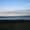
Loch Of Yarrows


Cairnfield (Period Unassigned), Hut Circle (Prehistoric)
Site Name Loch Of Yarrows
Classification Cairnfield (Period Unassigned), Hut Circle (Prehistoric)
Canmore ID 9059
Site Number ND34SW 51
NGR ND 30983 42891
Datum OSGB36 - NGR
Permalink http://canmore.org.uk/site/9059


- Council Highland
- Parish Wick
- Former Region Highland
- Former District Caithness
- Former County Caithness
ND34SW 51 30983 42891.
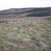
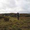
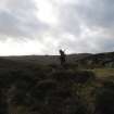
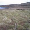
At ND 3098 4287, set into a SW-facing slope, is a circular stone-walled hut heavily covered by heather, measuring 8.0m in diameter between the centres of a wall spread to 2.0m. The entrance is in the SW. In the vicinity are one or two small peat-covered mounds with some stone clearance heaps from contemporary cultivation plots although the depth of peat hides their true identity.
Surveyed at 1:10,000.
Visited by OS (I S S) 14 March 1972.
(Centred ND 309 428) Settlement (NR) (See ND34SW 44 and ND34SW 45 for other hut circles)
OS 1:10,000 map, (1976)
Surveyed at 1:1000.
K Sabine 1980.
Scheduled with hut-circles ND34SW 44 and ND34SW 45.
Information from Historic Scotland, scheduling document dated 29 October 1999.
This hut-circle, which is situated in moorland about 480m SE of South Yarrows farmsteading (ND34SW 474), lies at the foot of a W-facing slope. It measures up to 7.5m in diameter within a stony bank 2.5m in thickness and 0.5m in height, and there is a possible entrance on the SW. Three small grass-grown cairns, measuring up to 2.5m in diameter, stand about 20m to the N and NE of the hut-circle.
(YARROWS04 213)
Visited by RCAHMS (AGCH) 29 June 2004
Ground Penetrating Radar (January 2007)
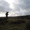
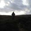
In January 2007, CFA Archaeology Ltd carried out a programme of palaeoenvionmental survey on behalf of the Scottish Wetlands Archaeology Programme (SWAP) within the locality of Loch of Yarrows, Caithness. This project is one of several research studies carried out by SWAP during 2006 as part of a wider framework to promote Scottish Wetland Archaeology (SWAP 2007 forthcoming) . The survey was carried with the help of volunteer members of the Caithness Archaeological Trust (CAT) and the Loch of Yarrows Archaeological Trust (YAT).
The project was designed to test the viability of Ground Penetrating Radar (GPR) over variable depths of blanket or mire peat formations. Three study areas were selected and included a sequence of deep, intermediate and shallow peat. The project was carried out following above average winter rainfalls that resulted in high saturation of the blanket peat which covers much of the area surrounding the study areas. A series of grids were peat probed and cored providing a biostratigraphic and basal profile of each survey grid. Each grid was subjected to GPR survey.
The three sites selected for survey were as follows:
Oliclate Farm to the north of Loch of Yarrows (grids A and B)
South of Loch of Yarrows (Yarrows 1 and 2)
Swartigill Burn, to the north of Loch of Yarrows
The results confirm that at Oliclate Farm, there is good correlation with the basal profile and biostratigraphic profiles obtained fom coring, although slight attenuation (loss of the radar signal) did occur owing to the very saturated nature of the peat. There is good correlation within the biostratigraphic profile and those obtained to the east by Tipping et al (2005). At South Yarrows 1, the shallow peat area, again good correlation was recorded between the environmental record and GPR results. At South Yarrows 2, an infilled palaeochannel provided the best correlation between the environmental record and the GPR results. At Swartigill Burn, the site of possible building remains resting on alluvial clay, the radar returns were confused by the distribution of building stone, possibly demolition material that was spread across the site. Although no wall alignments could be defined from within the radar patterns, the extent of the site within the survey grid itself is visible.
The results of this pilot study confirm that severely saturated peat does not adversely effect the radar returns gained from the apparatus used and both peat stratigraphy and basal morphology can be measured. GPR survey can provide a cost effective, non-destructive method for site demarcation of archaeological sites and monuments buried below deep peat.

