Ground Penetrating Radar


Date January 2007
Event ID 1014610
Category Recording
Type Ground Penetrating Radar
Permalink http://canmore.org.uk/event/1014610
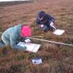
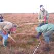
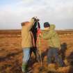
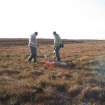
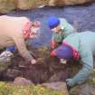
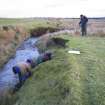
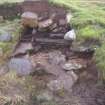
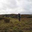
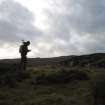
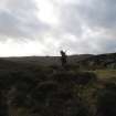
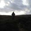
In January 2007, CFA Archaeology Ltd carried out a programme of palaeoenvionmental survey on behalf of the Scottish Wetlands Archaeology Programme (SWAP) within the locality of Loch of Yarrows, Caithness. This project is one of several research studies carried out by SWAP during 2006 as part of a wider framework to promote Scottish Wetland Archaeology (SWAP 2007 forthcoming) . The survey was carried with the help of volunteer members of the Caithness Archaeological Trust (CAT) and the Loch of Yarrows Archaeological Trust (YAT).
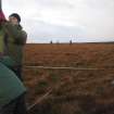
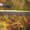
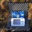
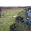
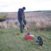
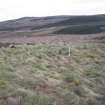
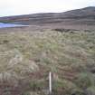
The project was designed to test the viability of Ground Penetrating Radar (GPR) over variable depths of blanket or mire peat formations. Three study areas were selected and included a sequence of deep, intermediate and shallow peat. The project was carried out following above average winter rainfalls that resulted in high saturation of the blanket peat which covers much of the area surrounding the study areas. A series of grids were peat probed and cored providing a biostratigraphic and basal profile of each survey grid. Each grid was subjected to GPR survey.
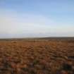
The three sites selected for survey were as follows:
Oliclate Farm to the north of Loch of Yarrows (grids A and B)
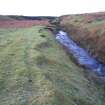
South of Loch of Yarrows (Yarrows 1 and 2)
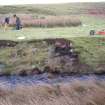
Swartigill Burn, to the north of Loch of Yarrows
The results confirm that at Oliclate Farm, there is good correlation with the basal profile and biostratigraphic profiles obtained fom coring, although slight attenuation (loss of the radar signal) did occur owing to the very saturated nature of the peat. There is good correlation within the biostratigraphic profile and those obtained to the east by Tipping et al (2005). At South Yarrows 1, the shallow peat area, again good correlation was recorded between the environmental record and GPR results. At South Yarrows 2, an infilled palaeochannel provided the best correlation between the environmental record and the GPR results. At Swartigill Burn, the site of possible building remains resting on alluvial clay, the radar returns were confused by the distribution of building stone, possibly demolition material that was spread across the site. Although no wall alignments could be defined from within the radar patterns, the extent of the site within the survey grid itself is visible.
The results of this pilot study confirm that severely saturated peat does not adversely effect the radar returns gained from the apparatus used and both peat stratigraphy and basal morphology can be measured. GPR survey can provide a cost effective, non-destructive method for site demarcation of archaeological sites and monuments buried below deep peat.