 |
On-line Digital Images |
DP 324206 |
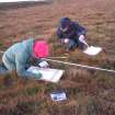
Ground penetrating radar survey, Biostratigraphic recording at Oliclate Site A, Loch of Yarrows, Highland |
14/1/2007 |
Item Level |
 |
On-line Digital Images |
DP 324207 |
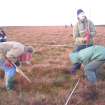
Ground penetrating radar survey, Members of CAT and YAT working at Oliclate Site A, Loch of Yarrows, Highland |
14/1/2007 |
Item Level |
 |
On-line Digital Images |
DP 324208 |
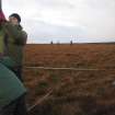
Ground penetrating radar survey, Peat probing and GPR survey at Oliclate Site A, Loch of Yarrows, Highland |
14/1/2007 |
Item Level |
 |
On-line Digital Images |
DP 324209 |
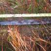
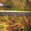
Ground penetrating radar survey, Blue-grey deposit at the base of the core at Oliclate Site A, Loch of Yarrows, Highland |
14/1/2007 |
Item Level |
 |
On-line Digital Images |
DP 324210 |
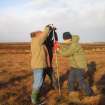
Ground penetrating radar survey, Homogenous peat above the blue-grey layer at Oloclate Site A, Loch of Yarrows, Highland |
14/1/2007 |
Item Level |
 |
On-line Digital Images |
DP 324211 |
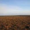
Ground penetrating radar survey, Peat probing at Oliclate Site A, Loch of Yarrows, Highland |
14/1/2007 |
Item Level |
 |
On-line Digital Images |
DP 324212 |
Ground penetrating radar survey, General view of Oliclate Site A from the W, Loch of Yarrows, Highland |
14/1/2007 |
Item Level |
 |
On-line Digital Images |
DP 324213 |
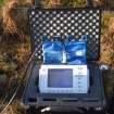
Ground penetrating radar survey, GPR data logger with display, Loch of Yarrows, Highland |
14/1/2007 |
Item Level |
 |
On-line Digital Images |
DP 324214 |
Ground penetrating radar survey, GPR apparatus in use at Oliclate Site B, Loch of Yarrows, Highland |
14/1/2007 |
Item Level |
 |
On-line Digital Images |
DP 324215 |
Ground penetrating radar survey, Loch of Yarrows, S end near broch, Loch of Yarrows, Highland |
14/1/2007 |
Item Level |
 |
On-line Digital Images |
DP 324216 |
Ground penetrating radar survey, Swartigill burn eroding stream bank and GPR survey, Loch of Yarrows, Highland |
15/1/2007 |
Item Level |
 |
On-line Digital Images |
DP 324217 |
Ground penetrating radar survey, GPR survey in progress at Swartigill burn, Loch of Yarrows, Highland |
15/1/2007 |
Item Level |
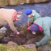 |
On-line Digital Images |
DP 324218 |
Ground penetrating radar survey, YAT members cleaning eroding section, Loch of Yarrows, Highland |
15/1/2007 |
Item Level |
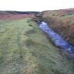 |
On-line Digital Images |
DP 324219 |
Ground penetrating radar survey, General view looking up Swartigill Burn, Loch of Yarrows, Highland |
15/1/2007 |
Item Level |
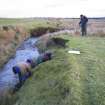 |
On-line Digital Images |
DP 324220 |
Ground penetrating radar survey, Looking E on Swartigill Burn GPR site and CAT members at work, Loch of Yarrows, Highland |
15/1/2007 |
Item Level |
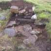 |
On-line Digital Images |
DP 324221 |
Ground penetrating radar survey, Detail shot of eroding archaeology at Swartigill Burn, Loch of Yarrows, Highland |
15/1/2007 |
Item Level |
 |
On-line Digital Images |
DP 324222 |
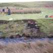
Ground penetrating radar survey, Eroding feature at Swartigill Burn from the N bank of the stream, Highland |
15/1/2007 |
Item Level |
 |
On-line Digital Images |
DP 324223 |
Ground penetrating radar survey, N facing side of the stream with eroding archaeological remains, Loch of Yarrows, Highland |
15/1/2007 |
Item Level |
 |
On-line Digital Images |
DP 324224 |
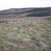
Ground penetrating radar survey, Topography over the S Yarrows 1 site, Loch of Yarrows, Highland |
15/1/2007 |
Item Level |
 |
On-line Digital Images |
DP 324225 |
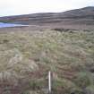
Ground penetrating radar survey, Peg marking the corner of the S Yarrows grid survey, Loch of Yarrows, Highland |
15/1/2007 |
Item Level |
 |
On-line Digital Images |
DP 324226 |
Ground penetrating radar survey, GPS survey in progress at S Yarrows Site 1, Loch of Yarrows, Highland |
15/1/2007 |
Item Level |
 |
On-line Digital Images |
DP 324227 |
Ground penetrating radar survey, GPS survey in progress at S Yarrows Site 1, Loch of Yarrows, Highland |
15/1/2007 |
Item Level |
 |
On-line Digital Images |
DP 324228 |
Ground penetrating radar survey, GPS survey in progress at S Yarrows Site 1, Loch of Yarrows, Highland |
15/1/2007 |
Item Level |
 |
On-line Digital Images |
DP 324229 |
Ground penetrating radar survey, GPS survey in progress at S Yarrows Site 1, Loch of Yarrows, Highland |
15/1/2007 |
Item Level |


