
Ulbster, St Martin's Burial Ground And Sinclair Mausoleum


Burial Ground (Period Unassigned), Chapel (Medieval), Mausoleum (18th Century)(Possible)
Site Name Ulbster, St Martin's Burial Ground And Sinclair Mausoleum
Classification Burial Ground (Period Unassigned), Chapel (Medieval), Mausoleum (18th Century)(Possible)
Alternative Name(s) St Martin's Chapel; Wic 204; Ulbster Sinclair Mausoleum And St Martin's Burial Ground With Gate Piers
Canmore ID 9031
Site Number ND34SW 28
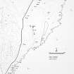
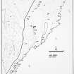
NGR ND 33568 41857
Datum OSGB36 - NGR
Permalink http://canmore.org.uk/site/9031


First 100 images shown. See the Collections panel (below) for a link to all digital images.
- Council Highland
- Parish Wick
- Former Region Highland
- Former District Caithness
- Former County Caithness
ND34SW 28 33568 41857
(ND 3356 4185) Mausoleum (NAT)
on site of St Martin's Chapel (NR)
OS 1:10,000 map, (1976).
See also ND16NW 13.
Although the RCAHMS (1911) confirms that the mausoleum, bearing the date '1700', occupies the site of St Martin's Chapel, both Oliphant (Macfarlane 1906-8) and Thomson (NSA 1845) maintain that the mausoleum is the converted remains of the chapel.
The Ulbster Stone (ND16NW 13), a cross slab with symbols, originally stood in a corner of the churchyard. It is now in Thurso Museum.
New Statistical Account (NSA, written by C Thomson - 1841) 1845; J Stuart 1856; W Macfarlane 1906-8; RCAHMS 1911.
The mausoleum is a 6.7m square building, harled and showing signs of recent repair. A weather vane on the top bears the date '1700'. Some of the stones in the building appear to be of very old date and may have come from the chapel. Otherwise, there are no extant remains of the chapel. The burial ground around the mausoleum is still in use.
There are no indications that the stones of the older chapel are incorporated in the newer building.
C E Batey 1981.
NOTES:
Although the RCAHMS (1911) confirms that the mausoleum, bearing the date '1700', occupies the site of St Martin's Chapel, both Oliphant (Macfarlane 1906-8) and Thomson (NSA 1845) maintain that the mausoleum is the converted remains of the chapel.
The Ulbster Stone (ND16NW 13), a cross slab with symbols, originally stood in a corner of the churchyard. It is now in Thurso Museum (ND16NW 69.2)
RCAHMS 1911; W Macfarlane 1906-8; NSA (written by C Thomson - 1841) 1845; J Stuart 1856.
The mausoleum is a 6.7m square building, harled and showing signs of recent repair. A weather vane on the top bears the date '1700'. Some of the stones in the building appear to be of very old date and may have come from the chapel. Otherwise, there are no extant remains of the chapel. The burial ground around the mausoleum is still in use.
C E Batey 1981.
There are no indications that the stones of the older chapel are incorporated in the newer building.
C E Batey 1981.
SURVEY:
This B-listed building was surveyed as part of the Listed Buildings Recording Programme (LBRP) for 1999-2000.
Situated on an area of rising ground some 400m north of the coast between Sellifar and Land Cove, and some 150m south of the deserted farmhouse of Mains of Ulbster, the Sinclair Mausoleum is reputed to stand on or near the site of a chapel (RCAHMS 1911, no. 596)
It stands square on plan and measures some 6.7m across each face. Its walls, which are some 3.6m in height from the floor to the wall-head, are constructed of harled rubble. To the south, the entrance front, there is a stone-constructed forestair, with nine steps, which rises approximately 2m from ground level. The building is covered with an ogee-shaped roof laid with Caithness slates. The roof structure consists of rough rafters (approx. 160 by 120 mm) set into the wall, braced by tie-beams at two principal levels, the uppermost supporting a king-post. At the corners there are further minor rafters.
There are two windows in the east wall and one in the north wall, all splayed to the interior. The north window in the east wall has been blocked. There is a fireplace with a stone bolection-moulded surround in the west wall, flanked by shallow square-headed aumbries. There is a deeper aumbry to the east end of the north wall. A recess in the external face of the east wall, which has an inscribed cill, is likely to have contained a family armorial. The inscription on the cill has been recorded as follows (RCAHMS 1911): THOU WHO DESIRES ANE HUMBLING/ SIGHT TO SEE COME IN BEHOLD/ WHAT THOU ERE LONG MUST BE.
The floor of the building is stone-flagged, with a slab, set in the middle of the east side of the floor, covering access to the burial vault. The had been sealed at time of survey, but its overall from can be deduced from the evidence of plans prepared by the Leet Rodgers Practice (architects) in 1995. These show that it has a low barrel vault with scarcements set at the springing-points.
There is a metal weather-vane of the apex of the roof which is pierced with the date '1700'. Although this date is not corroborated by any other evidence, this is a plausible date for the building of the mausoleum. Of interest as a vernacular version of late 17th- or early 18th-century sub-classicism, the gatepiers to the graveyard are worthy of note.
This structure was replaced by a mausoleum near Thurso Castle. This new mausoleum was built before 1800 by Sir John Sinclair of Ulbster on a site which he considered to be 'highly picturesque'. He believed it marked the site of an early chapel said to have been the burial-place of the Viking King Harold who Sinclair considered to have been his ancestor. A representation of the new mausoleum was published as the frontispiece to the twentieth volume of the OSA. (For information on the new mausoleum, see Cameron typescript 1999.)
REFERENCES:
Cameron, N M, Sir John Sinclair and the Architecture of Improvement, typescript of lecture given to the Society of Antiquaries of Scotland, 1999 (copy in NMRS).
OSA
Statistical Account of Scotland, Edinburgh, 1798.

