
Edington Mill


Watermill (19th Century)
Site Name Edington Mill
Classification Watermill (19th Century)
Alternative Name(s) Whiteadder Water
Canmore ID 90046
Site Number NT85SE 28
NGR NT 89397 54898
Datum OSGB36 - NGR
Permalink http://canmore.org.uk/site/90046


- Council Scottish Borders, The
- Parish Chirnside
- Former Region Borders
- Former District Berwickshire
- Former County Berwickshire
NT85SE 28.00 89397 54898
NT85SE 28.01 NT 89245 54933 2 Edington Mill Cottages
NT85SE 28.02 NT 89220 54930 Edington Mill Cottage
NT85SE 28.03 NT 89255 54931 3 Edington Mill Cottages
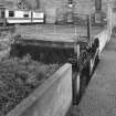
NT85SE 28.04 NT 89058 54945 Weir
NT85SE 28.05 NT 89065 54988 to NT 89624 54963 Lade; Sluice
Edington Mill (Corn) [NAT]
OS 1:10,000 map, 1982.
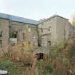
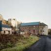
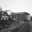
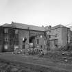
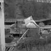
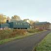
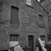
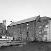
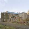
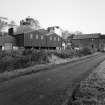
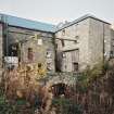
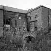
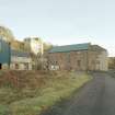
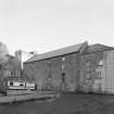
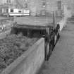
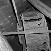
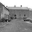
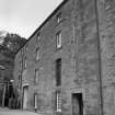
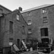
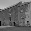
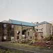
(Location cited as NT 893 549). Edington Mill, mid 19th century. A four-storey, six-bay rubble main block with a two-bay kiln block and a range od two-storey workshops. There are four waterwheels, the principal ones being 6-spoke, 3-ring, low-breast wood and iron shrouded paddle-wheels, 6ft (1.83m) wide by 16ft (4.88m) diameter with rim drive. In the same house is a ruinous Poncelet wheel about 2ft 6ins (0.76m) by 6ft (1.83m) diameter. In another house is a low-breast, wood and iron shrouded paddle-wheel 3ft (0.91m) wide by 13ft (3.96m) diameter. Still in use, grinding oatmeal.
J R Hume 1976.
Sbc Note
Visibility: This is an upstanding building.
Information from Scottish Borders Council.

