Following the launch of trove.scot in February 2025 we are now planning the retiral of some of our webservices. Canmore will be switched off on 24th June 2025. Information about the closure can be found on the HES website: Retiral of HES web services | Historic Environment Scotland
Rattarburn
Broch (Iron Age)(Possible)
Site Name Rattarburn
Classification Broch (Iron Age)(Possible)
Alternative Name(s) Dun 018; Rattar Burn
Canmore ID 8875
Site Number ND27SE 2
NGR ND 2525 7389
Datum OSGB36 - NGR
Permalink http://canmore.org.uk/site/8875
- Council Highland
- Parish Dunnet
- Former Region Highland
- Former District Caithness
- Former County Caithness
ND27SE 2 2525 7389.
(ND 2525 7389) Brough (NR) (site of)
OS 1:10,000 map, (1976)
There are no visible remains of this broch.
RCAHMS 1911.
There are no certain traces of a broch at this site, except for a slightly elevated ridge, in which no trace of walling or stones could be found. No further information was obtained regarding this feature. Revised at 1:2500.
Visited by OS (R B) 23 February 1965.
The site of this broch is visible only as a slight depression. There is no structural evidence.
C E Batey 1982.
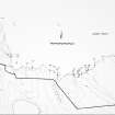
The site of this broch is as described by the previous authorities. The slight ridge noted by previous OS field investigator delimits the S side of the depression mentioned by Batey.
Visited by OS (J B) 26 April 1982.
Field Visit (23 February 1965)
There are no certain traces of a broch at this site, except for a slightly elevated ridge, in which no trace of walling or stones could be found. No further information was obtained regarding this feature. Revised at 1:2500.
Visited by OS (R B) 23 February 1965.
Project (1980 - 1982)
Field Visit (26 April 1982)
The site of this broch is as described by the previous authorities. The slight ridge noted by previous OS field investigator delimits the S side of the depression mentioned by Batey.
Visited by OS (J B) 26 April 1982.
Field Visit (1982)
The site of this broch is visible only as a slight depression. There is no structural evidence.
C E Batey 1982.
Publication Account (2007)
ND27 4 RATTAR BURN (‘Rattarburn’, 'Rattar Broch') ND/2525 7389
Site of possible broch in Dunnet, Caithness, at the mouth of the Burn, visible only as a slight depression.
Sources: 1. NMRS site no. ND 27 SE 2: 2. RCAHMS 1911b, 27, no. 84: 3. Anderson 1890, 184: 4. Batey (ms) 1982, Dun 18.
E W MacKie 2007


