
Glen Cochill


Building (Medieval) - (Post Medieval), Enclosure (Medieval) - (Post Medieval), Quarry (Medieval) - (Post Medieval)
Site Name Glen Cochill
Classification Building (Medieval) - (Post Medieval), Enclosure (Medieval) - (Post Medieval), Quarry (Medieval) - (Post Medieval)
Canmore ID 87679
Site Number NN94SW 18
NGR NN 9085 4027
Datum OSGB36 - NGR
Permalink http://canmore.org.uk/site/87679


- Council Perth And Kinross
- Parish Little Dunkeld
- Former Region Tayside
- Former District Perth And Kinross
- Former County Perthshire
Field Visit (9 December 1993)
NN94SW 18 9085 4027
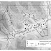
This building is situated on a heather-covered terrace on the W bank of the Cochill Burn, about 180m SSE of the point where the present A826 road crosses the line of the Military Road (MR 3). It measures 13.6m from NW to SE by 4.5m transversely within a wall reduced to a stony bank spread to 1.1m in thickness and no more than 0.3m high. The SW side is bowed and the entrance may have been on the NE. About 60m to the NNW of the building, at NN 9084 4034, there is a subrectangular enclosure, partly destroyed by a small quarry.
(Braan93 425)
Visited by RCAHMS (SDB) 9 December 1993

