
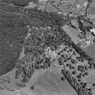
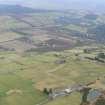
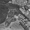
Achterneed, Strathpeffer Station


Railway Station (19th Century) - (20th Century)
Site Name Achterneed, Strathpeffer Station
Classification Railway Station (19th Century) - (20th Century)
Alternative Name(s) Achterneed, Station; Strathpeffer, Old Station
Canmore ID 87583
Site Number NH45NE 69
NGR NH 4910 5980
Datum OSGB36 - NGR
Permalink http://canmore.org.uk/site/87583


- Council Highland
- Parish Fodderty
- Former Region Highland
- Former District Ross And Cromarty
- Former County Ross And Cromarty
NH45NE 69 4910 5980
See also NH45NE 61.
This station opened (as Strathpeffer Station) on 19th August 1870, it was re-named Achterneed Station in 1885. It closed to regular passenger traffic 7 December 1964 and re-opened as a private unstaffed halt 8 February 1965.
J Thomas 1977; G Daniels and L Dench 1980.

