
Pricing Change
New pricing for orders of material from this site will come into place shortly. Charges for supply of digital images, digitisation on demand, prints and licensing will be altered.
Broomhead


Building (Post Medieval)
Site Name Broomhead
Classification Building (Post Medieval)
Canmore ID 87257
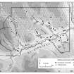
Site Number NN94SE 24
NGR NN 98877 41513
Datum OSGB36 - NGR
Permalink http://canmore.org.uk/site/87257


- Council Perth And Kinross
- Parish Little Dunkeld
- Former Region Tayside
- Former District Perth And Kinross
- Former County Perthshire
Field Visit (10 November 1993)
NN94SE 24 9887 4150
Situated on a bracken-covered, S-facing hillside, 400m to the NE of Meikle Logie, there is a building of two unequal compartments, which measures 13m from WNW to ESE by 2.9m transversely, within faced-rubble walls 0.8m in thickness and 1m height. There is an entrance on the SSW and a pen has been built into the NE corner.
(Braan93 180)
Visited by RCAHMS (PJD) 10 November 1993.
A single unroofed building is depicted on the 1st edition of the OS 6-inch Map (Perthshire 1867, sheet lxi) and on the current edition of the OS 1:10000 map (1983).
Information from RCAHMS (AKK) 31 October 1997

