
Meikle Tombane


Building (Post Medieval)
Site Name Meikle Tombane
Classification Building (Post Medieval)
Canmore ID 87248
Site Number NN94SE 21
NGR NN 95004 40401
Datum OSGB36 - NGR
Permalink http://canmore.org.uk/site/87248

- Council Perth And Kinross
- Parish Little Dunkeld
- Former Region Tayside
- Former District Perth And Kinross
- Former County Perthshire
Field Visit (9 November 1993)
NN94SE 21 9500 4040
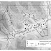
The remains of this building are situated on the S side of a track on a SSW-facing hillside about 300m NE of Meikle Tombane steading. The NNE side wall has been robbed, and the surviving remains have been incorporated into a field wall. Enough remains, however, to show that the building measured 7.9m from ESE to WNW by 3.7m transversely within faced-rubble walls 0.6m thick. The 1st edition of the OS 6-inch map (Perthshire 1867, sheet lxi) shows this building much as it appears today, missing its NNE side and incorporated into the field wall.
(Braan93 154)
Visited by RCAHMS (SDB) 9 November 1993

