
Outfields Of Trochrie


Farmstead (Post Medieval), Rig And Furrow (Medieval) - (Post Medieval)
Site Name Outfields Of Trochrie
Classification Farmstead (Post Medieval), Rig And Furrow (Medieval) - (Post Medieval)
Alternative Name(s) Trochry
Canmore ID 86478
Site Number NN93NE 20
NGR NN 9962 3946
Datum OSGB36 - NGR
Permalink http://canmore.org.uk/site/86478

- Council Perth And Kinross
- Parish Little Dunkeld
- Former Region Tayside
- Former District Perth And Kinross
- Former County Perthshire
Field Visit (7 September 1993)
NN93NE 20 9962 3946
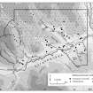
This farmstead is situated on a broad terrace on a N-facing hillside to the W of the Dancy Burn. It stands at the centre of a group of enclosed fields, about 20ha in extent, within which rig cultivation is well preserved. There are two buildings, both gable-ended; that to the N is the larger, measuring 17.3m in length from E to W by 4.2m in breadth within faced-rubble walls 0.6m thick and up to 1.5m high. The entrance is on the S side and the interior is divided into two compartments, the W compartment having a chimney at its W end and two windows in the N wall. At its E end the building has been extended by the addition of two outshots, one 7.7m and 2.7m in length (Braan93 10). The other building stands to the S of the first, set at right angles to it. It measures 5.5m in length and 3.1m in breadth within faced-rubble walls 0.65m thick and 1m high, its longer axis running N-S. The entrance is in the E wall, and in the W wall there is a possible window and what may be a cruck slot (Braan93 9).
'Outfields of Trochrie' is depicted on the 1st edition of the OS 6-inch map (Perthshire 1867, sheet lxi). Both the recorded buildings are shown, and both are roofed, although the outshots at the E end of the longer building are unroofed.
(Braan93, 9-10)
Visited by RCAHMS (SDB) 7 September 1993

