
Scheduled Maintenance
Please be advised that this website will undergo scheduled maintenance on the following dates: •
Tuesday 3rd December 11:00-15:00
During these times, some services may be temporarily unavailable. We apologise for any inconvenience this may cause.
Corsehill Quarry


Sandstone Quarry(S) (19th Century) - (20th Century)
Site Name Corsehill Quarry
Classification Sandstone Quarry(S) (19th Century) - (20th Century)
Canmore ID 81438
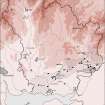
Site Number NY27SW 29
NGR NY 2050 7010
NGR Description Centred NY 2050 7010
Datum OSGB36 - NGR
Permalink http://canmore.org.uk/site/81438

- Council Dumfries And Galloway
- Parish Annan
- Former Region Dumfries And Galloway
- Former District Annandale And Eskdale
- Former County Dumfries-shire
Field Visit (29 November 1994)
NY27SW 29 centred 2050 7010
Corsehill Quarry was extensively worked throughout the 19th and early 20th centuries and supplied good quality building stone, much of which was used locally although a substantial quantity was exported.
The expansion of the quarry during the latter half of the 19th century may be illustrated by comparing the 1st and 2nd editions of the OS 6-inch map (Dumfriesshire, sheet lvii, 1862 and 1900 respectively). The earlier edition depicts the working face of the quarry as being served by a fork from the Annan to Langholm road. The later edition shows the quarry as having been extended to the NE and linked by a spur to the Kirtlebridge, Annan and Brayton branch of the Caledonian Railway. The workings lay to either side of the railway, and several roofed buildings are depicted.
Although a small section is still being worked, the greater part of the quarry is now being backfilled as a council refuse dump
Visited by RCAHMS (ARW, SPH), 29 November 1994.
Listed as quarry.
RCAHMS 1997.

