Pricing Change
New pricing for orders of material from this site will come into place shortly. Charges for supply of digital images, digitisation on demand, prints and licensing will be altered.
North Roe, Fethaland, Fishing Station
Fishing Station (19th Century), Naust(S) (19th Century)
Site Name North Roe, Fethaland, Fishing Station
Classification Fishing Station (19th Century), Naust(S) (19th Century)
Alternative Name(s) Fedeland; Isle Of Fethaland
Canmore ID 81165
Site Number HU39SE 19
NGR HU 3750 9427
NGR Description Centred HU 3750 9427
Datum OSGB36 - NGR
Permalink http://canmore.org.uk/site/81165
- Council Shetland Islands
- Parish Northmavine
- Former Region Shetland Islands Area
- Former District Shetland
- Former County Shetland
External Reference (10 October 1994)
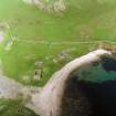
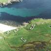
(HU 374 942) (Scheduled with HU39SE 1 as Fedeland, fishing station and prehistoric house). The monument consists of the remains of an 18th-19th century fishing station, within which are the remains of a prehistoric house (HU39SE 1). Fedeland, or Fethaland as it appears on maps, was one of the most important stations used for the 'haaf', the open-boat long-line fishery practised during the summer months in Shetland. Initially undertaken to supplement subsistence diet, this fishery developed into an integral part of the islands' economy, with farming tenancies requiring participation in the "haaf" at fixed prices. The industry was wiped out during the later 19th century by a combination of larger, competing, vessels, severe losses of life and the abolition of the complex system of credit, fishing leases and joint ownership which maintained it. Like most 'haaf' stations, Fedeland is at an extremity of the islands, at the extreme N tip of Shetland. The physical remains take the form of the walls of up to 20 rectangular houses. Most are of one compartment and all, with the sole exception, on the NE, of the factor's house, were of single-storey construction, with drystone walls occasionally patched with mortar. The roofs of these houses were generally temporary affairs, constructed for the fishing period only, due to the scarcity of timber. Old photographs show much use of old spars, masts and sailcloth.
Towards the central N side of the settlement, on a grassy slope, are the remains of an oval prehistoric house (HU39SE 1), perhaps of Iron Age date.
Information from Historic Scotland, scheduling document dated 10 October 1994.
Publication Account (1997)
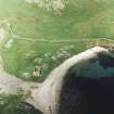
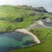
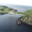
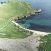
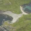
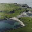
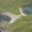
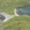
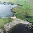
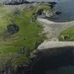
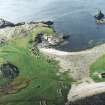
It is a long walk out to Fethaland but very beautiful and well worth the effort. This was an ideal spot for a fishing station, for the north tip of the promontory narrows before it becomes the Isle of Fethaland, resulting in a sheltered harbour and a wide sweep of pebble beach on the east side. The remains of more than twenty stone-built fishing lodges can be explored. Most of them stand to roof level since their remote location has saved them from stone-robbing for dykes. About sixty boats would have been based here between the beginning of June and the middle of August, and the fish would have been salted and dried on the beach.
Farther round the east coast at HU 377 942 (HU39SE 5) is a very steep outcrop of steatite at Cleber Geos (cleber is the local name for this rock). Clearly visible are the remains of quarrying for bowls, and this is likely to be of prehistoric or Viking date. There are also many 19th-century graffiti.
Information from ‘Exploring Scotland’s Heritage: Shetland’, (1997).
Note (7 February 2001)
Four unroofed buildings, two partially roofed buildings, nineteen roofed buildings and one enclosure are depicted on the 1st edition of the OS 6-inch map (Orkney and Shetland (Shetland) 1880, sheet x).
Sixteen roofed buildings are shown on the current edition of the OS 1:10000 map (1973).
Information from RCAHMS (SAH), 7 February 2001.
Laser Scanning (1 August 2010 - 12 August 2010)
HU 3750 9427
A detailed survey of the Fishing Station at Fethaland was undertaken 1–12 August 2010 due to concerns over the stability of the buildings, some of which are threatened by erosion. The work was undertaken as a collaborative project between SCAPE and Queen’s University, Belfast.
The fishing station is a scheduled monument at the northern tip of Northmavine. It was the centre of the seasonal haaf fisheries, and crews travelled many miles in
small boats (sixereens) to catch deep sea fish such as ling, cod and tusk. The station consists of a number of buildings, including the remains of store houses and structures that housed boat crews and shore workers. At least 32 individual
structures were noted during the survey, some of which were sub-divided meaning that there would have originally been more structures. Several of the buildings are reduced to foundation level, but an examination of historic photographs showed that many of the flattened buildings were in this state at the end of the 19th century. Three structures are collapsing as a result of erosion and many more are very close to the coast edge.
The fishing station was recorded with a terrestrial laser scanner. Data was captured by John Meneely using a Leica 3-D laser scanner (HDS 3000). The resulting data was used to create elevations and plans of every building. Additionally, a 3-D model of the fishing village was constructed and used to model future storm surge and sea level rise scenarios. A detailed photographic survey of every building was undertaken, with images annotated with notes on building
condition, architectural features, etc. Detailed archival research undertaken in Shetland Museum supported the project. The SCAPE Trust and Queen’s University, Belfast thank the Murray family for allowing access to the fishing station
and for their interest in the project. Thanks go to John Mackenzie of SAT for organising the project and logistics.
Archive: RCAHMS and Shetland Archives. Report: Is available on the
SCAPE website
Funder: Historic Scotland and Shetland Amenity Trust
T Dawson 2010


