Pricing Change
New pricing for orders of material from this site will come into place shortly. Charges for supply of digital images, digitisation on demand, prints and licensing will be altered.
Bridge Of Keig
Road Bridge (Period Unassigned)
Site Name Bridge Of Keig
Classification Road Bridge (Period Unassigned)
Alternative Name(s) Church Of Keig; River Don
Canmore ID 80716
Site Number NJ61NW 13
NGR NJ 61792 18681
Datum OSGB36 - NGR
Permalink http://canmore.org.uk/site/80716
- Council Aberdeenshire
- Parish Keig
- Former Region Grampian
- Former District Gordon
- Former County Aberdeenshire
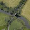
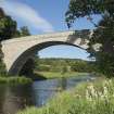
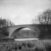
Bridge of Keig, 1817, Thomas Telford. Brilliantly spare treatment: the Don is crossed by a single segmental arch of 101ft span in sharply squared granite. Above, the road is carried on a slight hump.
Taken from "Aberdeenshire: Donside and Strathbogie - An Illustrated Architectural Guide", by Ian Shepherd, 2006. Published by the Rutland Press http://www.rias.org.uk
NJ61NW 13 61792 18681
Bridge of Keig [NAT]
OS 1:10,000 map, 1980
EXTERNAL REFERENCE: SRO
Bridge over the River Don near Putachie.
Proposal, specification, estimate of £2,054 sterling, elevation and plan.
1815 GD/52/23.
(Undated) information in NMRS.
(Location cited as NJ 617 186). Bridge of Keig. Built 1817; engineer Thomas Telford. A single segmental-arched span of 101 ft (30.8m).
J R Hume 1977.
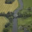
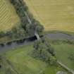
Visible on air photographs AAS/93/G28/4-5, flown 27 October 1993. (Copies held by Grampian Regional Council).
Information from Grampian Regional Council (Mrs M Greig), March 1994.
Newspaper reference: Aberdeen Press and Journal, 27 March 1955.
NMRS, MS/712/56.
This bridge carries the B992 public road over the River Don to the SE of Keig village (NJ61NW 16).
The location assigned to this record defines the apparent midpoint of the structure. The available map evidence indicates that it extends from NJ c. 61787 18699 to NJ c. 61797 18664.
Information from RCAHMS (RJCM), 6 June 2006.
Publication Account (2007)
Bridge of Keig
This bridge, completed in 1817, was almost certainly influenced by Telford’s practice. It now carries the B992 road over the Don on a graceful 101 ft span granite masonry arch which is the third of its type in north-east Scotland. The bridge was built by William Minto.
The site of the bridge was chosen so that its foundations were carried on rock outcrops at each side of the river. Although the specification was prepared by Minto, the configuration of the bridge follows the guidelines laid down by Telford for bridges in the Highlands and the structure shows great simplicity and economy of design.
R Paxton and J Shipway, 2007.
Reproduced from 'Civil Engineering heritage: Scotland - Highlands and Islands' with kind permission from Thomas Telford Publishers.
Project (1 April 2015 - 31 March 2016)
Survey work undertaken to upgrade records of listed buildings by area.


