Pricing Change
New pricing for orders of material from this site will come into place shortly. Charges for supply of digital images, digitisation on demand, prints and licensing will be altered.
Borgue Langwell
Broch (Iron Age)(Possible)
Site Name Borgue Langwell
Classification Broch (Iron Age)(Possible)
Alternative Name(s) Berriedale; Langwell Water; Burg Langwell
Canmore ID 8067
Site Number ND12SW 1
NGR ND 10271 21812
NGR Description 1
Datum OSGB36 - NGR
Permalink http://canmore.org.uk/site/8067
- Council Highland
- Parish Latheron
- Former Region Highland
- Former District Caithness
- Former County Caithness
ND12SW 1 1026 2181
(ND 1026 2181) Borgue Langwell (NAT)
Broch (NR)
OS 6" map, (1964).
See also ND12SW 2.
On the S side of the Langwell Water, about half a mile due S of the gamekeeper's house, and at the upper end of a small glen, are the remains of a broch known as 'Burg Langwell'. Some recent excavation has been done on the structure, and a gallery 2ft 8ins in width has been exposed on the S, which probably contains the stair, and on the W for a short distance a portion of chamber has been opened up through a break in the outer wall at one end. The diameter of the broch over all is some 48ft, and the thickness of the wall, where exposed above the gallery, is 10ft. The wall on the exterior is reduced almost to the foundation.
RCAHMS 1911, visited 1910.
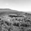
The mutilated remains of a broch, the over all diameter of which has been 17.0m. The SW is best preserved where the outer wall face can be traced at a height of from 0.1 to 1.2m; and here, within the breadth of the wall (some 5.0m) are exposed the remains of a gallery, extant for 3.2m long by 0.9m wide and 1.2m deep. On the N side, the greater part of the broch has been demolished, leaving a mass of stones covering the perimeter. Adjacent to the broch are the footings of two buildings and associated enclosures of early modern date (ND12SW 48).
Visited by OS (J L D), 14 June 1960.
No change to the previous field report.
Visited by OS (J M), 26 November 1982.
Site recorded during a survey undertaken of c 2 sq km of land either side of the Langwell Water, by Berriedale.
ND 1026 2181 Broch (ND12SW 1).
Sponsor: Historic Scotland
C Moloney and L Baker 1998.
Publication Account (2007)
3 BURG LANGWELL ('Borgue Langwell', 'Langwell Water 2', 'Berriedale 3')
ND/1026 2181
Probable broch in Latheron, Caith-ness, standing on low ground at the upper end of a small glen. In 1910 some excavation had been done "recently" and exposed a length of mural gallery 80cm (2ft 8in) wide and 3.2m long on the south side which probably contained the stair. Part of a mural cell was visible on the west. The outer wallface survives to a height of up to 1.2m on the south-west. The external diameter is about 17m (55.7ft) and the wall was 5m (16.4ft) thick above the gallery [1]. If this gallery is an upper one the site should be re-classified as a broch. The outer wallface was ruined down to foundation level.
Sources: 1. NMRS site no. ND 12 SW 1 and plate: 2. RCAHMS 1911b, 53, no. 201: 3. C Moloney and L Baker in Dis-covery and Excavation in Scotland 1998, 56.
E W MacKie 2007


