Pricing Change
New pricing for orders of material from this site will come into place shortly. Charges for supply of digital images, digitisation on demand, prints and licensing will be altered.
Craigcaffie
Enclosure (Period Unknown)(Possible), Field Boundary(S) (Post Medieval), Souterrain (Iron Age)(Possible)
Site Name Craigcaffie
Classification Enclosure (Period Unknown)(Possible), Field Boundary(S) (Post Medieval), Souterrain (Iron Age)(Possible)
Canmore ID 80257
Site Number NX06SE 88
NGR NX 08654 64140
NGR Description Centre
Datum OSGB36 - NGR
Permalink http://canmore.org.uk/site/80257
- Council Dumfries And Galloway
- Parish Inch
- Former Region Dumfries And Galloway
- Former District Wigtown
- Former County Wigtownshire
NX06SE 88 08647 64091
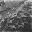
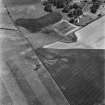
Cropmarks, including those of a possible souterrain and enclosures, have been revealed by aerial photography 300m SE of Dalminnoch farmsteading. A pair of parallel linear cropmarks, about 4m apart, run N-S from NX 086 640 to NX 086 643, a distance of some 360m. Visible near its S end there is a possible ditched rectilinear enclosure, measuring about 20m by 30m, parallel to and intersecting the linear features. An arc of ditch abutting against the E linear cropmark at NX c.0865 6418 may represent part of a circular enclosure with a centrally placed sub-circular marking. A cropmark feature, 2m by 9m with a kink in the centre, may be of a souterrain. Further cropmarks have been recorded in this field, including a large enclosure, linear cropmarks and a possible pit-alignment to the W (NX06SE 28) and a palisaded enclosure 180m to the S (NX06SE 89).
Information from RCAHMS (KB) 29th November 1999
Aerial Photographic Transcription (17 November 2011)
Note (4 March 2022)
The location, classification and period of this site have been reviewed and changed from ENCLOSURE(S) (PERIOD UNASSIGNED)(POSSIBLE), FIELD BOUNDARY(S) (PERIOD UNASSIGNED), SOUTERRAIN (PREHISTORIC)(POSSIBLE).


