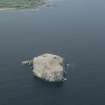
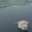
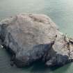
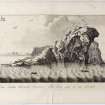
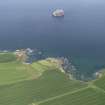
Bass Rock, Lighthouse
Lighthouse (20th Century)
Site Name Bass Rock, Lighthouse
Classification Lighthouse (20th Century)
Alternative Name(s) Bass Rock, South Side; East Landing; Outer Forth Estuary; Firth Of Forth
Canmore ID 79780
Site Number NT68NW 3
NGR NT 60200 87266
Datum OSGB36 - NGR
Permalink http://canmore.org.uk/site/79780
- Council East Lothian
- Parish North Berwick
- Former Region Lothian
- Former District East Lothian
- Former County East Lothian
NT68NW 3 60200 87266
Lighthouse [NAT]
OS 1:10,000 map, 1992.
(Listed as Bass Rock, south side. Detached siren [fog signal] also noted).
Admiralty List of Lights 1980.
Name: Bass Rock (1902)
Location: N56 5 W2 38 Firth of Forth, 3 miles NE of North Berwick
Designed and built: David A Stevenson
Light first exhibited: 1 November 1902
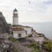
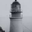
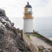
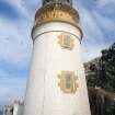
Description: circular stone tower, painted white
Height of light above MHW: 151ft (46m)
Height of tower: 66ft (20m)
Light source and characteristics: W Gp Fl (3) ev 20 secs. 20W bifilament lamp: 1,100cp: nominal range 10nm
Fog warning apparatus: siren (3) ev 120 secs
Manning: unwatched (automatic since 21 December 1988). Reduced to minor light status after automation, and monitored from Northern Lighthouse Board HQ, Edinburgh
C Nicholson 1995.
Site recorded by GUARD during the Coastal Assessment Survey for Historic Scotland, 'The Firth of Forth from Dunbar to the Coast of Fife' 1996.
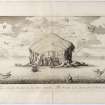
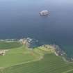
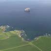
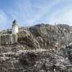
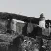
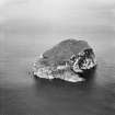
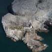
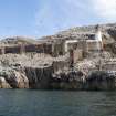
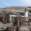
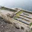
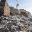
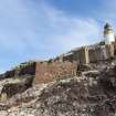
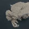
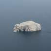
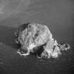
This rock or stack loghthouse stands on the gun-platform to the E of the 'old castle' (NT68NW 1), and close to the East Landing [name: NT 602 872]. From this position low down on the S side of the island, the short tower guards the relatively narrow passage between the island and North Berwick, rather than the main entrance into the Firth of Forth, from which it is hidden by the main mass of the island.
The lighthouse was built by D A Stevenson in 1902, and was apparently demanned during the Second World War. It was one of the last seven lighthouse in the Northern service to be lit by paraffin, not being automated until 1986.
Information from RCAHMS (RJCM), 7 March 2006.
R W Munro 1979; S Krauskopf 2001.
Field Visit (1996)
Site recorded by GUARD during the Coastal Assessment Survey for Historic Scotland, 'The Firth of Forth from Dunbar to the Coast of Fife' 1996.
Note (7 March 2006)
This rock or stack loghthouse stands on the gun-platform to the E of the 'old castle' (NT68NW 1), and close to the East Landing [name: NT 602 872]. From this position low down on the S side of the island, the short tower guards the relatively narrow passage between the island and North Berwick, rather than the main entrance into the Firth of Forth, from which it is hidden by the main mass of the island.
The lighthouse was built by D A Stevenson in 1902, and was apparently demanned during the Second World War. It was one of the last seven lighthouse in the Northern service to be lit by paraffin, not being automated until 1986.
Information from RCAHMS (RJCM), 7 March 2006.
Project (2007)
This project was undertaken to input site information listed in 'Civil engineering heritage: Scotland - Lowlands and Borders' by R Paxton and J Shipway, 2007.
Publication Account (2007)
In 1897 the Northern Lighthouse Board decided to erect two lighthouses on the Haddingtonshire coast. Barns Ness (NT 7230 7721) with its 121 ft high tower built of stone from Craigree and Barnton quarries, was erected from 1899 to 1901 and Bass Rock from 1900 to 1902. Bass Rock Lighthouse is said to be located on a former gun platform part way up the rock, a particularly awkward site. Its creation, to quote a later Northern Lighthouse Board engineer J. D. Gardner, required ‘the exercise of sound judgment and engineering skill’. The engineer for both lighthouses was David A. Stevenson. Bass Rock Lighthouse has a circular stone tower 65 ft high and cost about £8000. Its light is about 150 ft above sea level and has a nominal range of 21 miles. It adjoins the site of a former fortress and prison where, between 1672 and 1688, some 40 Covenanter prisoners are said to have perished. Barns Ness was automated in 1986 and is now a minor light with a nominal range of ten mile. The first lighthouse completed by Stevenson as Engineer to the Board was on nearby Fidra Island in 1885, the station on which, with its Alan Stevenson-type diagonal astragals lantern, can be best seen from the mainland at Yellowcraigs beach, where there is an interpretive board at the car park.
R Paxton and J Shipway 2007
Reproduced from 'Civil Engineering heritage: Scotland - Lowlands and Borders' with kind permission of Thomas Telford Publishers.


