
Glenlochar - Gatehouse Of Fleet - Loch Ryan


Roman Road (Roman)
Site Name Glenlochar - Gatehouse Of Fleet - Loch Ryan
Classification Roman Road (Roman)
Canmore ID 79387
Site Number NX15NW 75
NGR NX 14322 57726
NGR Description NX 1499 5753 to NX 1000 5975
Datum OSGB36 - NGR
Permalink http://canmore.org.uk/site/79387


- Council Dumfries And Galloway
- Parish Old Luce
- Former Region Dumfries And Galloway
- Former District Wigtown
- Former County Wigtownshire
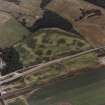
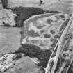
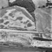
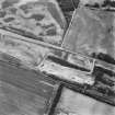
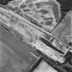
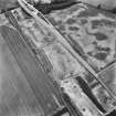
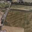
NX15NW 75.00 1499 5753 to 1000 5975. RR 8.
Formerly RX 23.
See also NX15NE 70.00.
NX15NW 75.01 NX 1425 5772 - NX 1498 5749
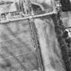
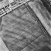
NX15NW 75.02 NX 1035 5910 - NX 1230 5845
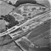
The Roman road from Glenlochar (NX76SW 2) to Loch Ryan via Gatehouse of Fleet is thought to follow the same track as the Old Military Road, which runs from the Bridge of Sark to Portpatrick (MR 23, see NX15NW 104).
From Dunragit (NX 150 577), a Roman line could have run to Cairnryan (NX 068 685, see xx), W of White Loch close to Airds Farm (NX 096 601) where Roman coins (NX06SE 24) are alleged to have been discovered or E of Black Loch where a crannog (NX16SW 7) produced 2 Romano-Native finds though these do not indicate Roman military presence.
A Wilson 1989.
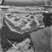
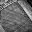
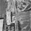
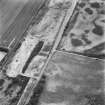
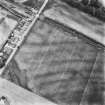
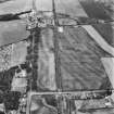
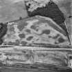
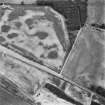
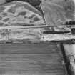
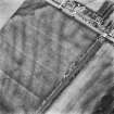
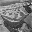
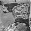
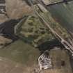
The Roman road is visible as quarry pits in RCAHMS oblique aerial photographs, S of the Old Military Road (see NX15NW 75.01 and NX15NW 75.02).
Information from RCAHMS, 23 July 2003.
Aerial Photographic Transcription (3 December 1992 - 10 December 1992)
An aerial transcription was produced from oblique aerial photographs. Information from Historic Environment Scotland (BM) 31 March 2017.
Aerial Photographic Transcription (10 September 1992 - 16 December 1992)
An aerial transcription was produced from oblique aerial photographs. Information from Historic Environment Scotland (BM) 31 March 2017.
Note (8 June 2022)
The location, classification and period of this site have been reviewed.

